Comment

My Second Nordic Adventure (Day 11) - Trolltunga

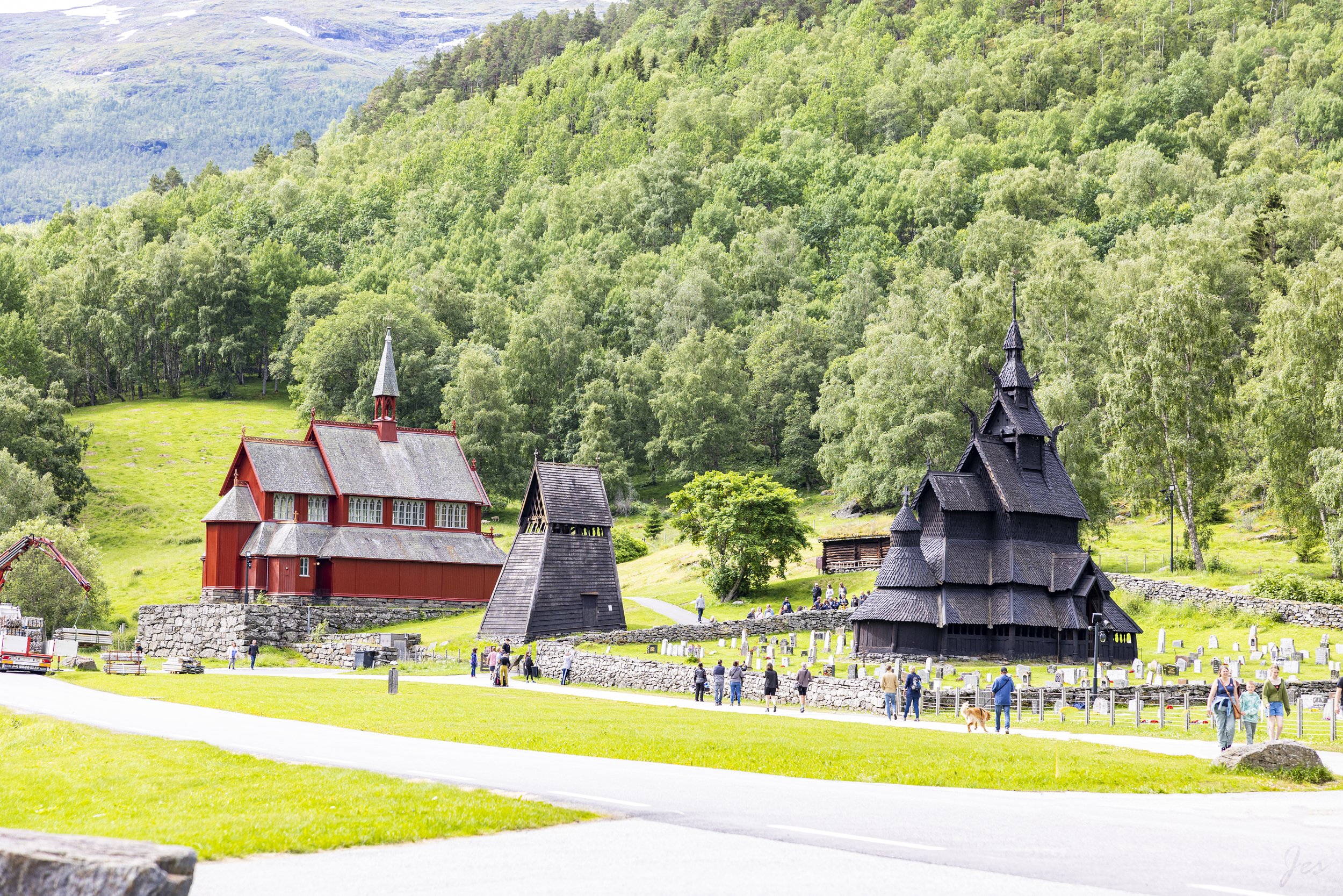
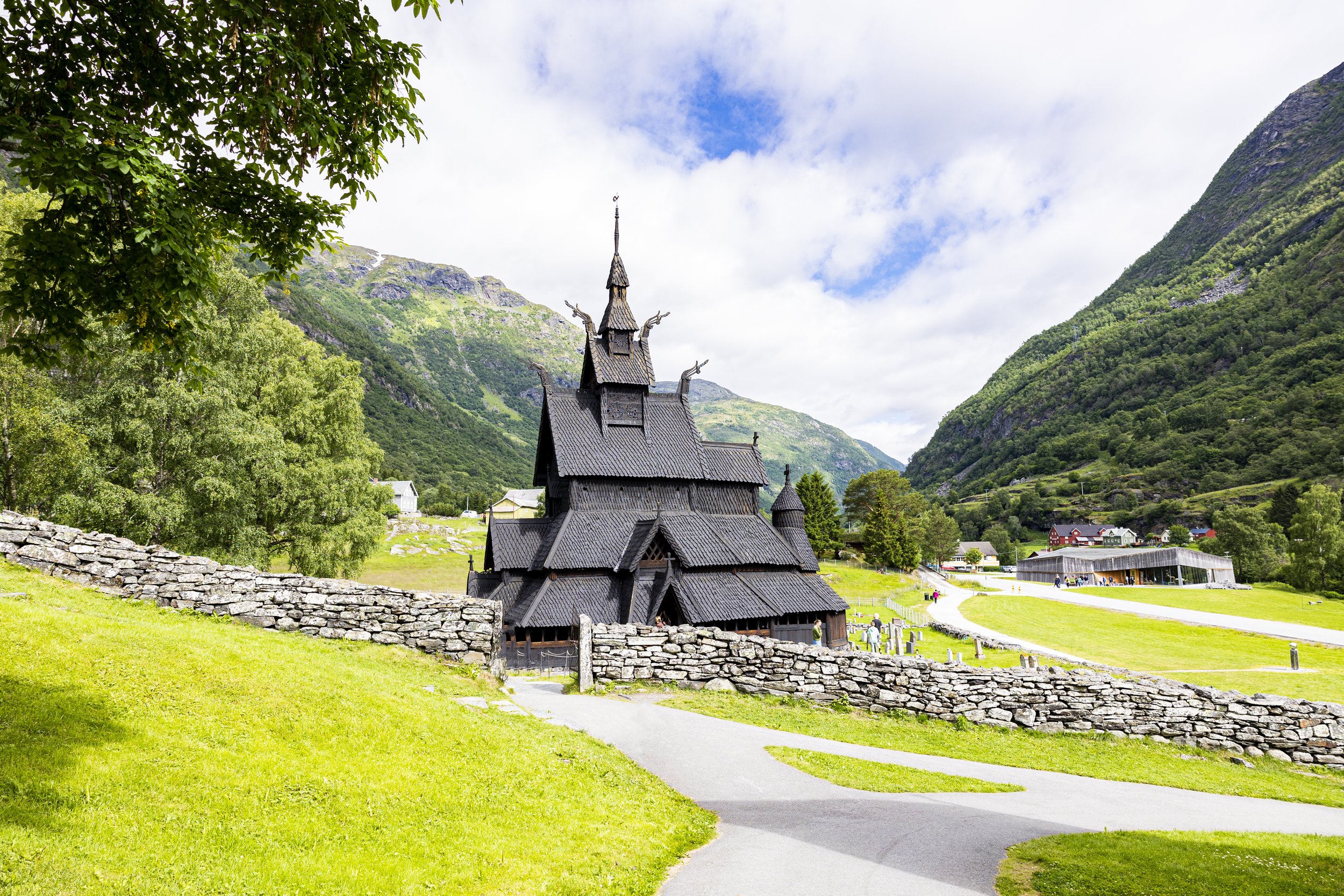
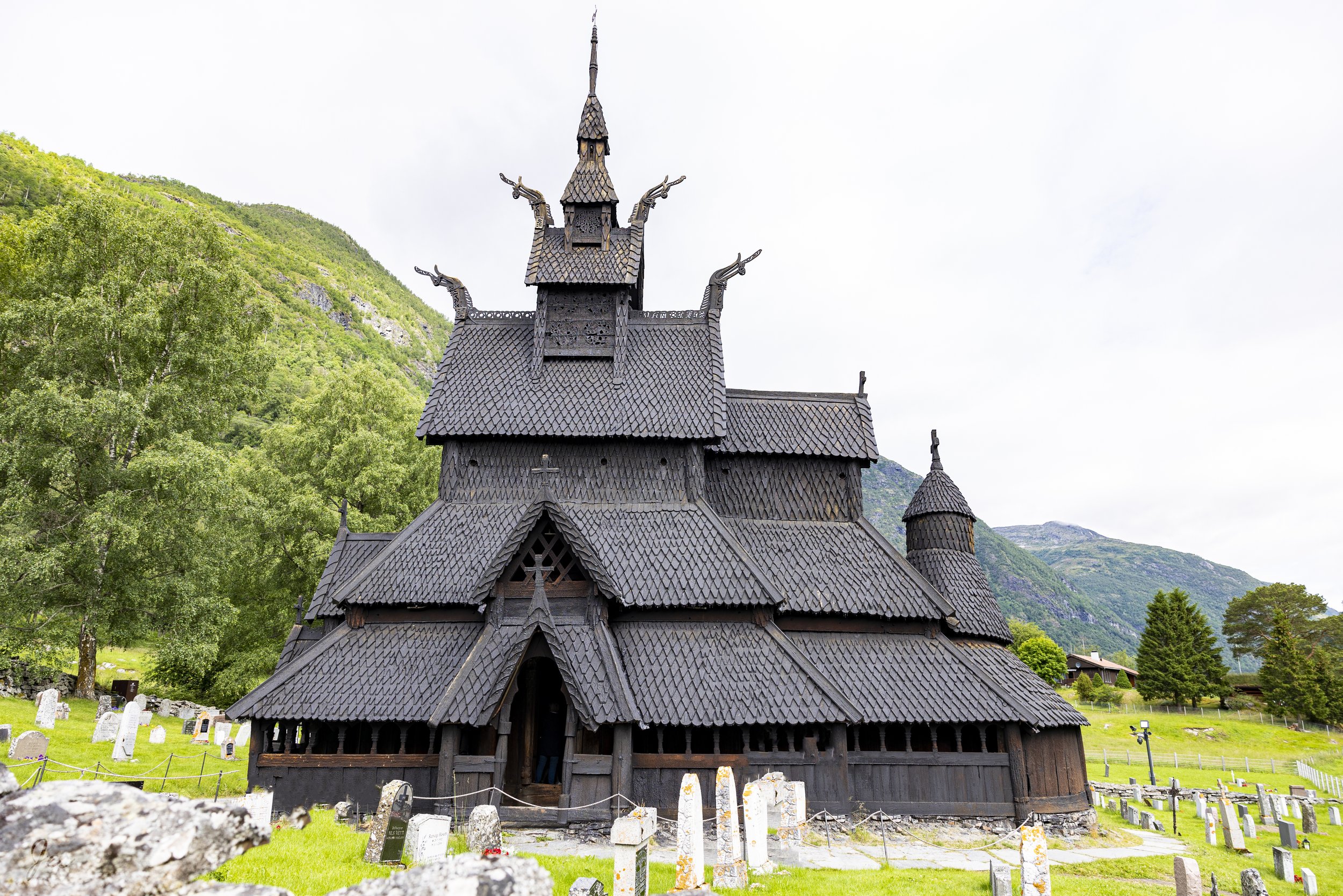
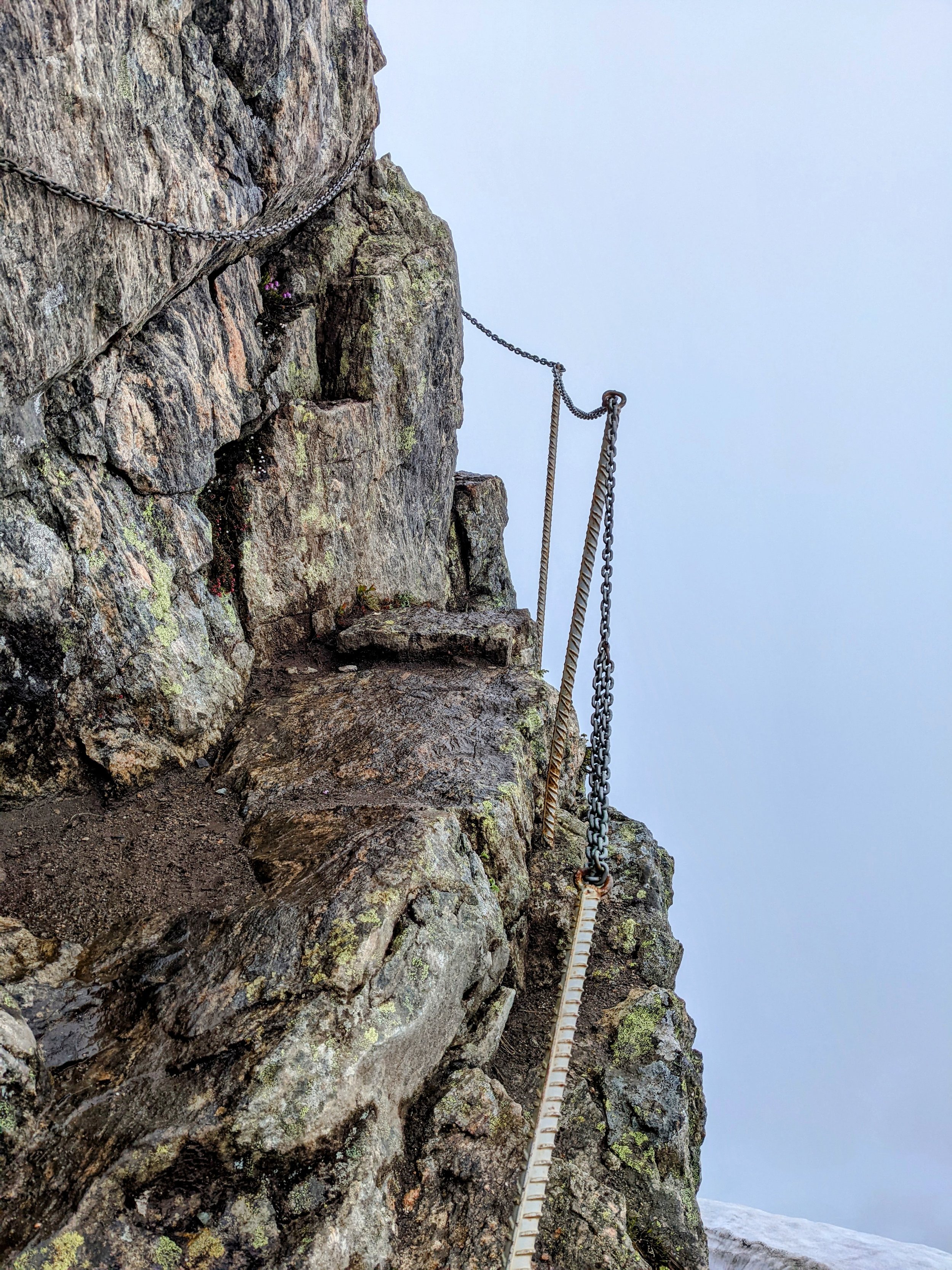
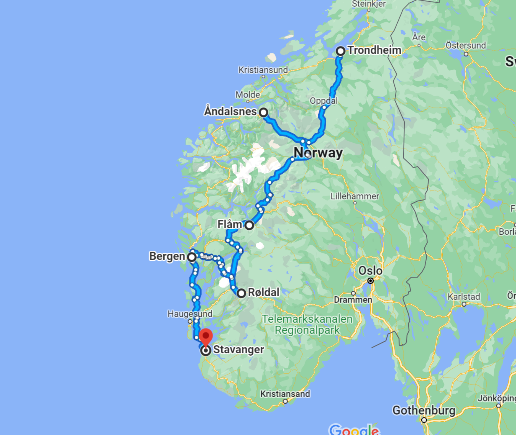
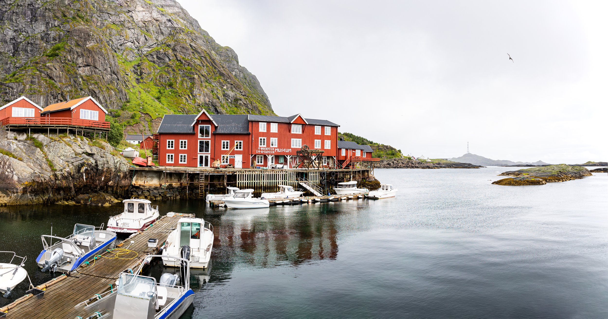
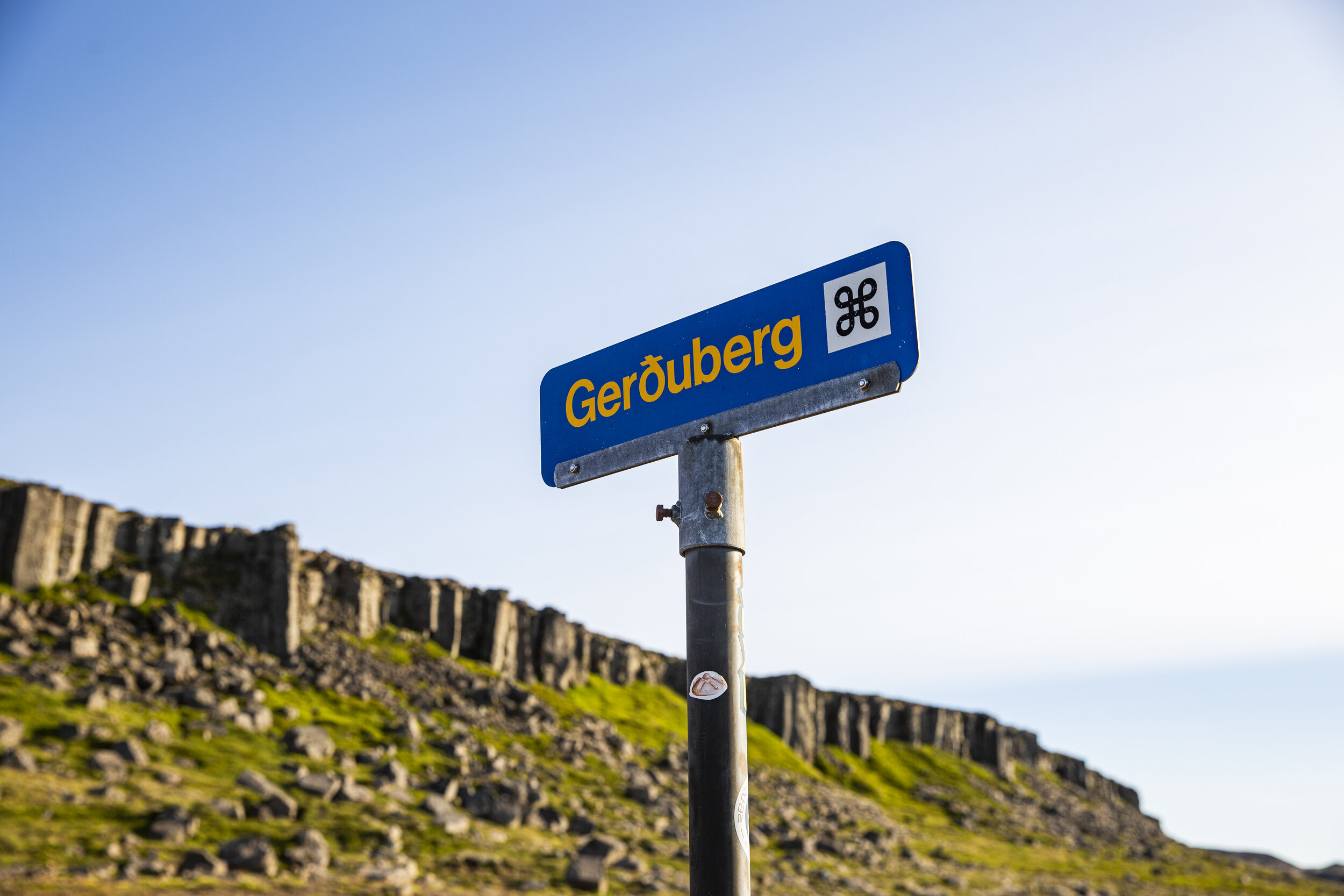
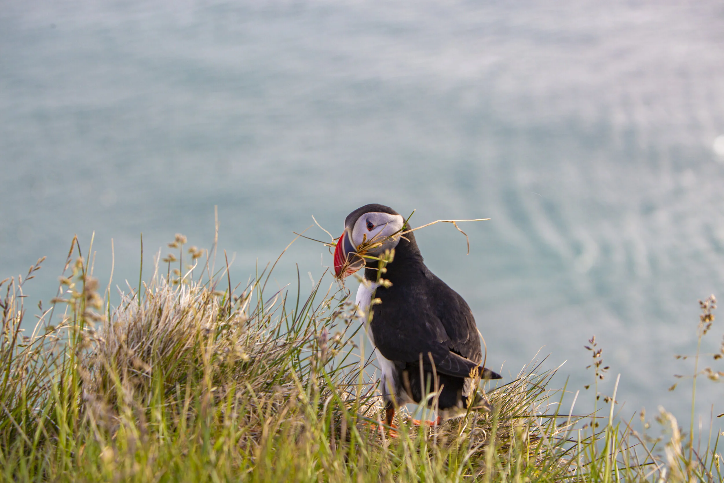
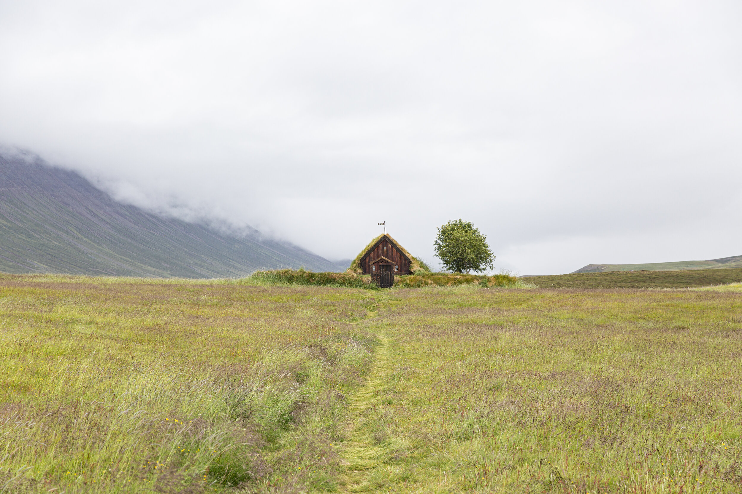
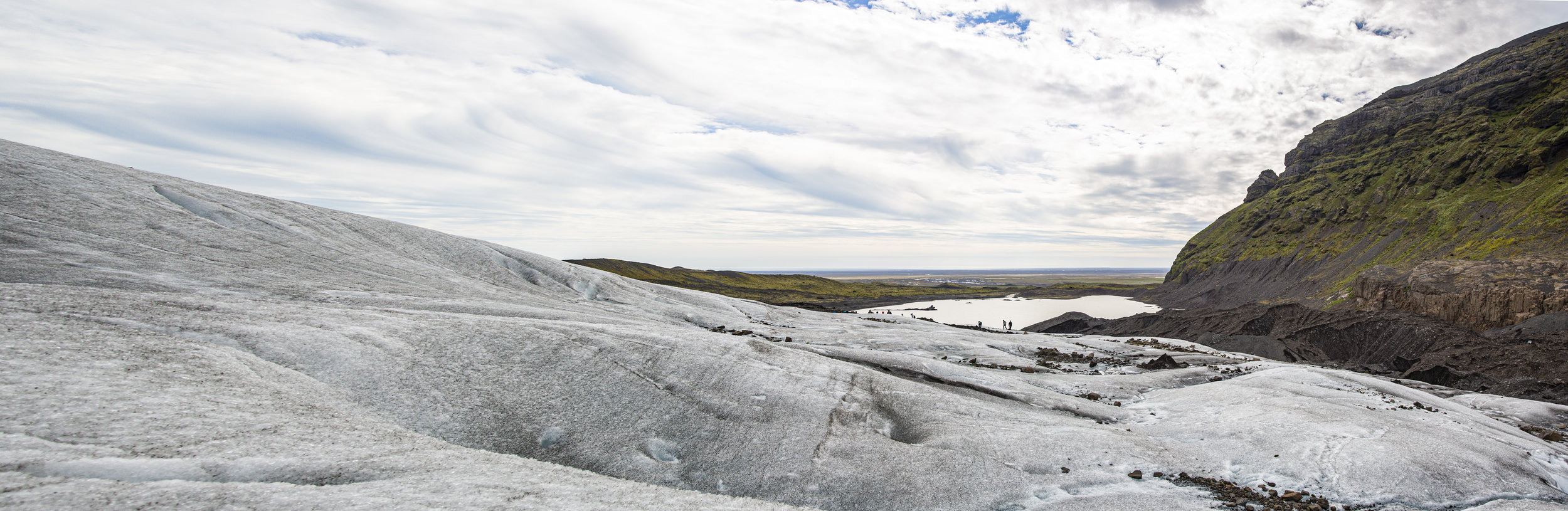
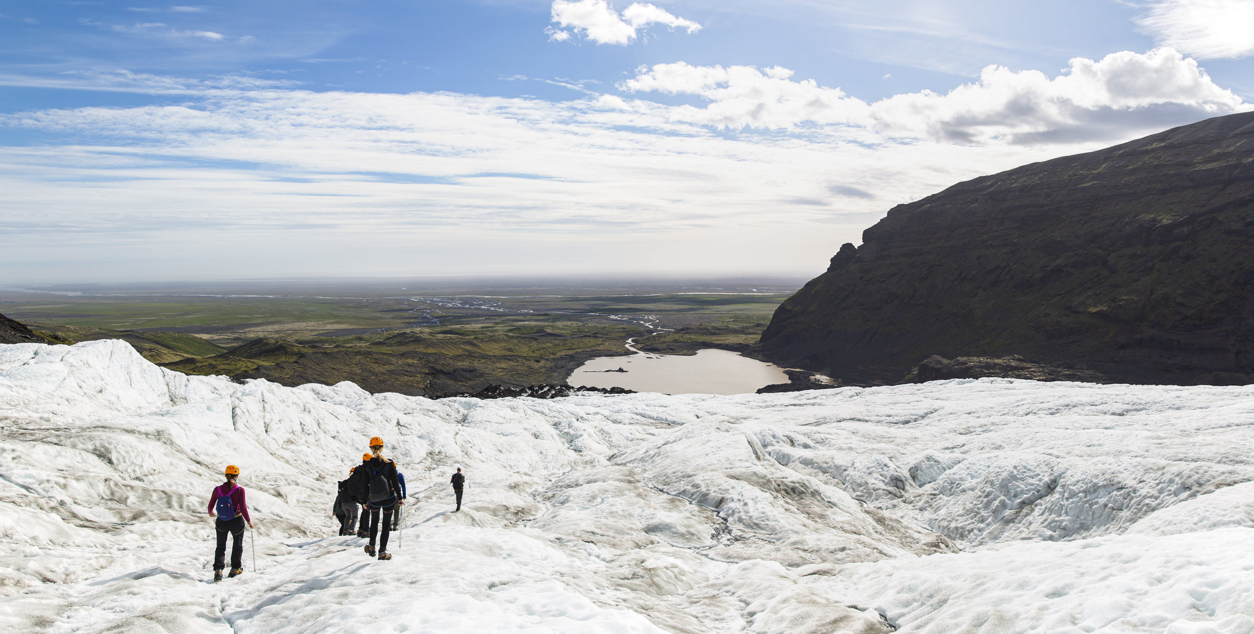
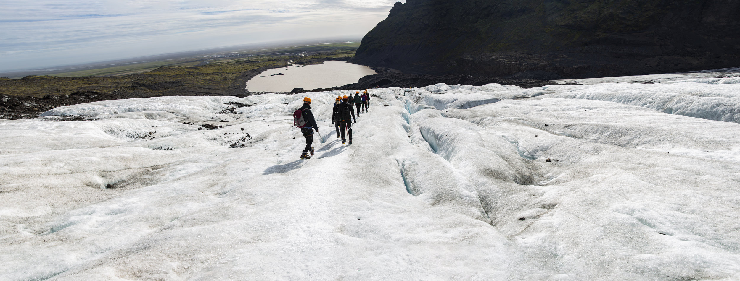
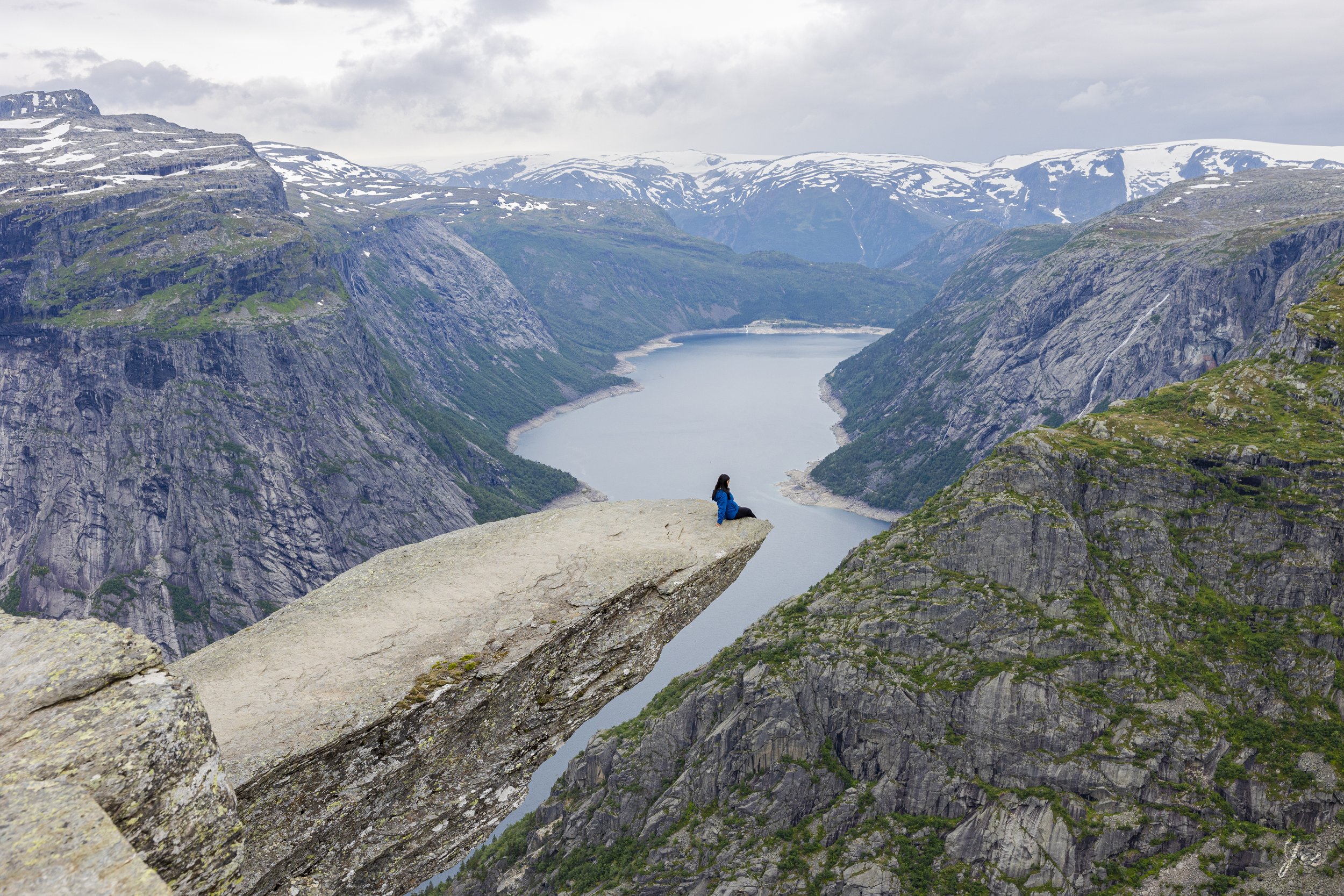
Today is the day that we hit the most famous spot of Norway - the Trolltunga. This is the longest hike we did in Norway - the full hike from the main trailhead from P2 in Skjeggedal is 27km (~17 miles) with 800m (~2600 feet) elevation gain, BUT there is an additional trailhead at P3 Mågelitopp (you can either reserve a parking spot ahead of time, or reserve a shuttle spot that takes you from P2 to P3), which shaves 7km AND almost 1600 feet off the full hike.

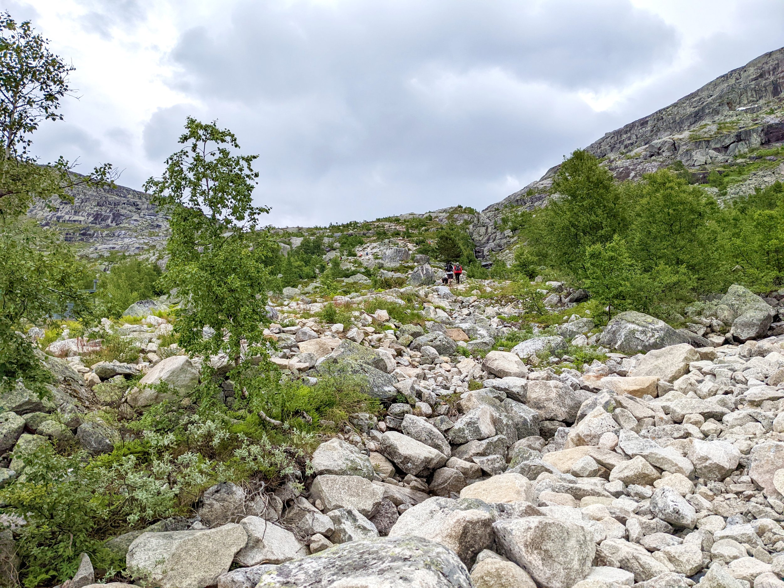
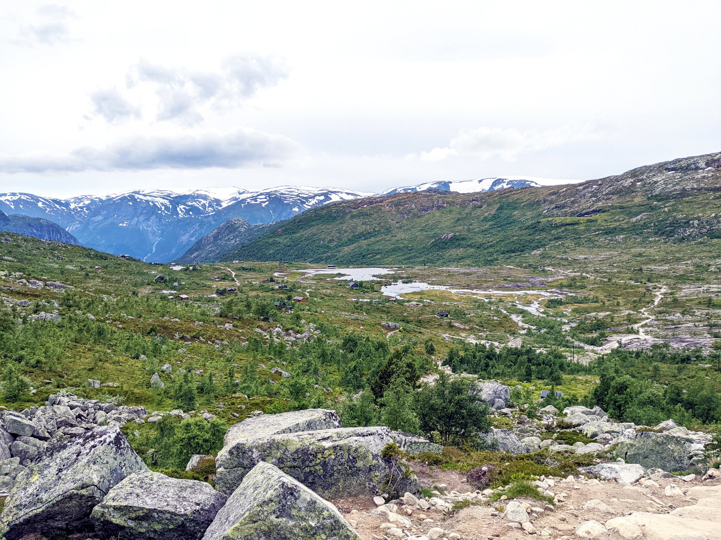
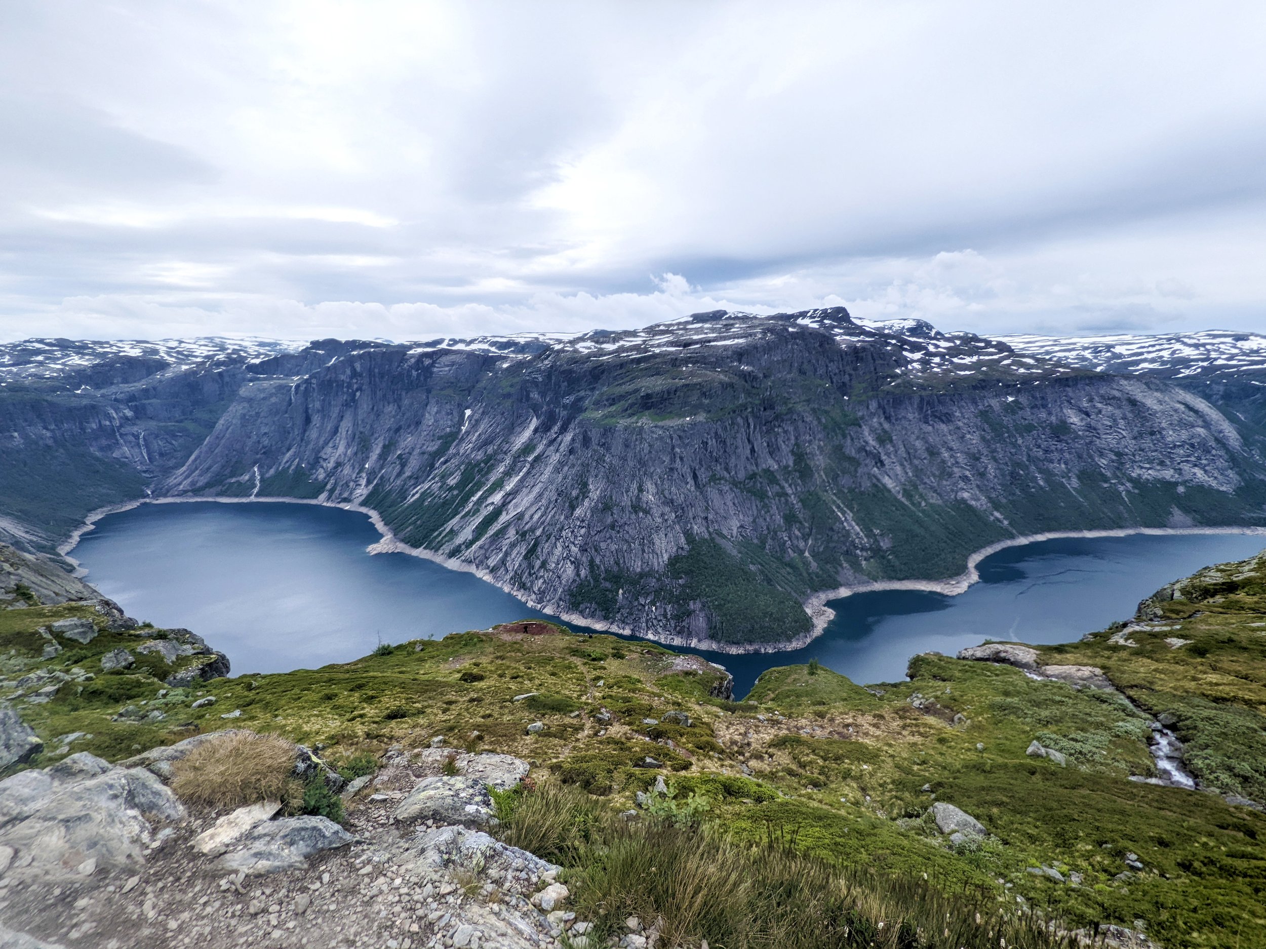
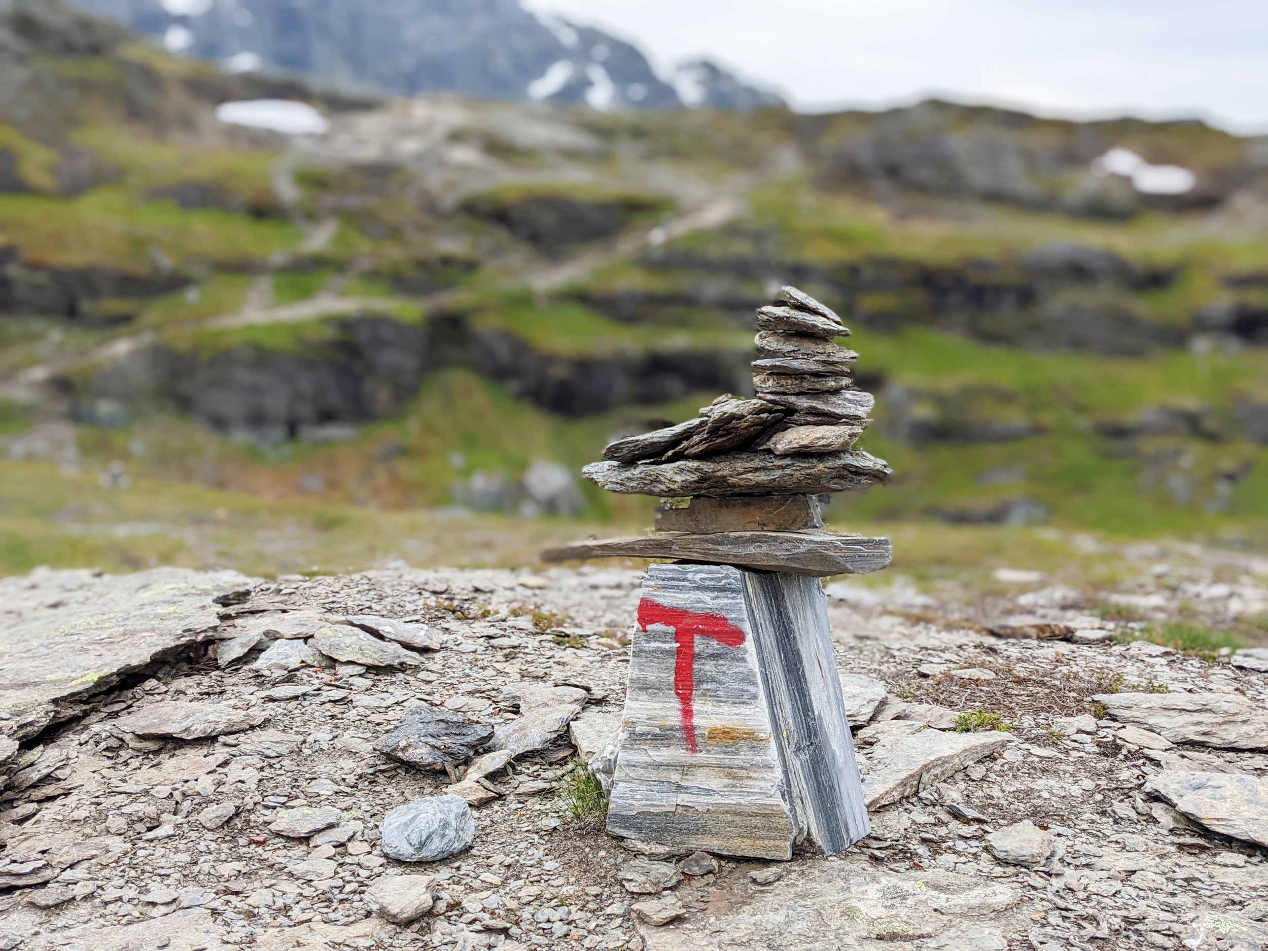
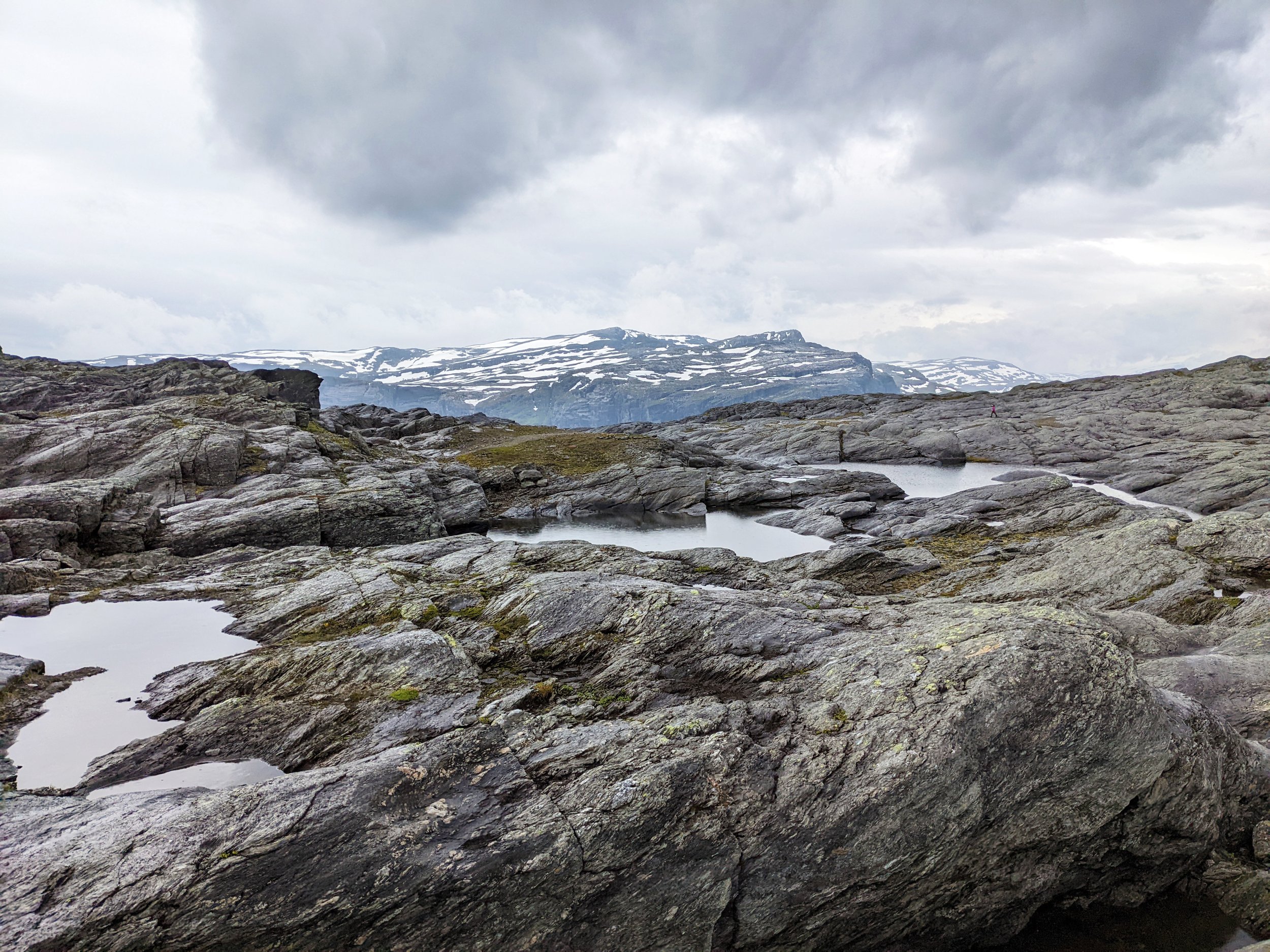
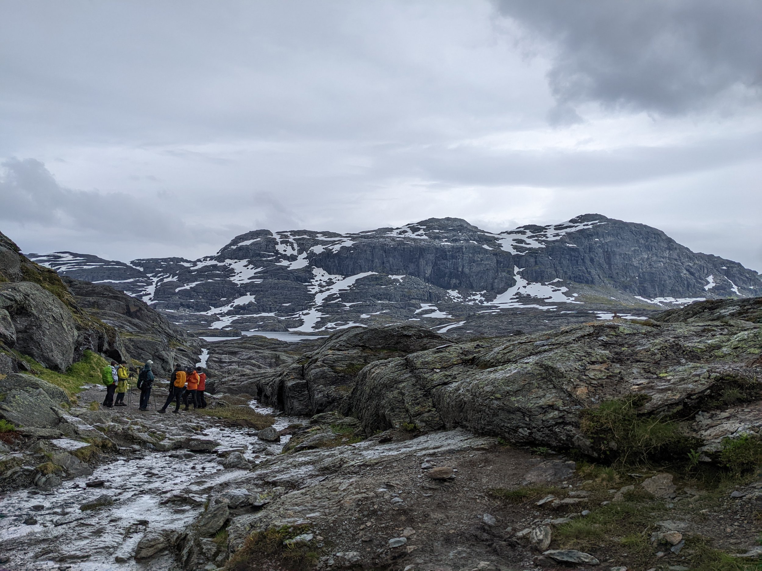
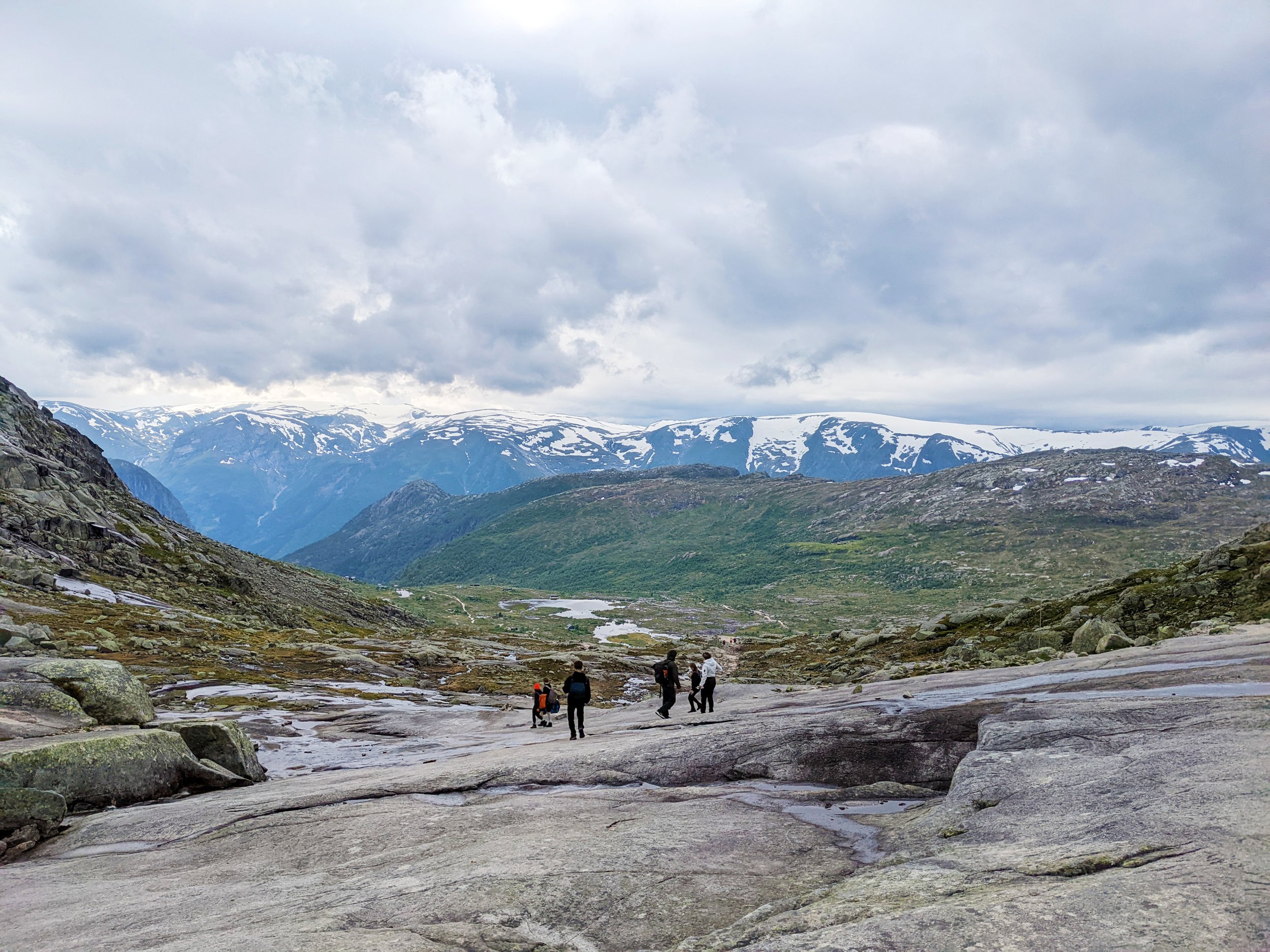
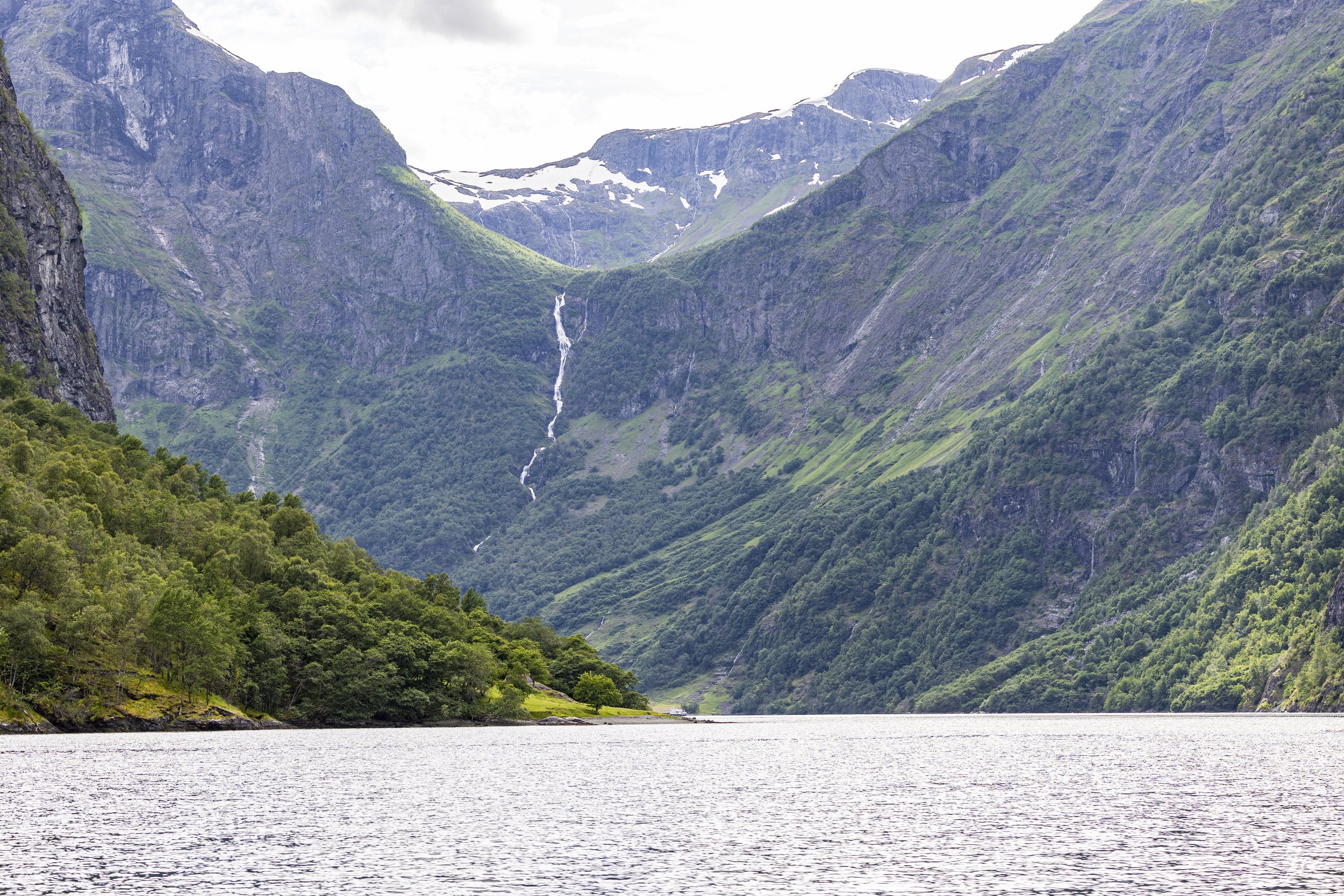
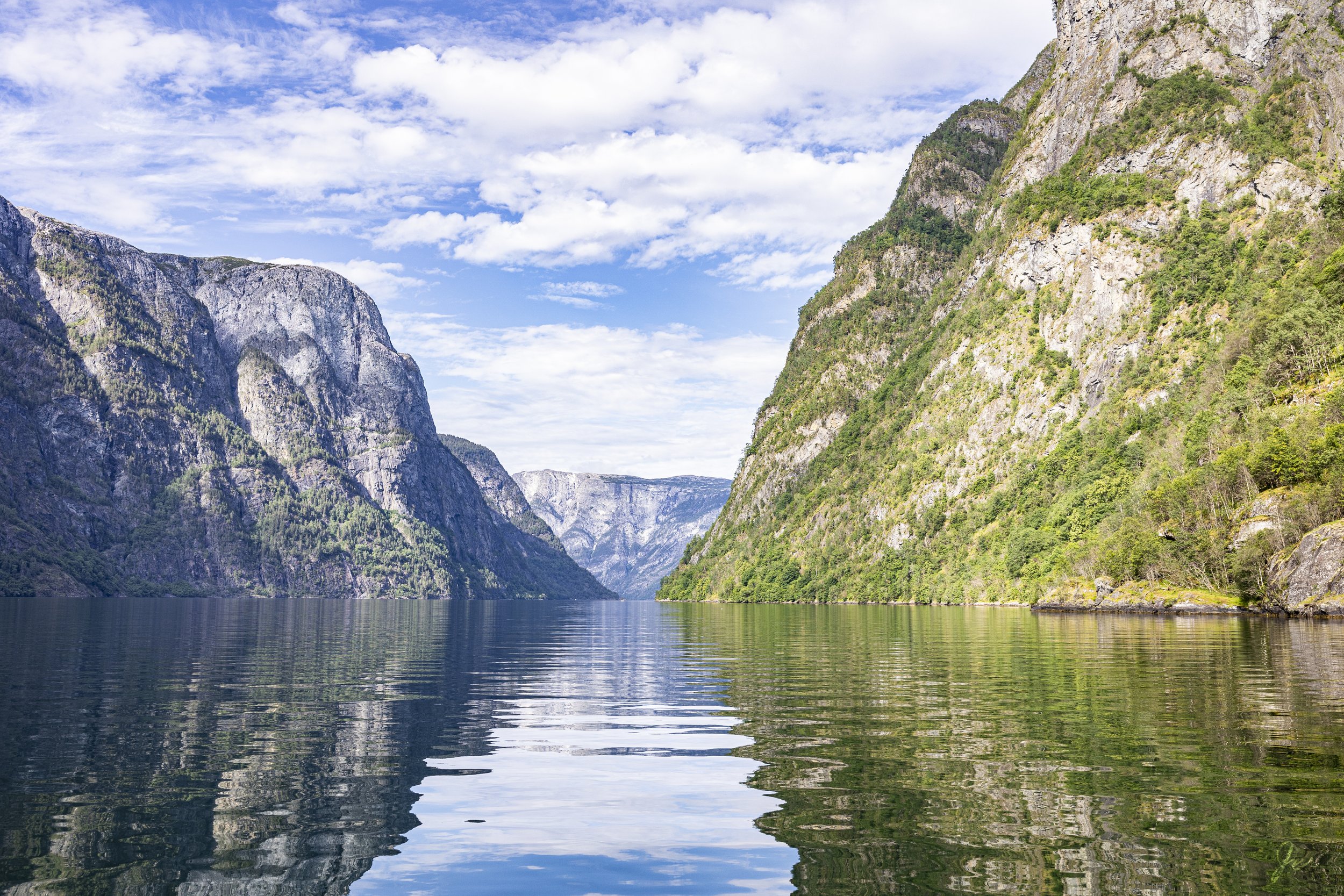
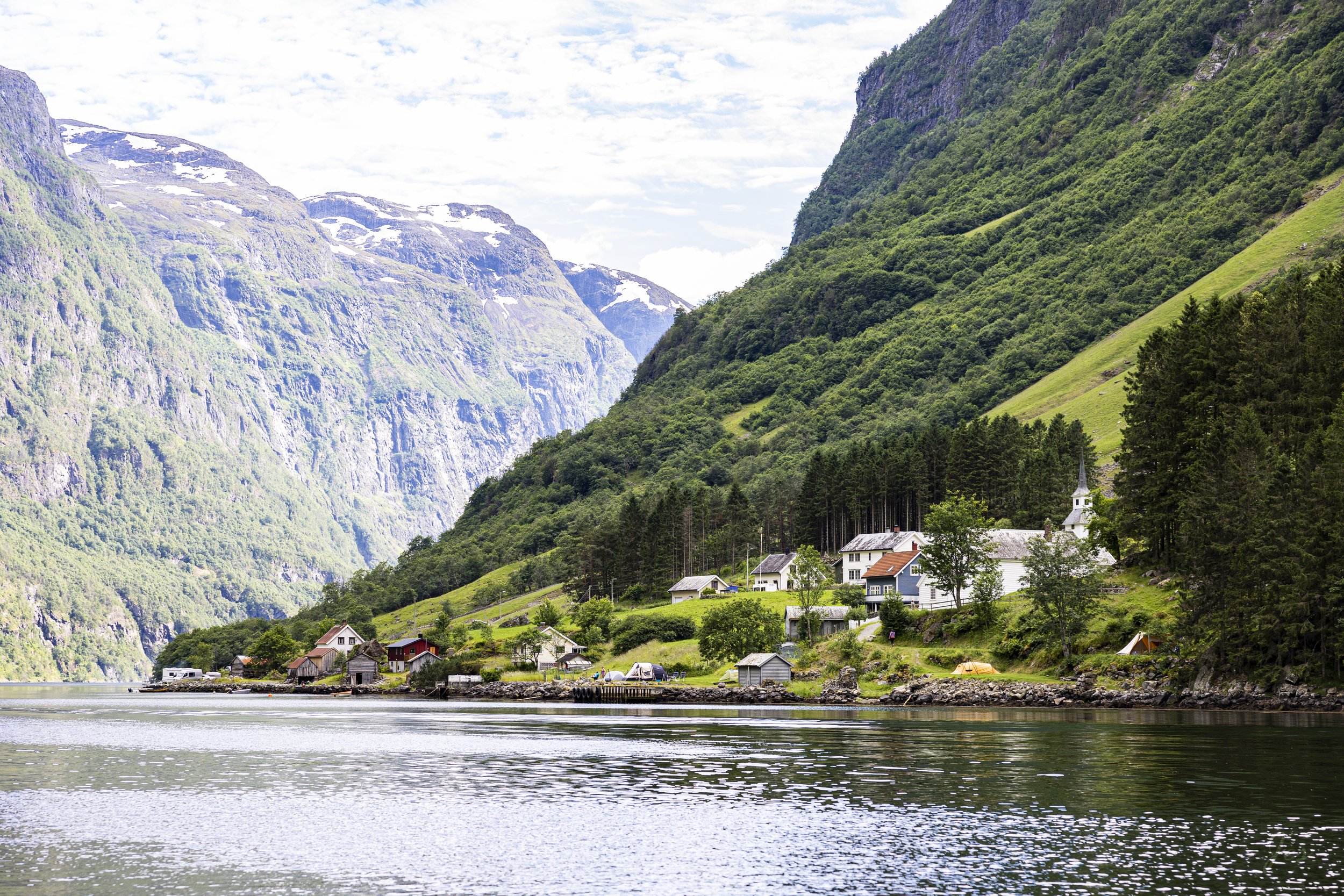
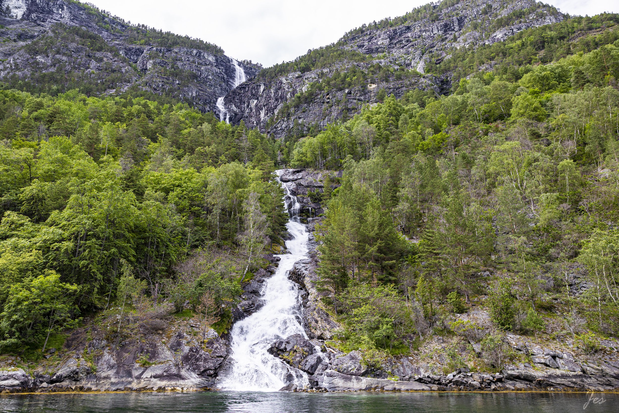
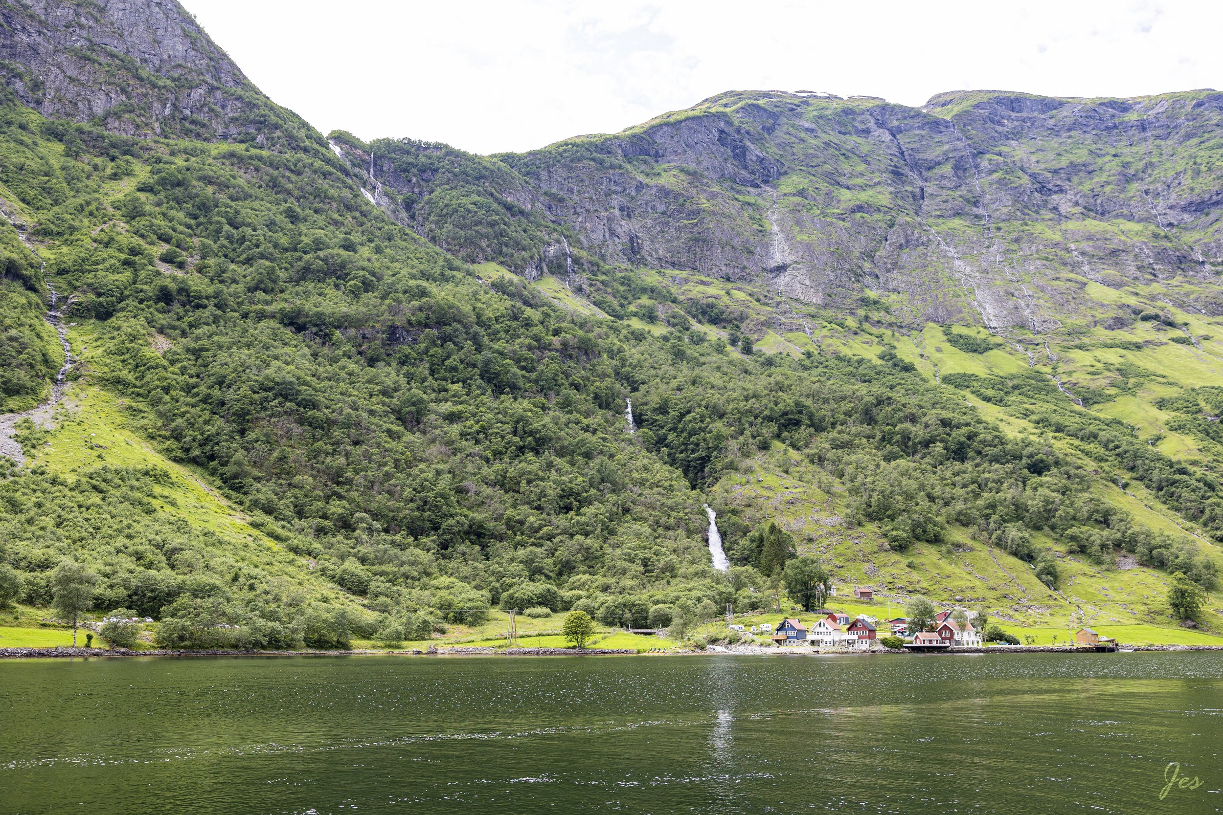
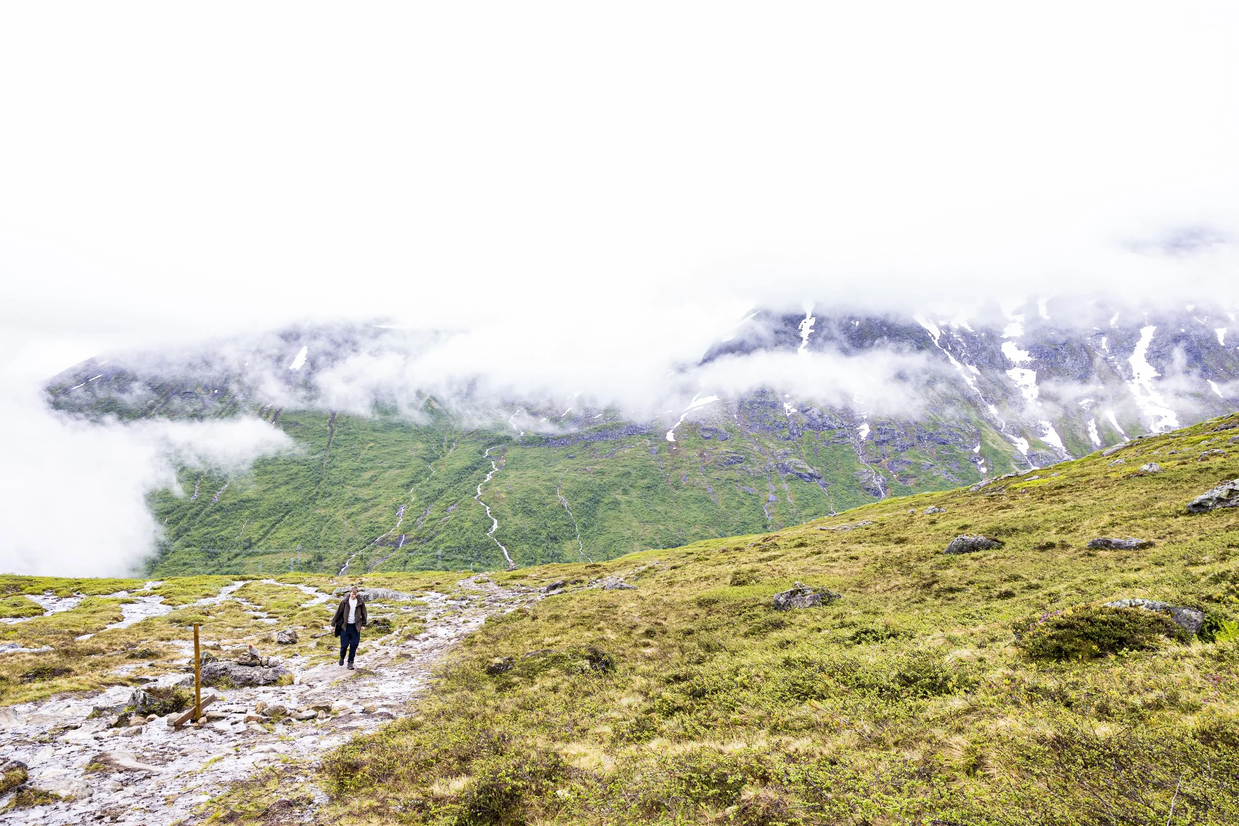
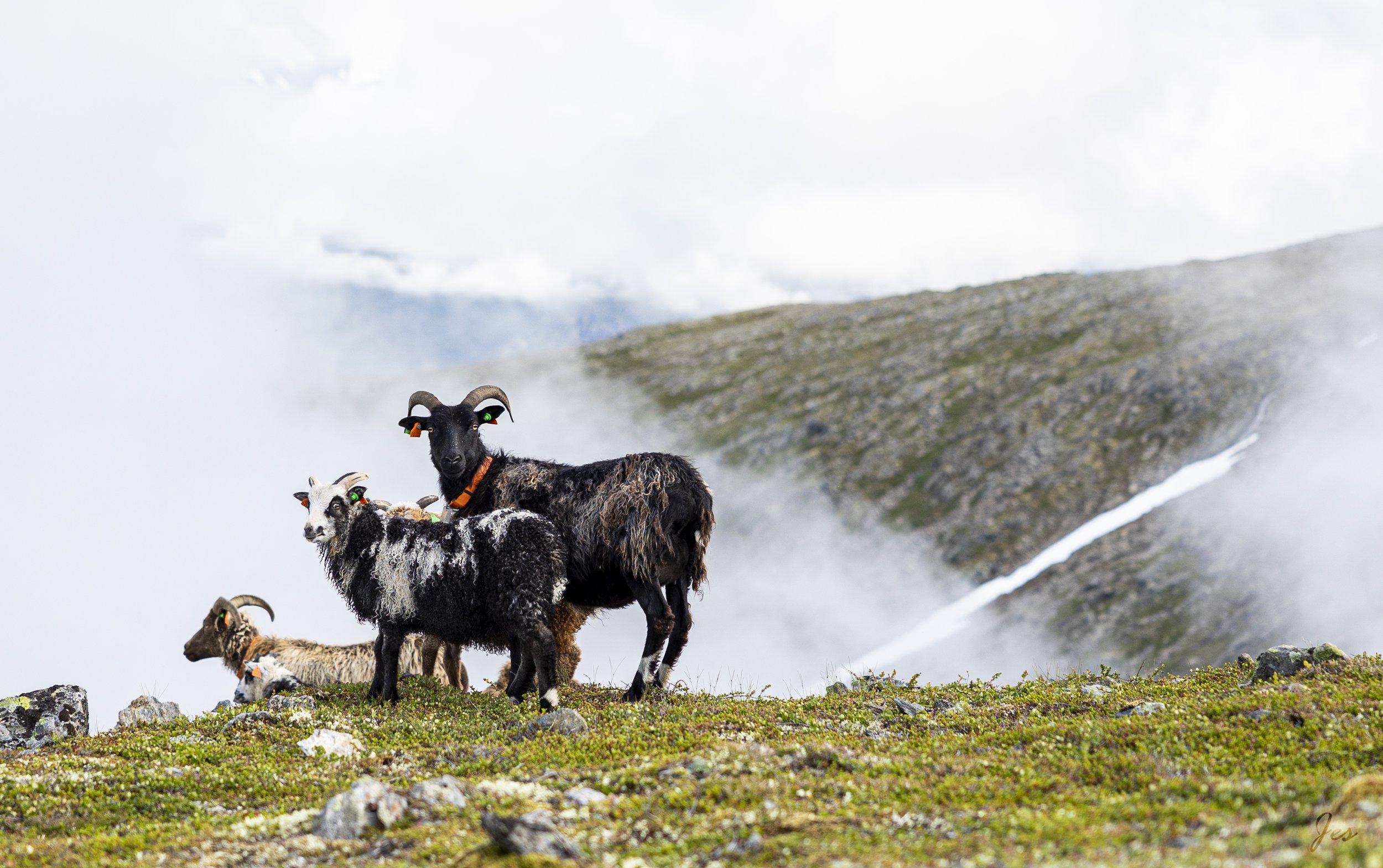
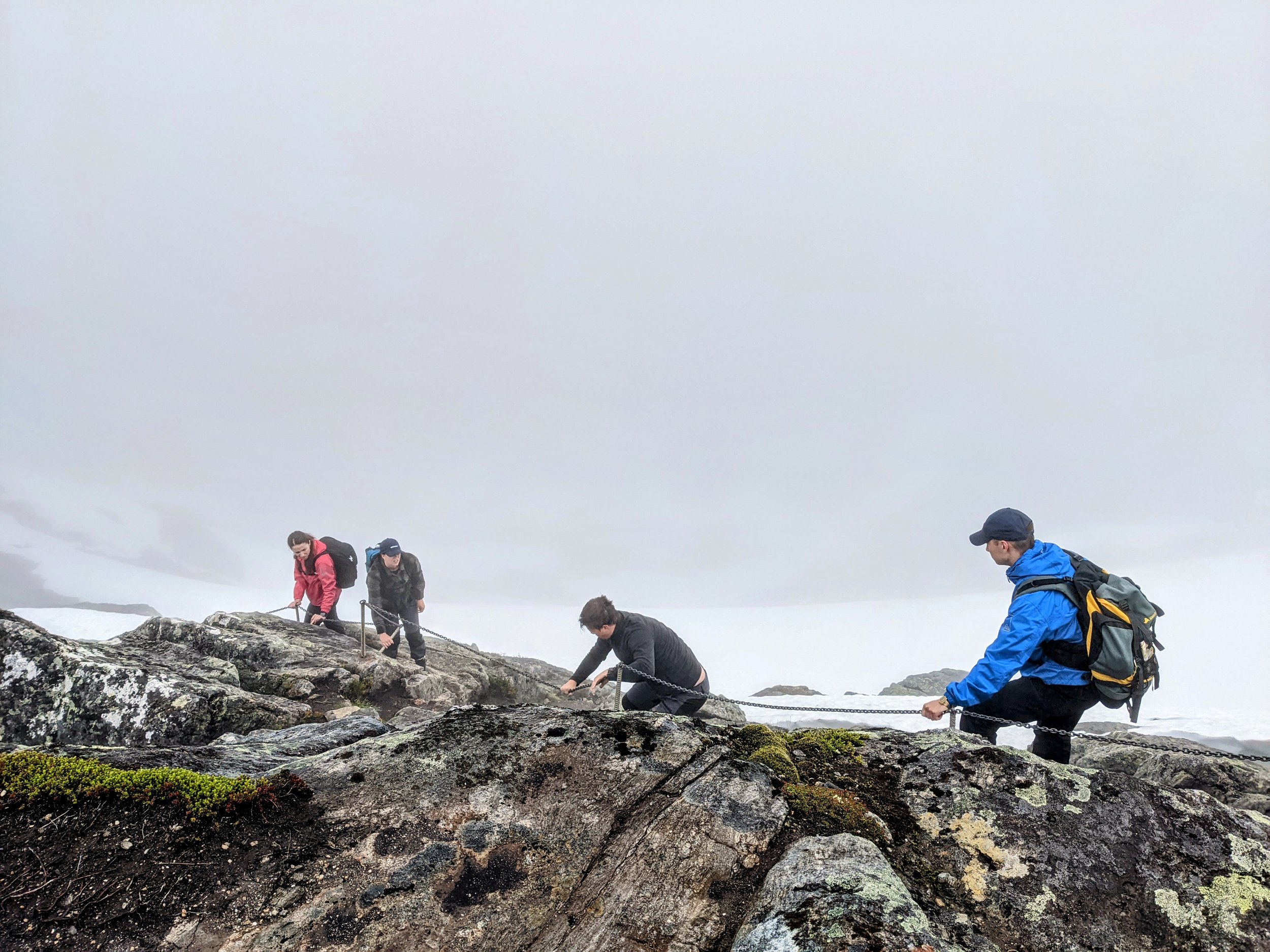
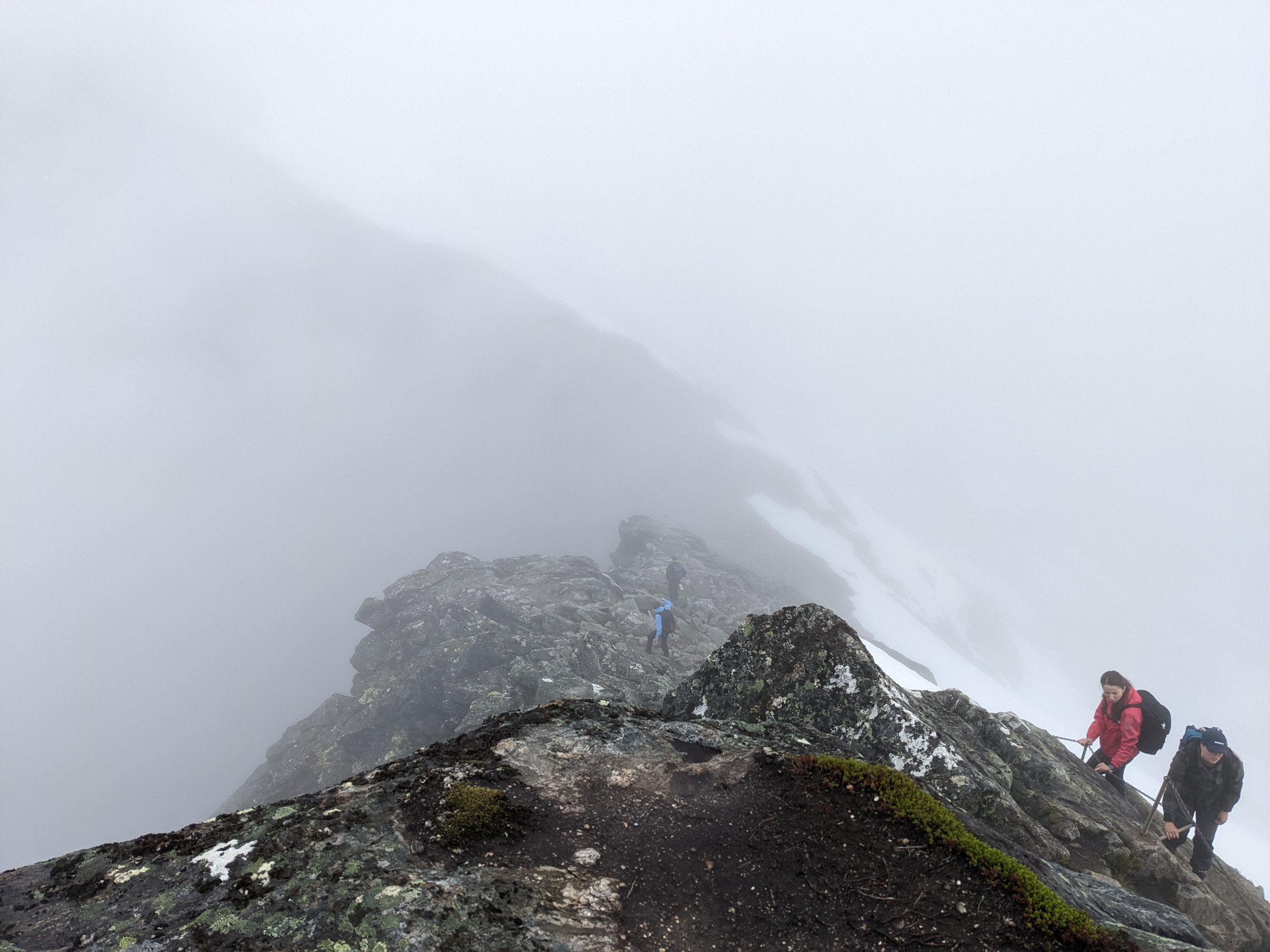
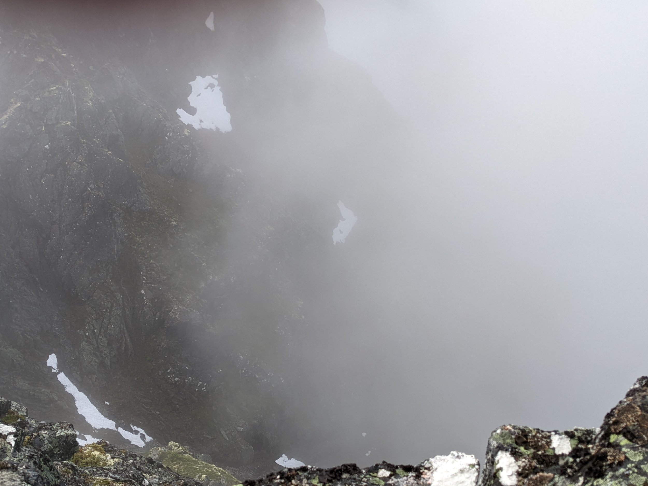
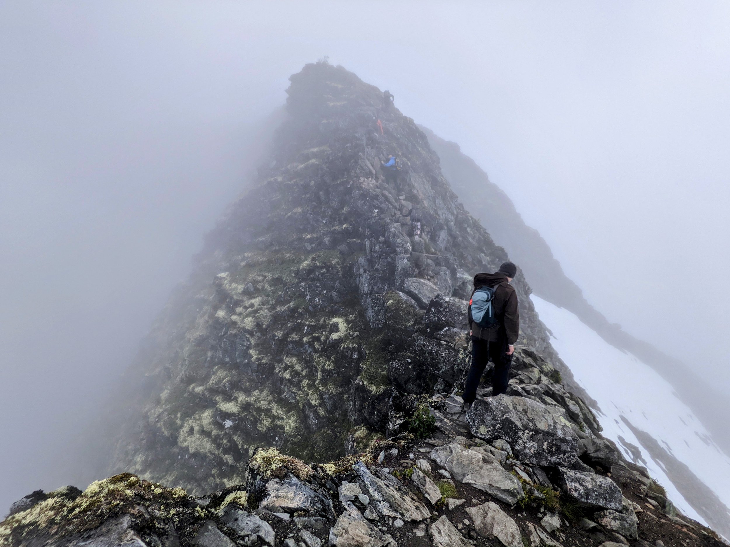
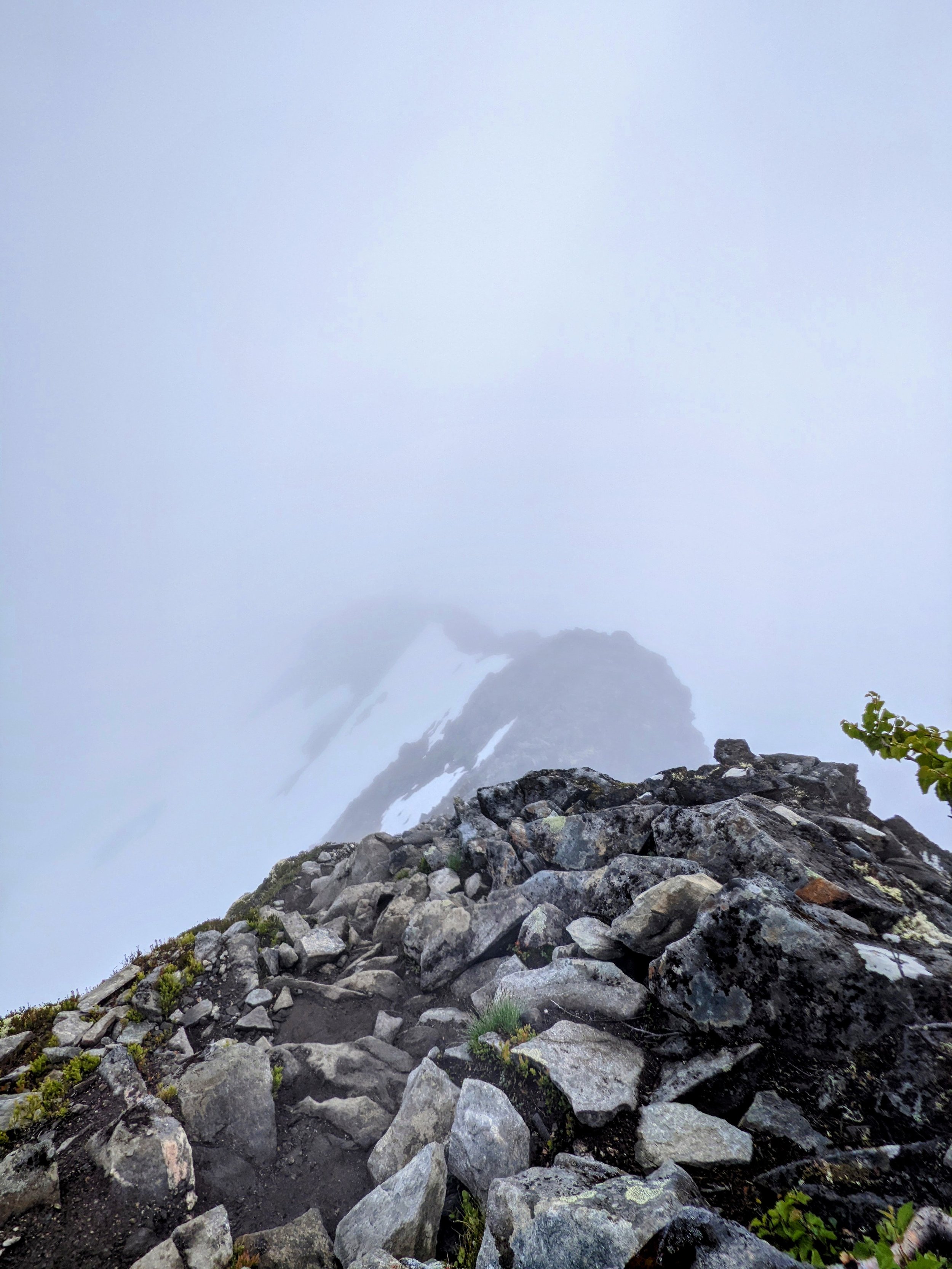
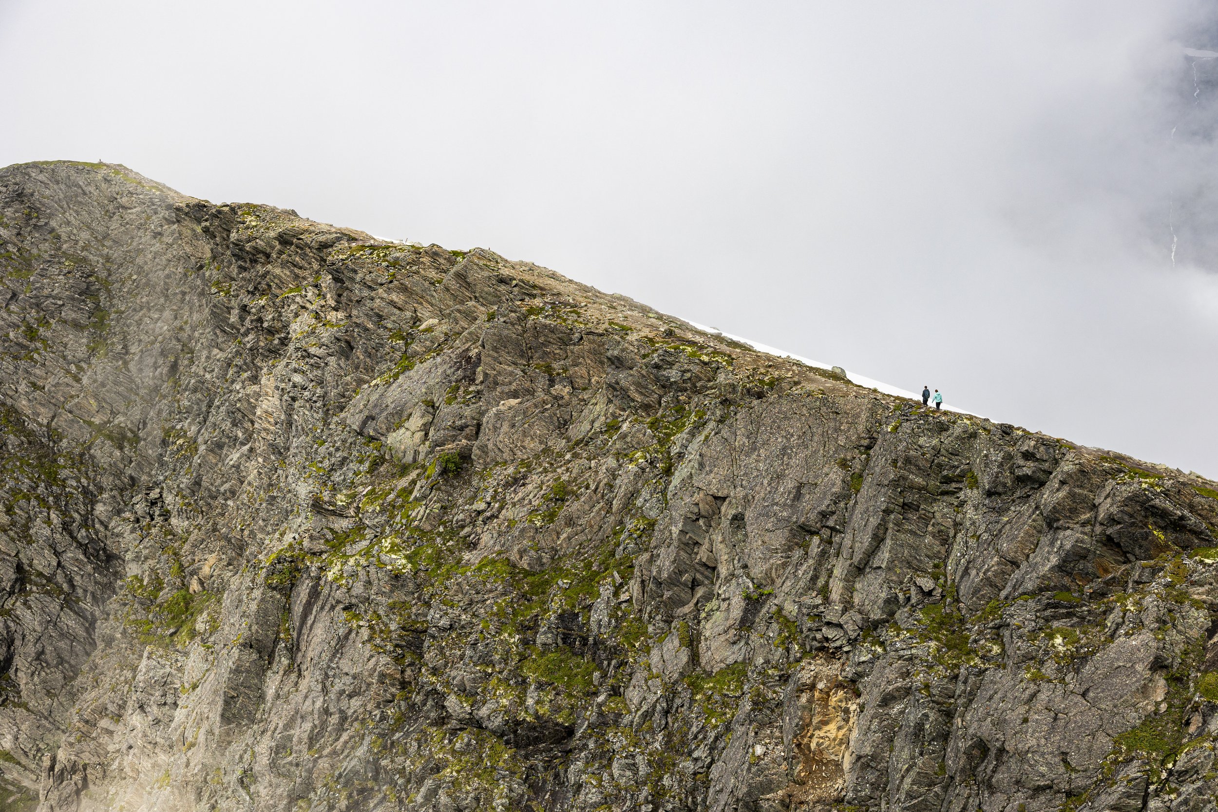
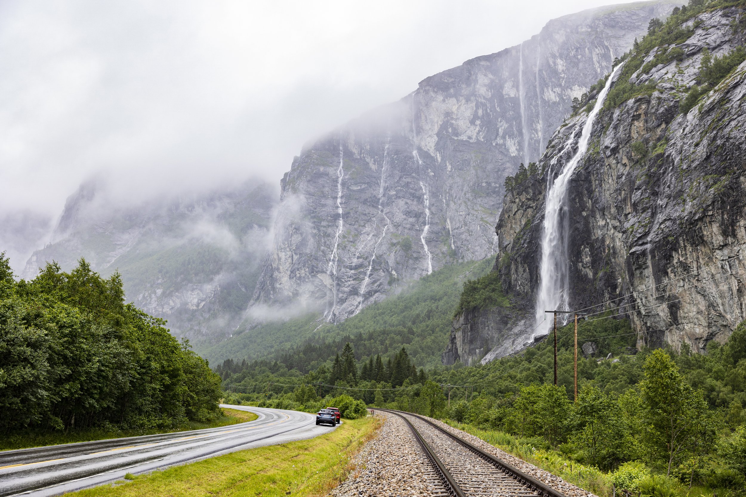
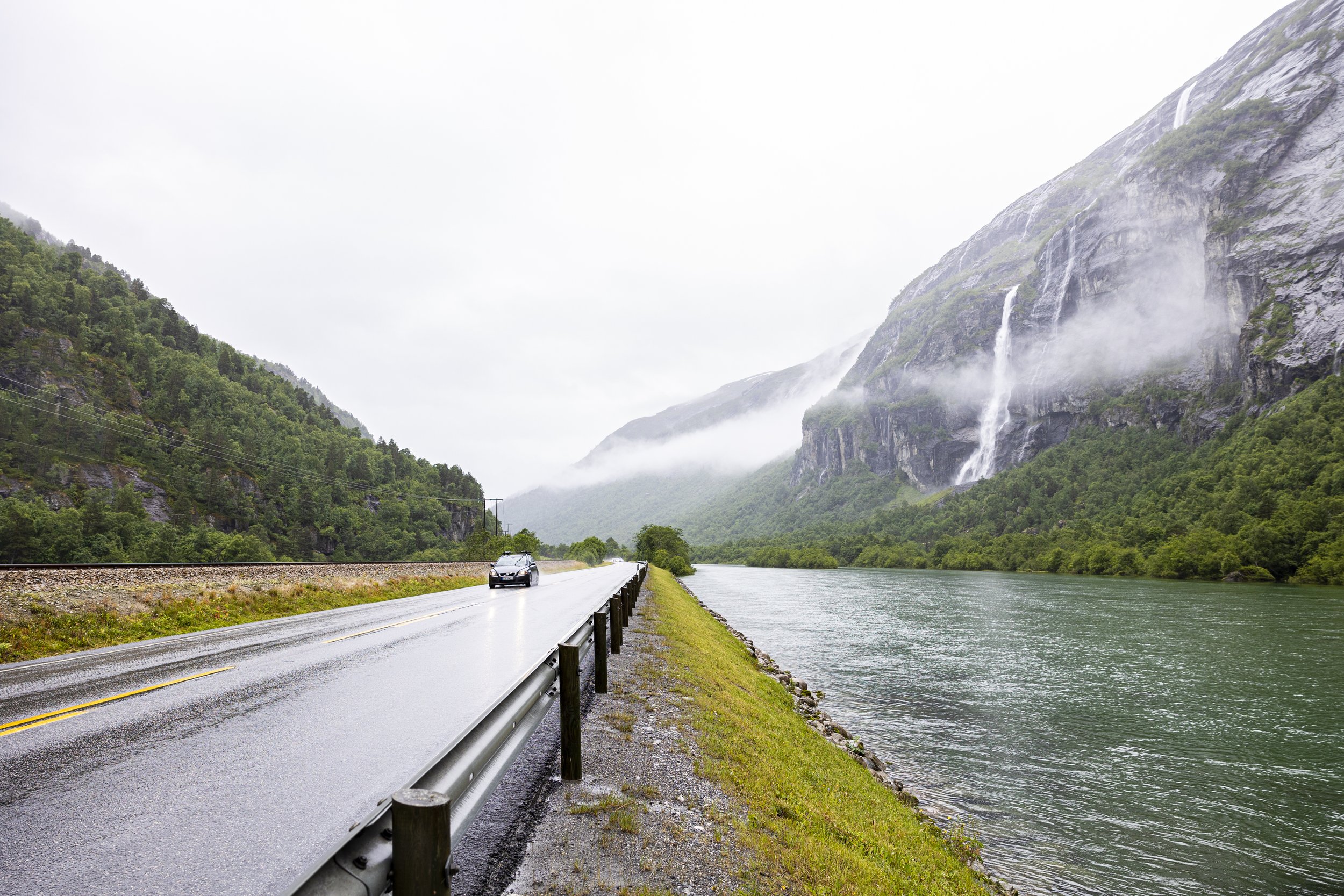
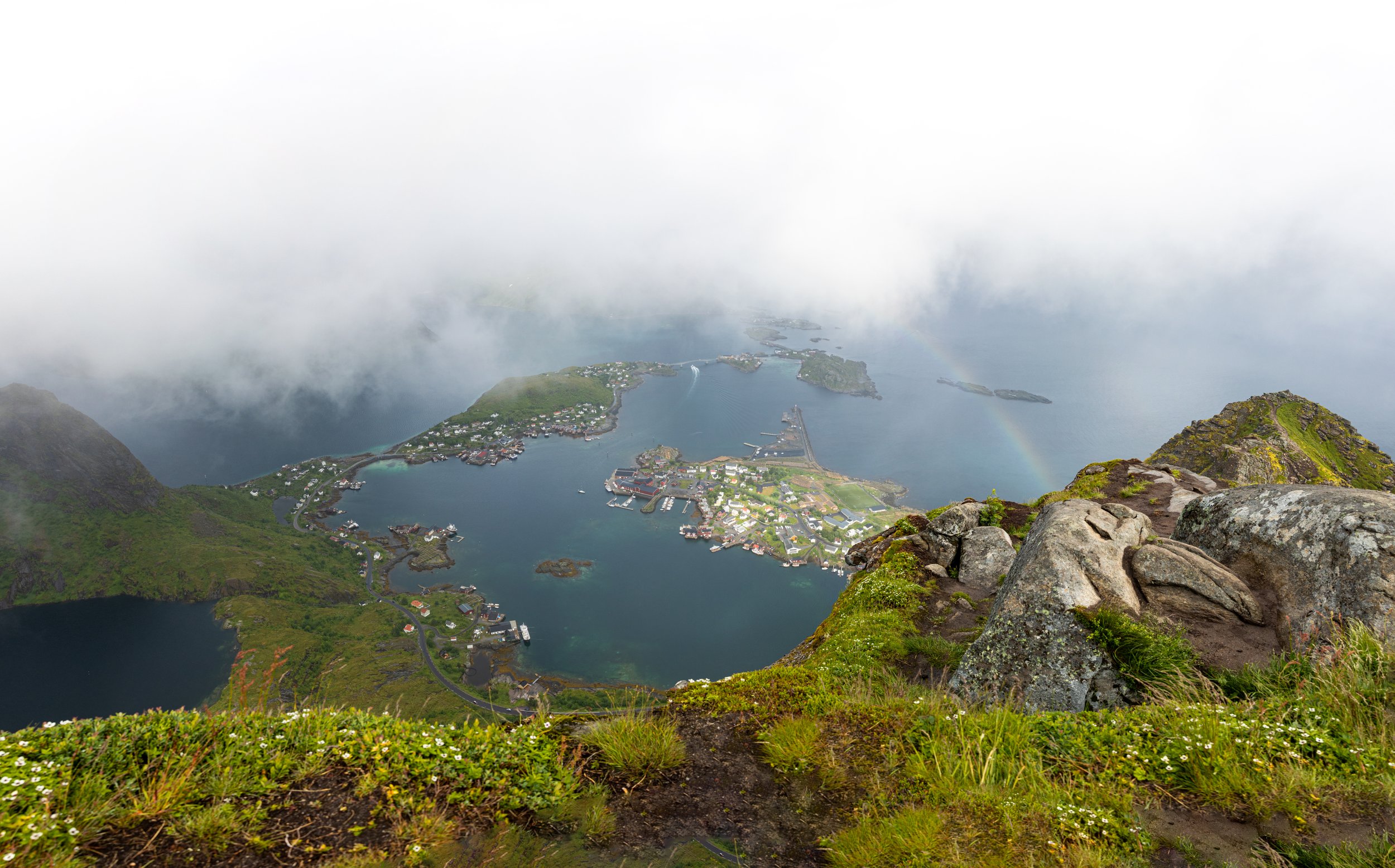
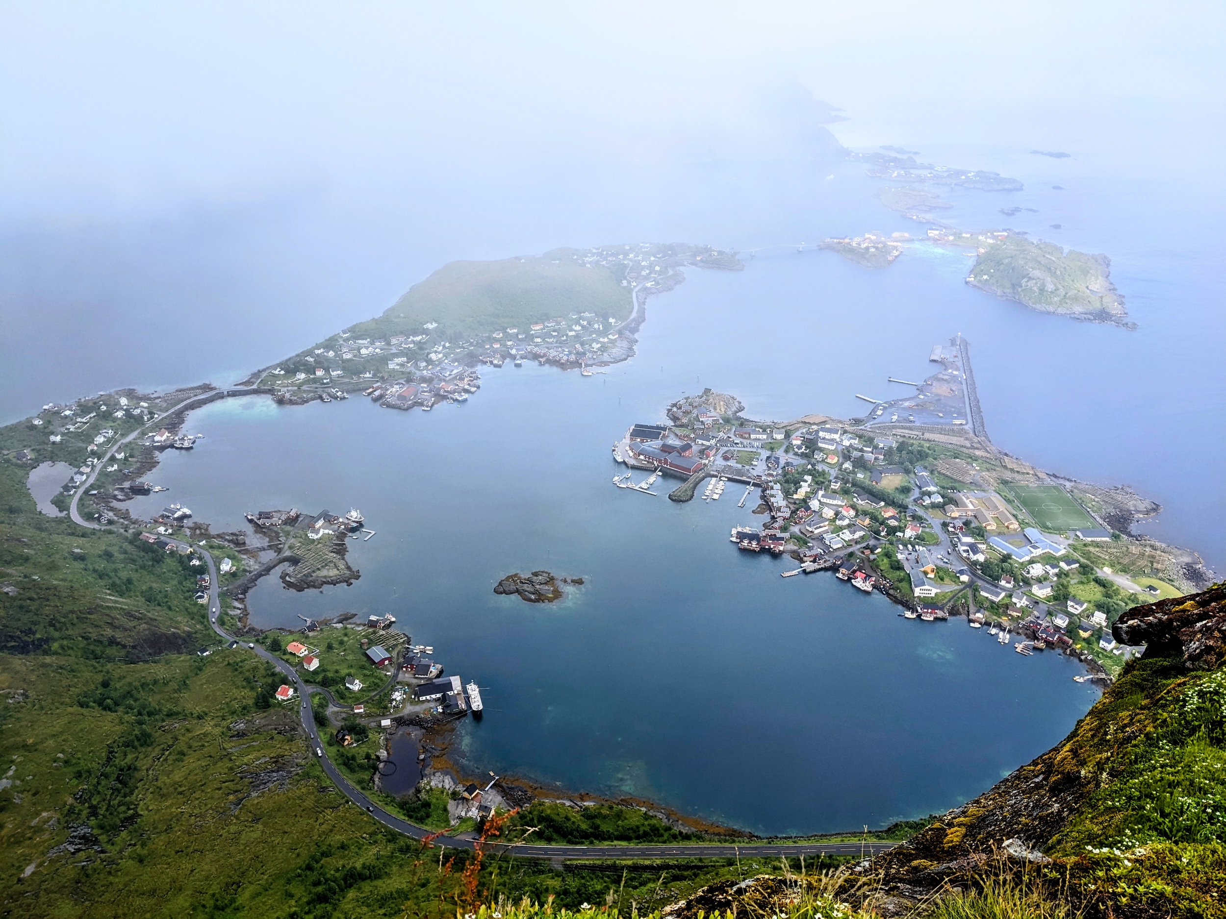
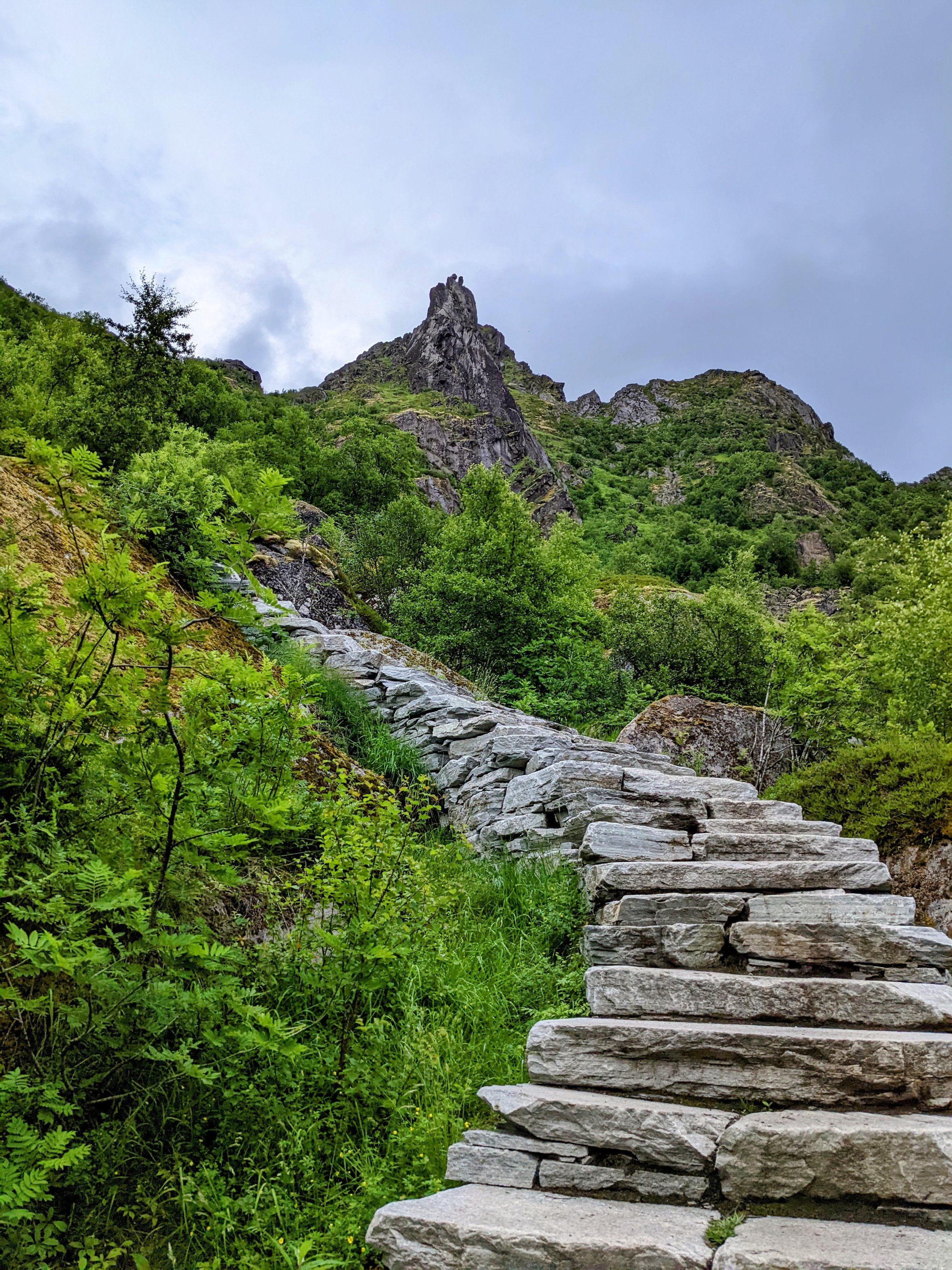
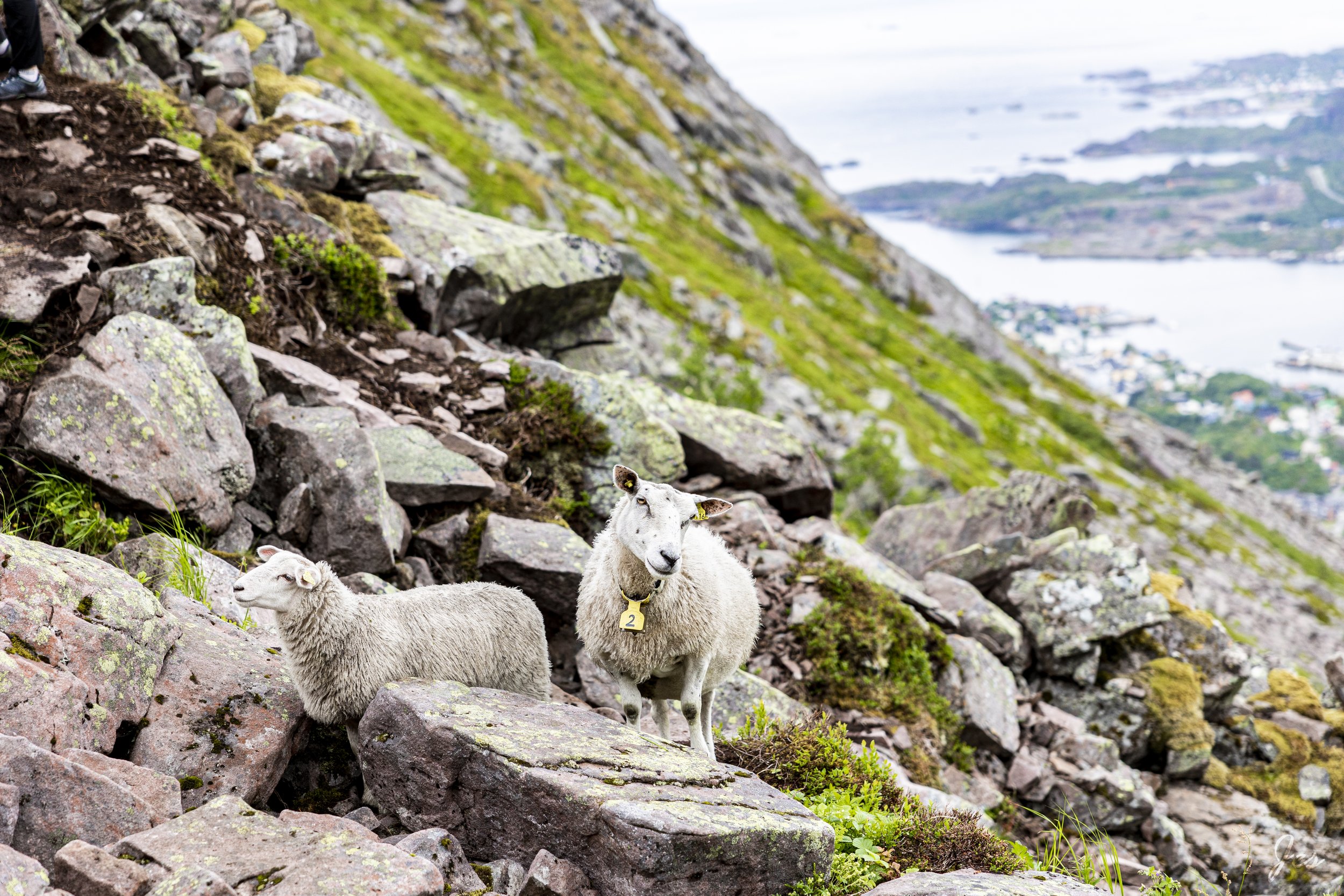
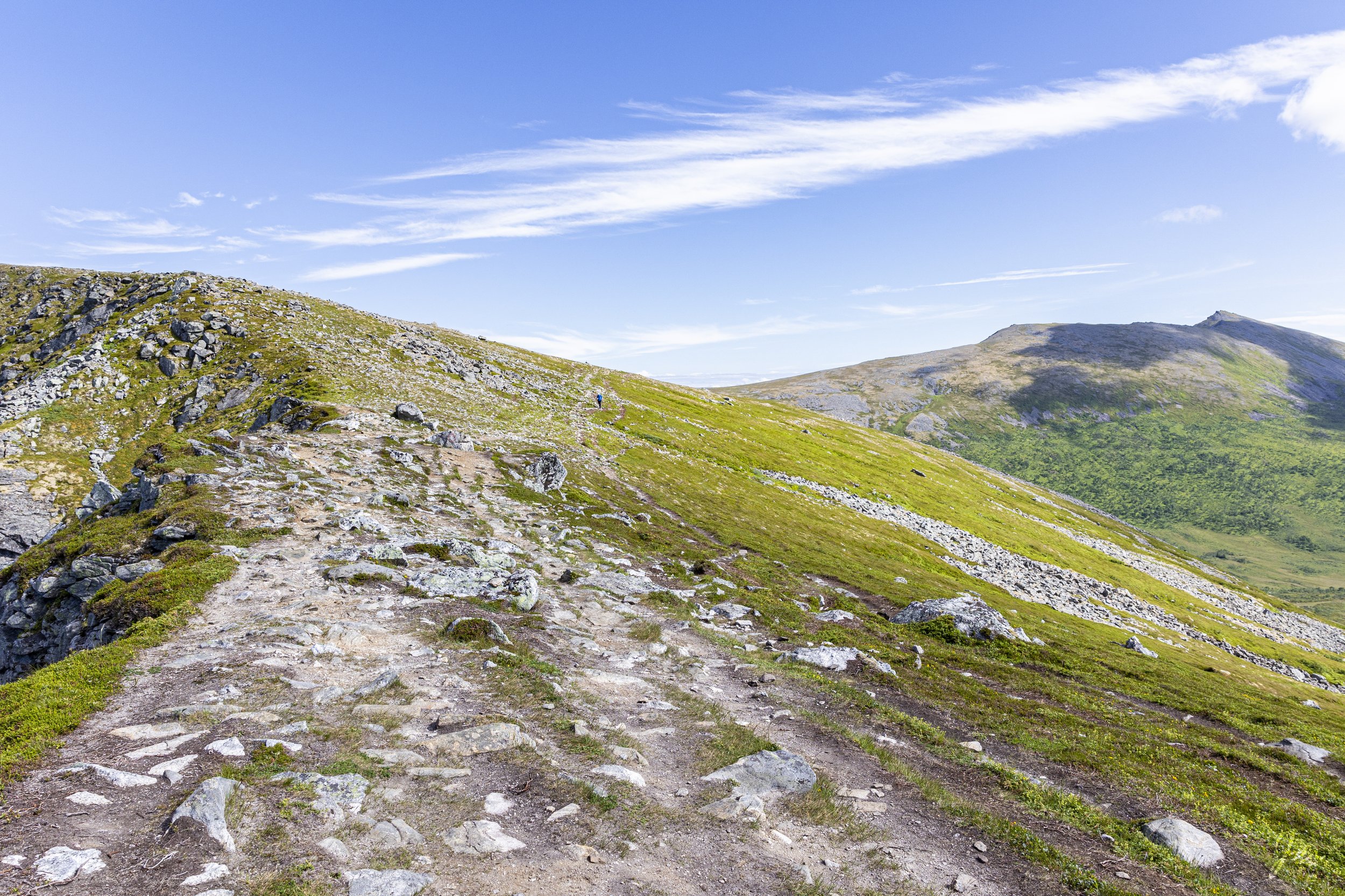
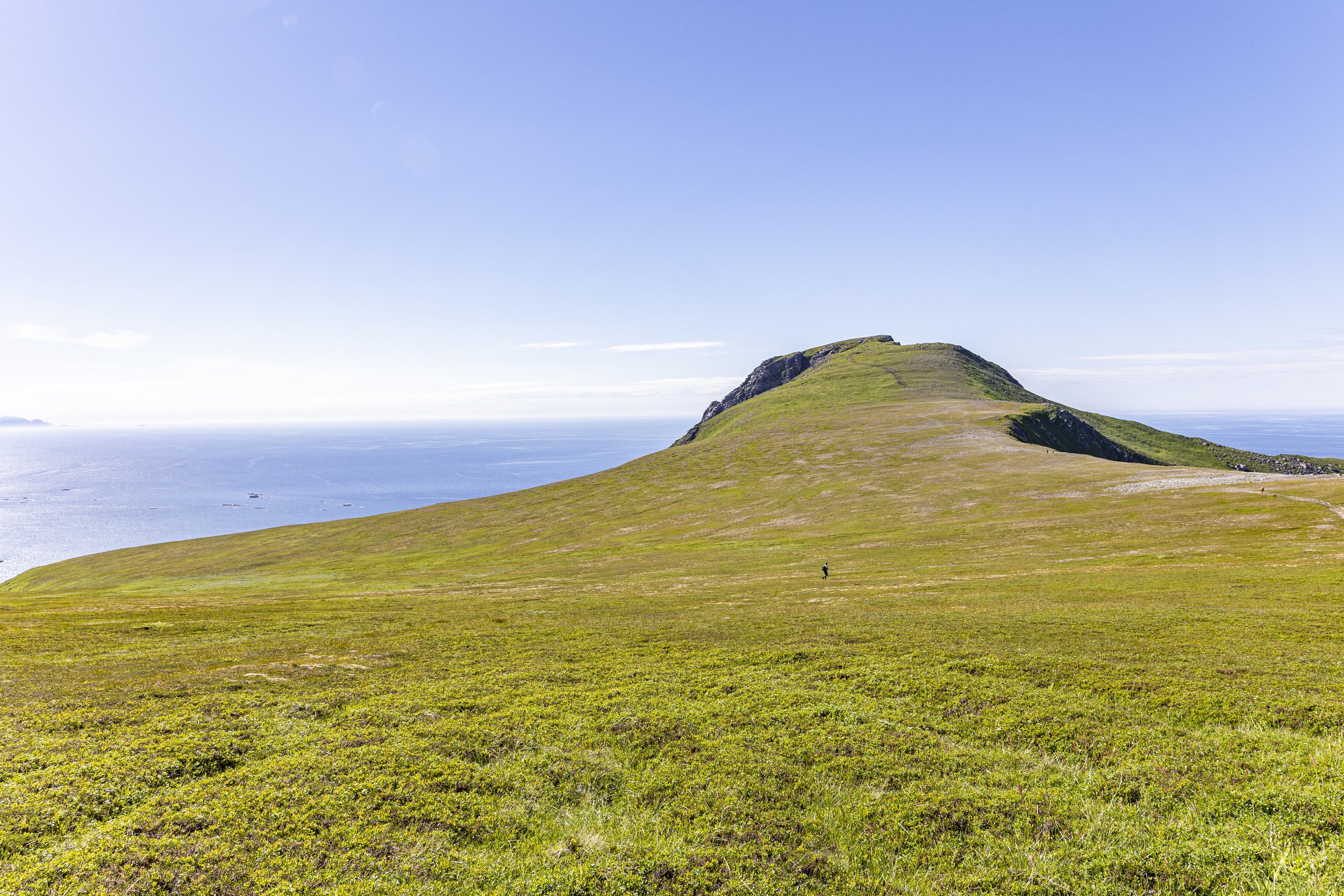
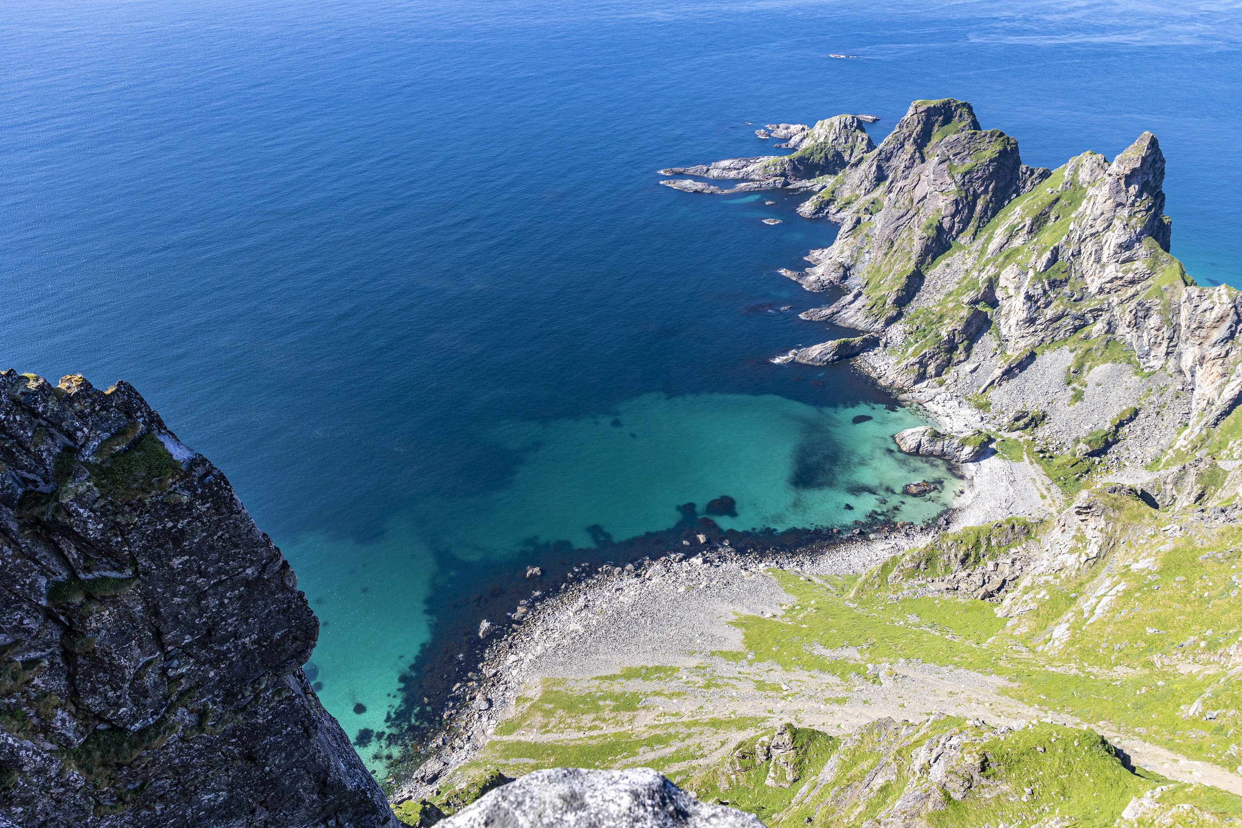
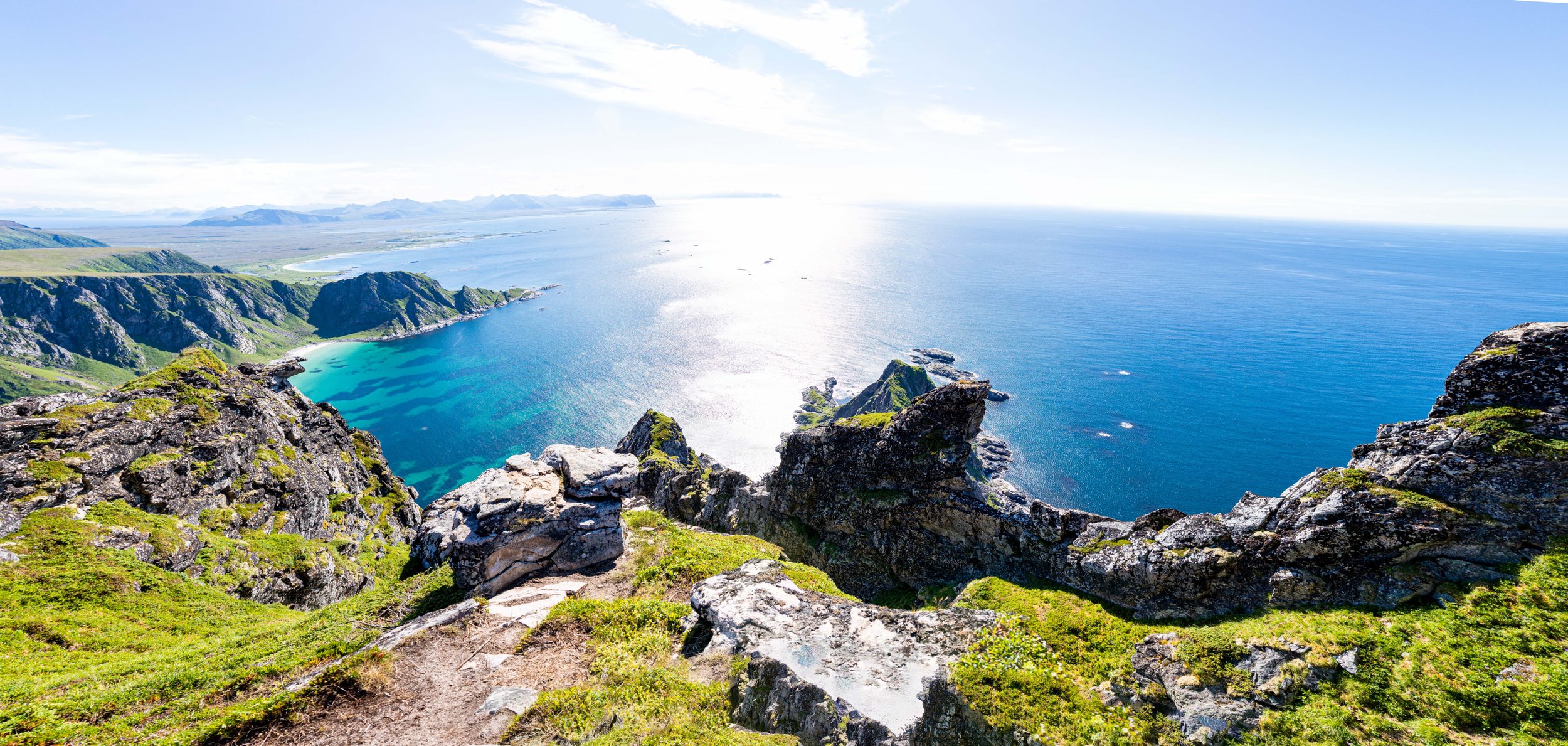
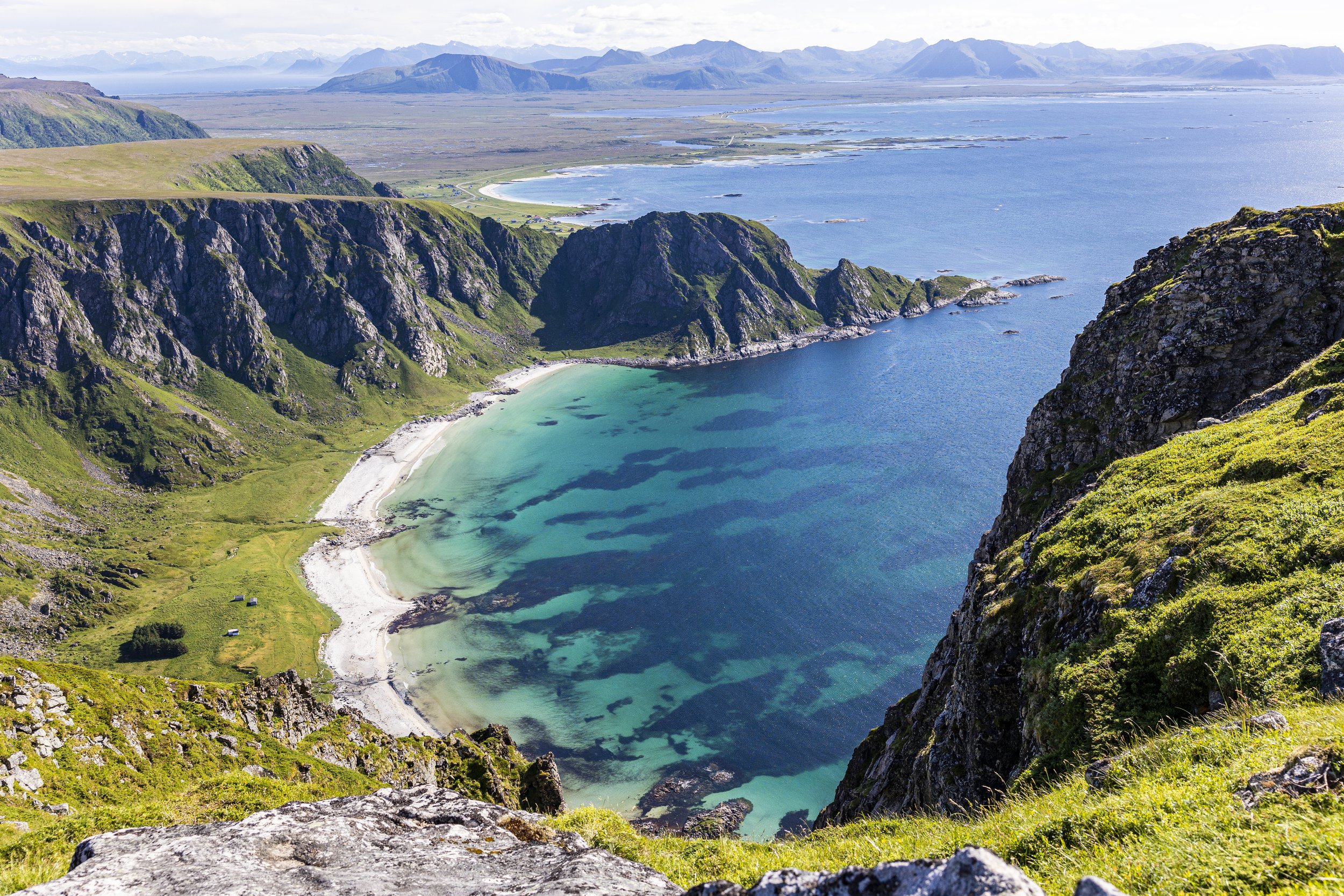
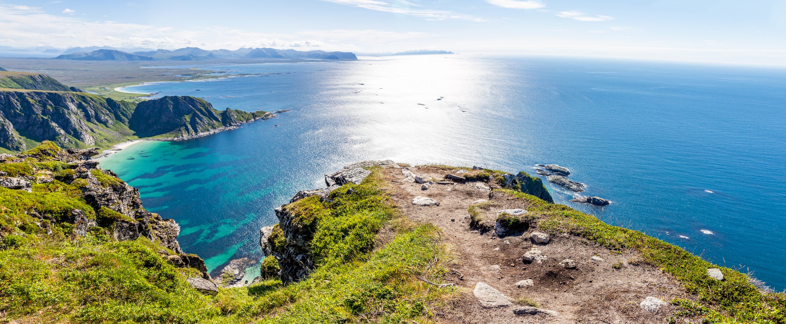
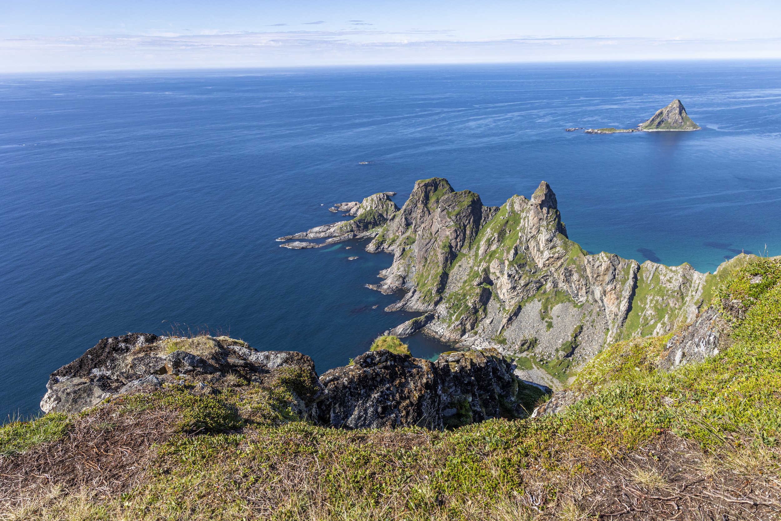
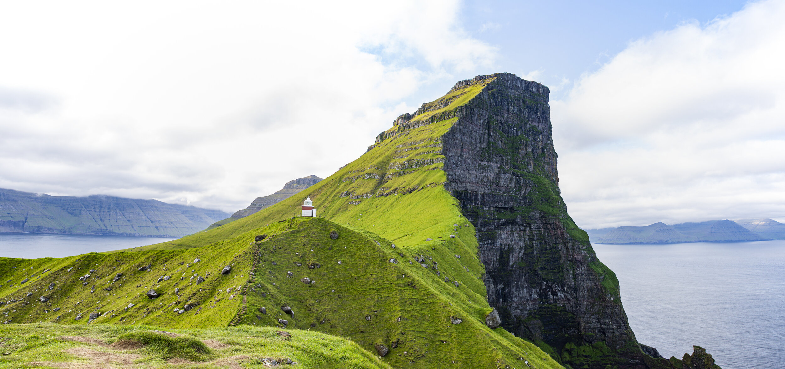
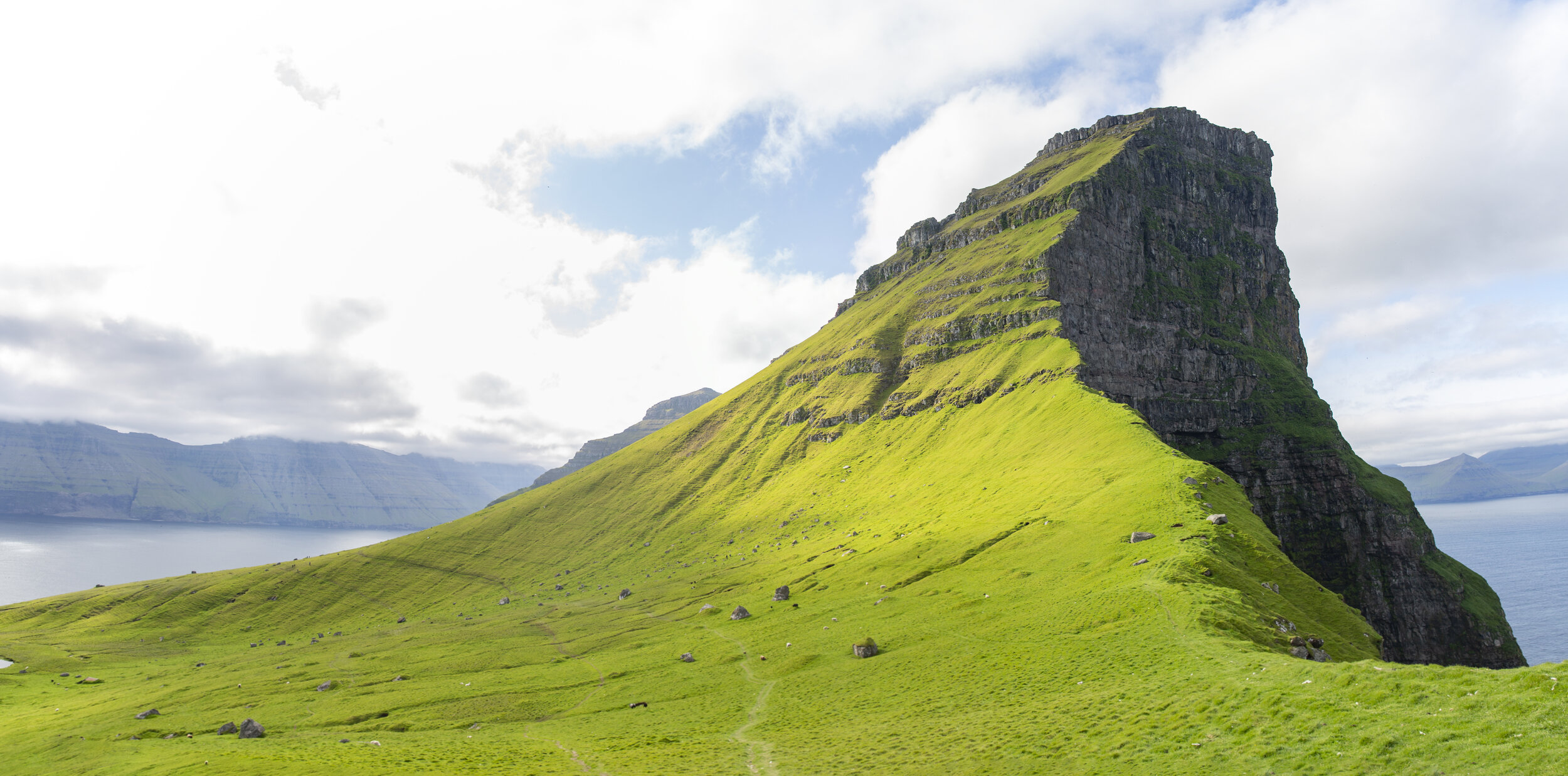
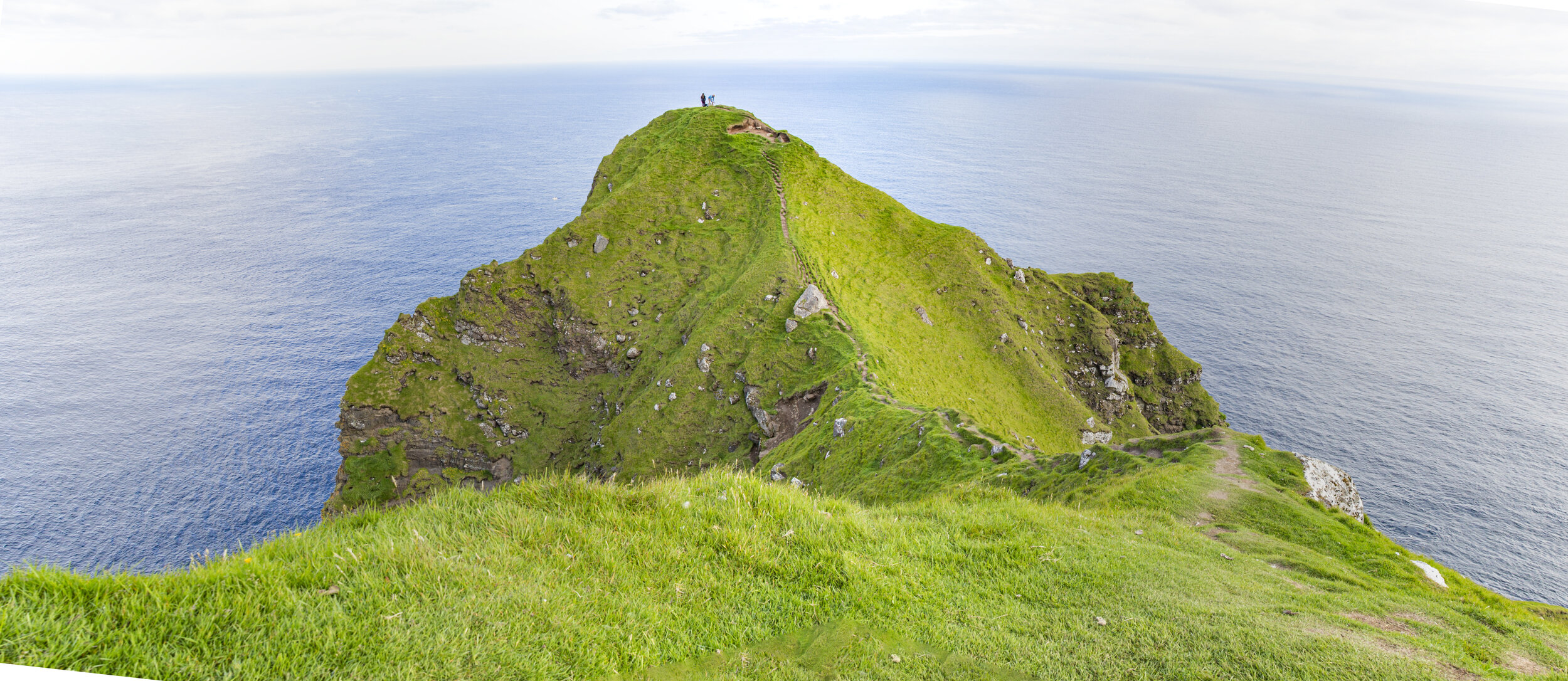
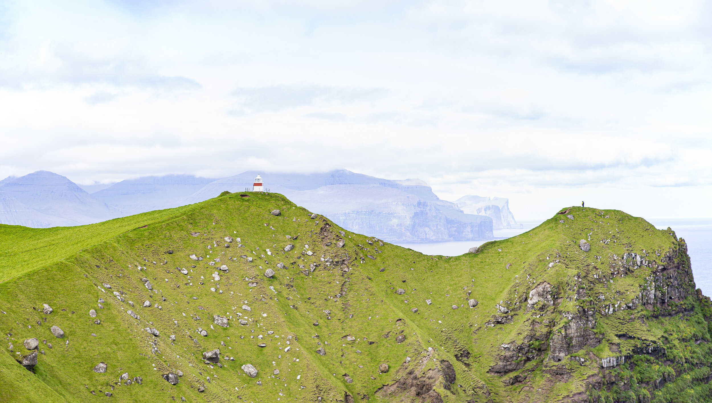
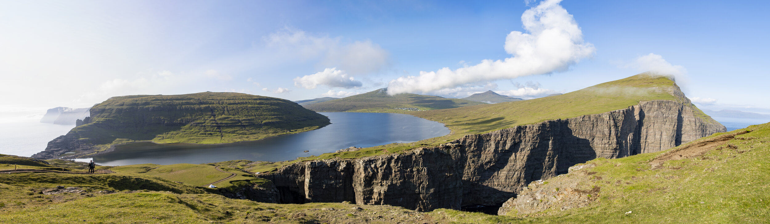
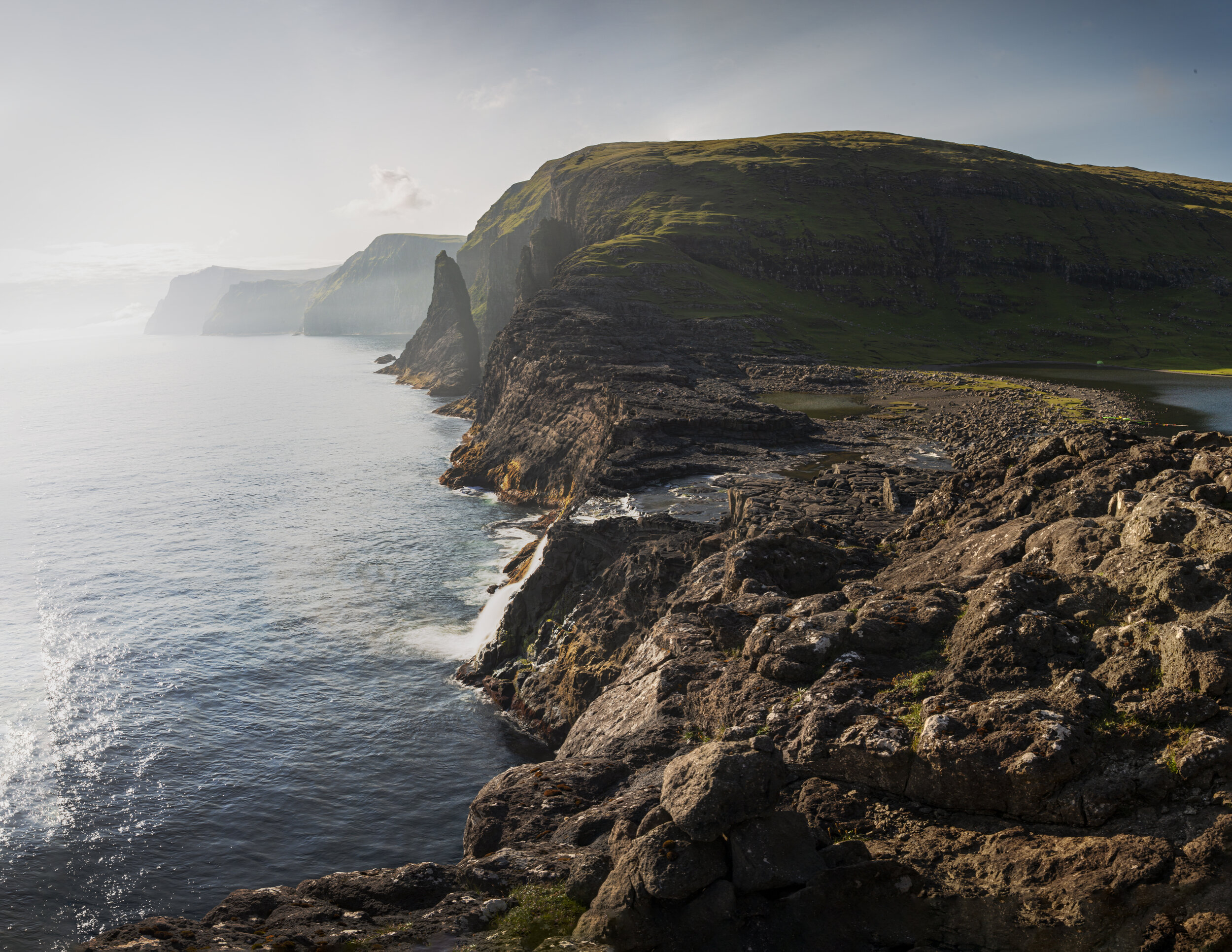
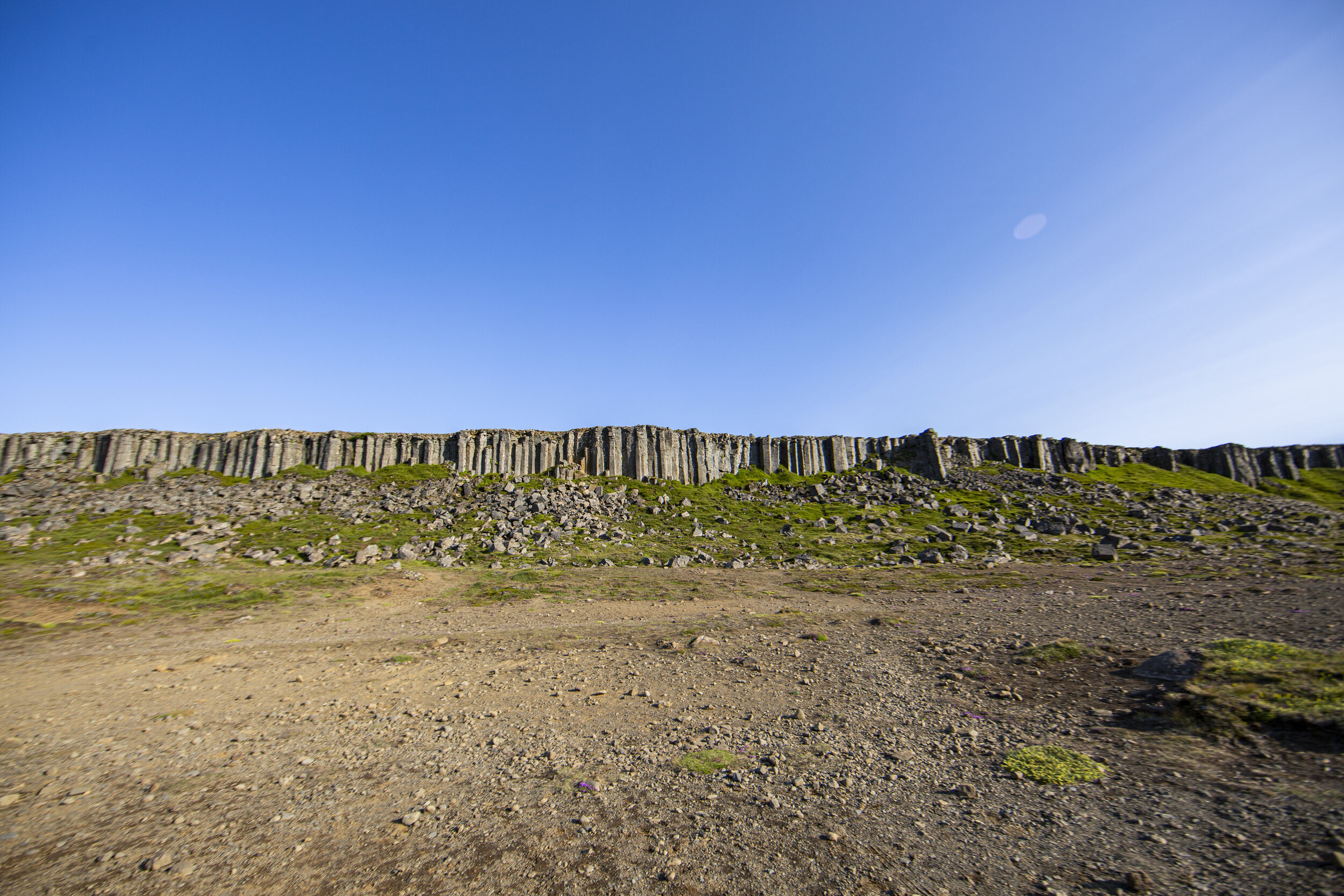
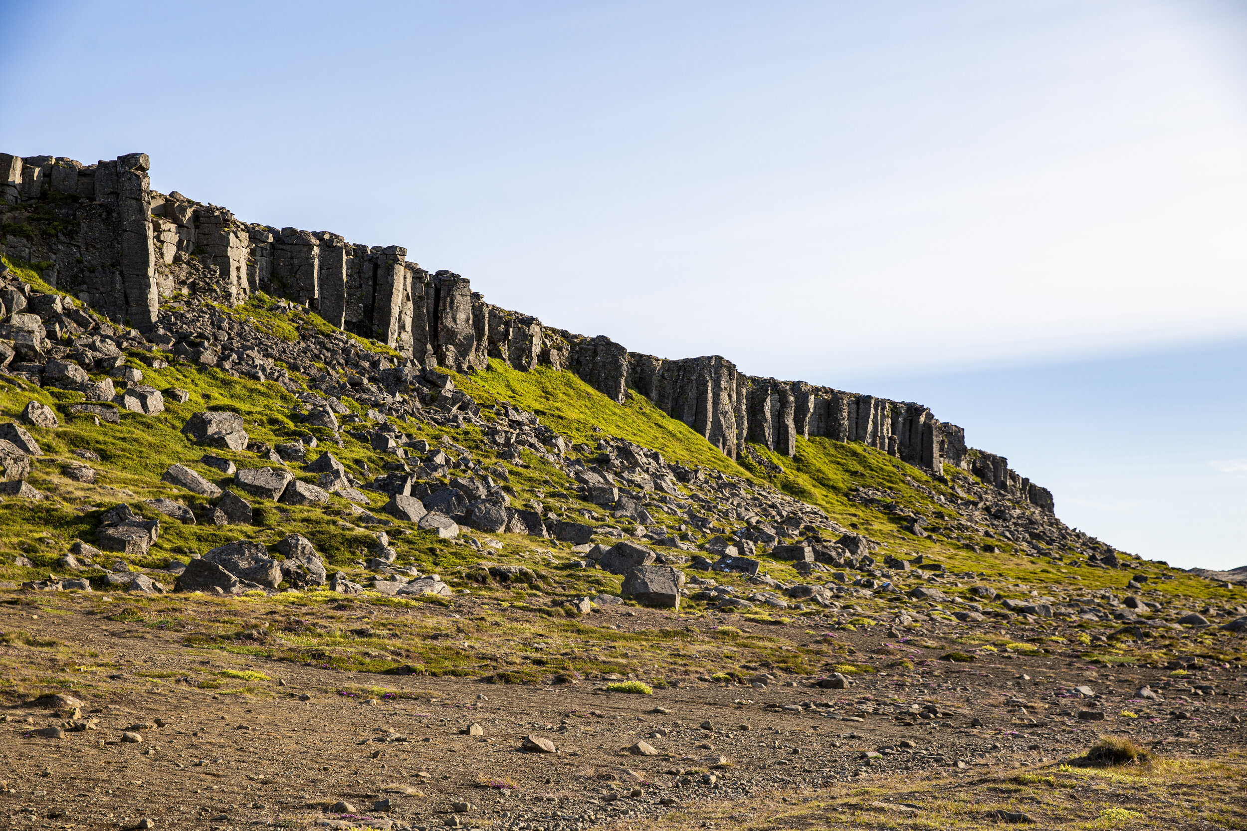
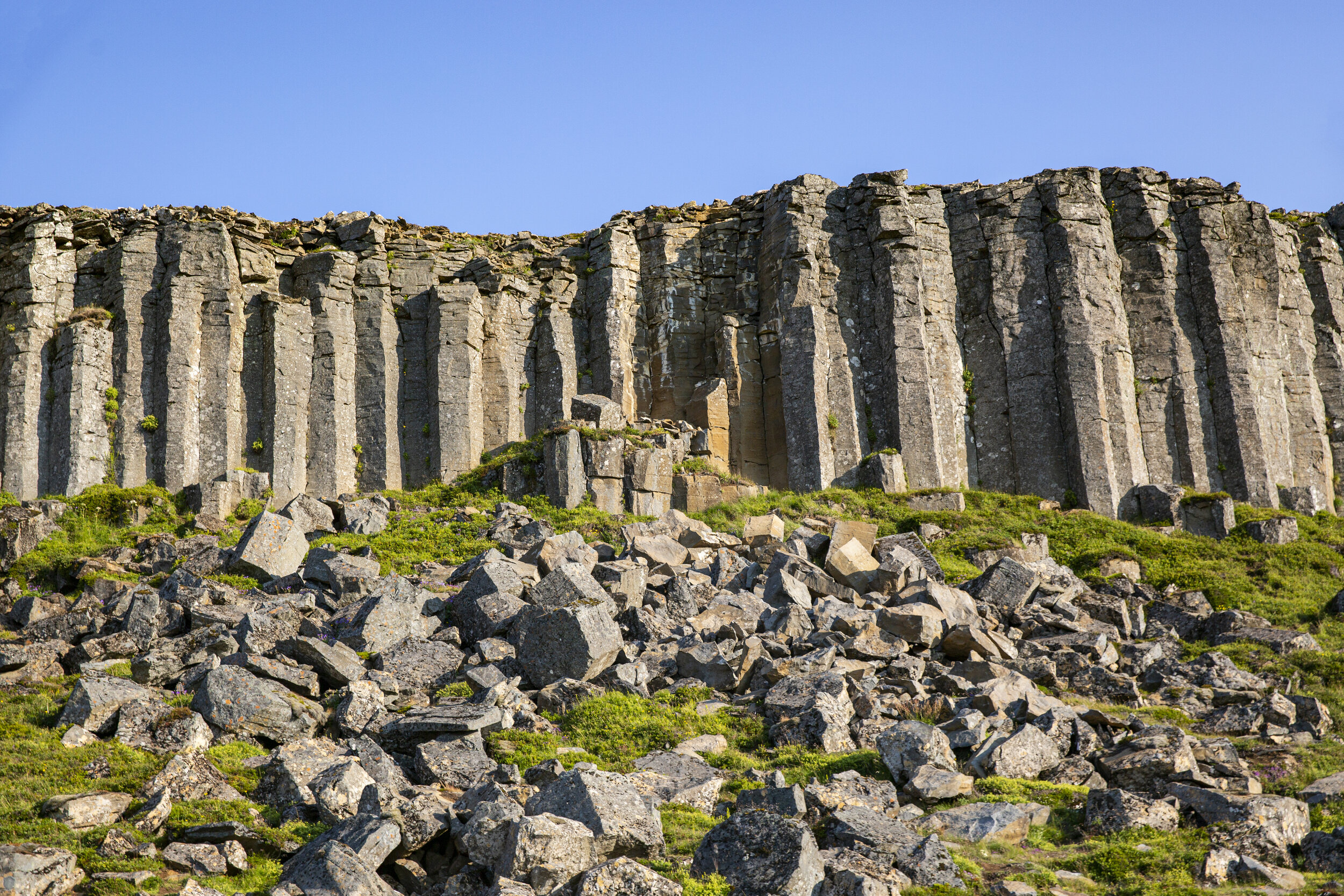
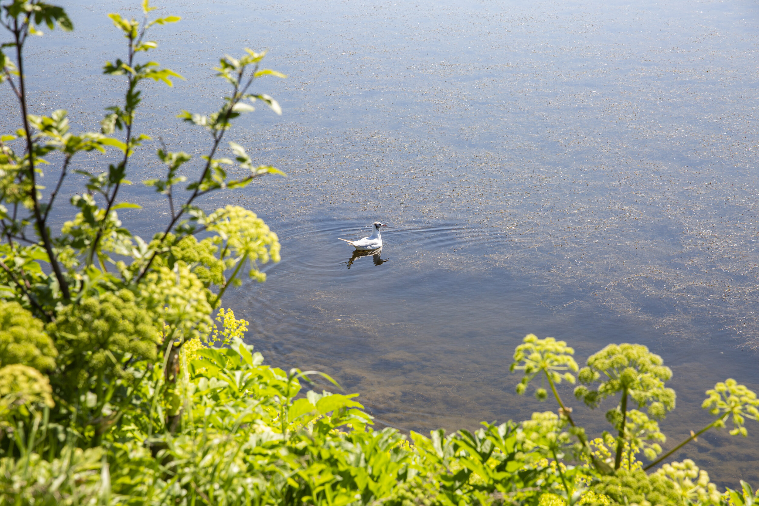
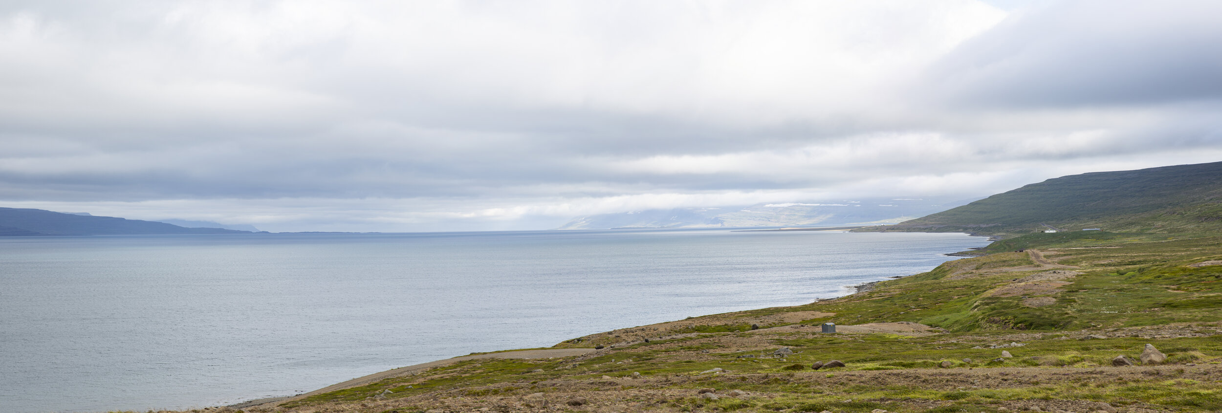
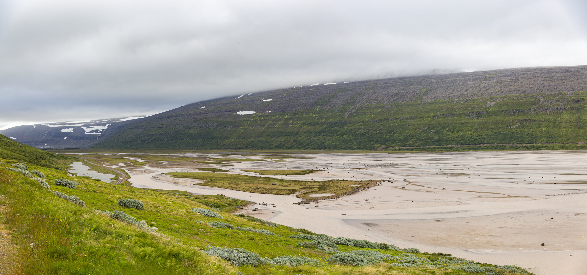
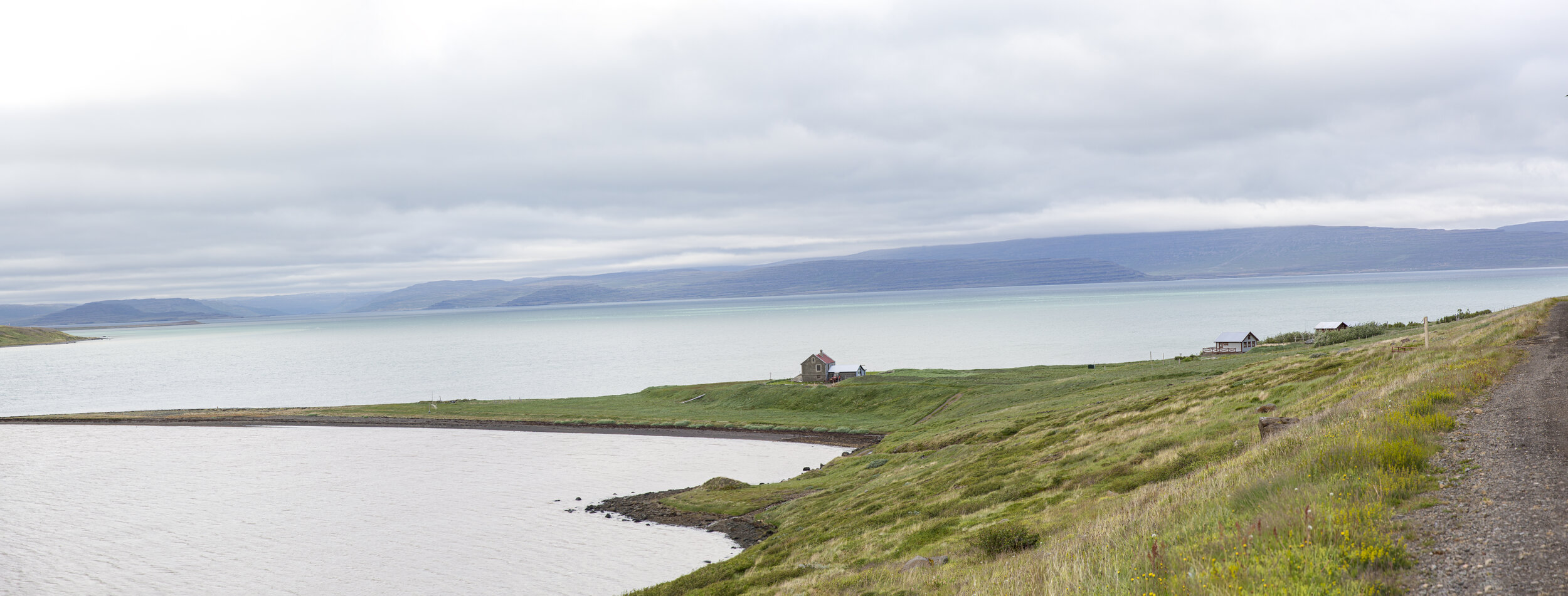
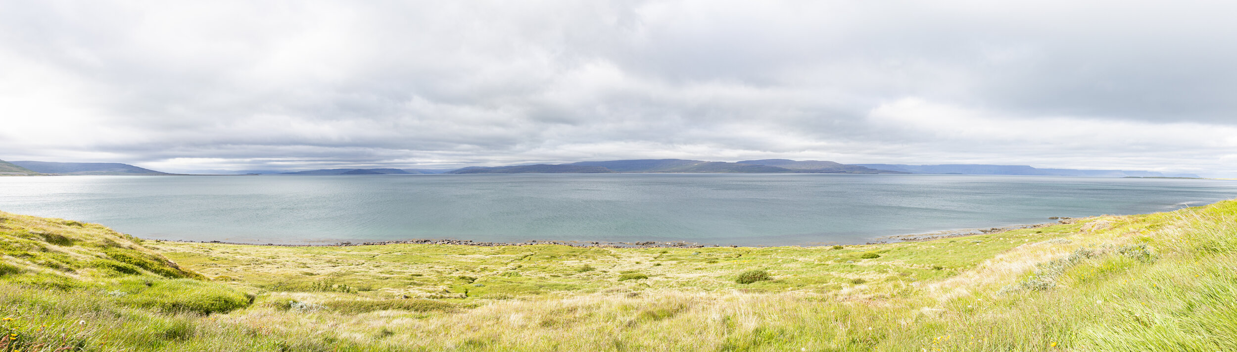
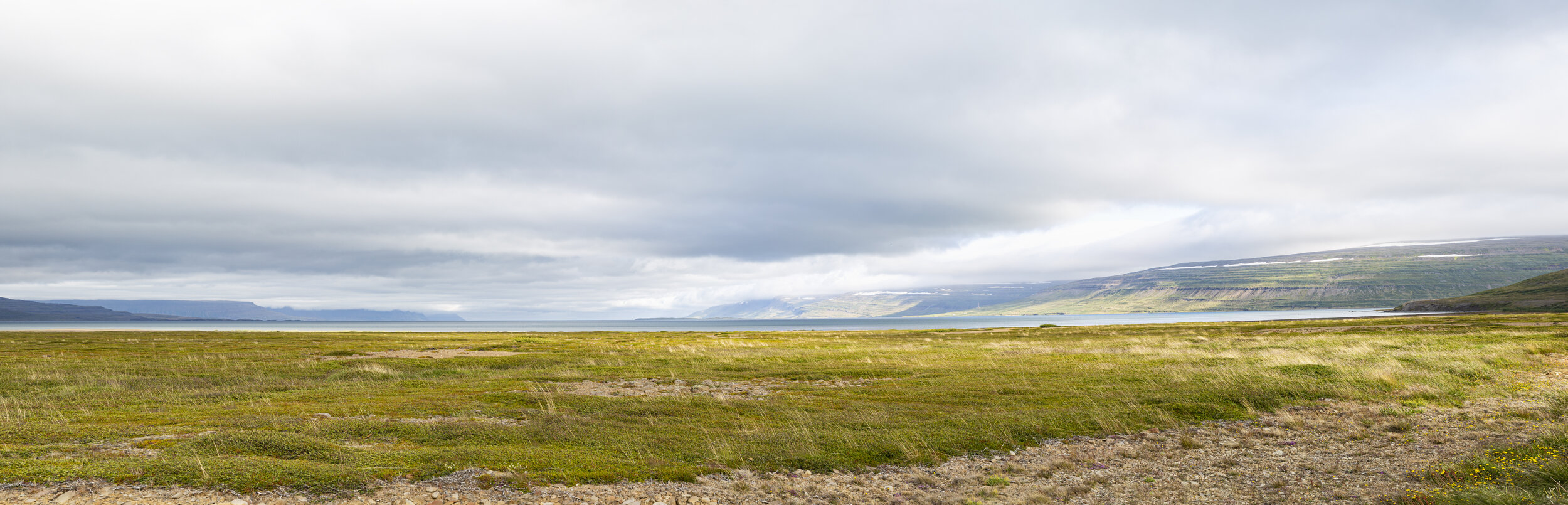
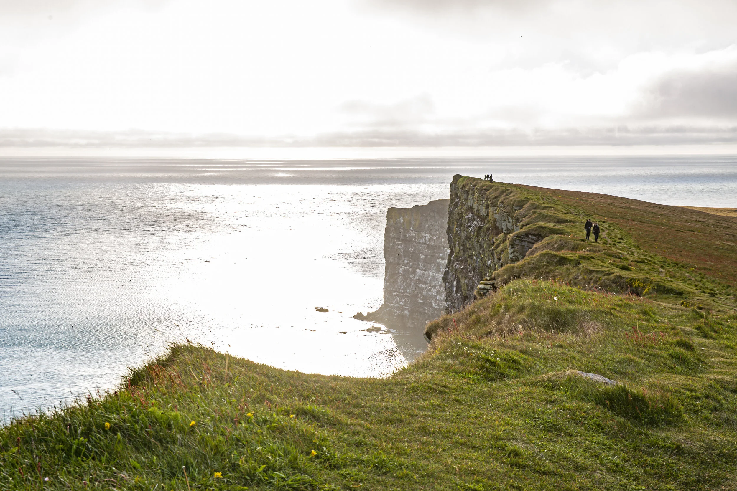
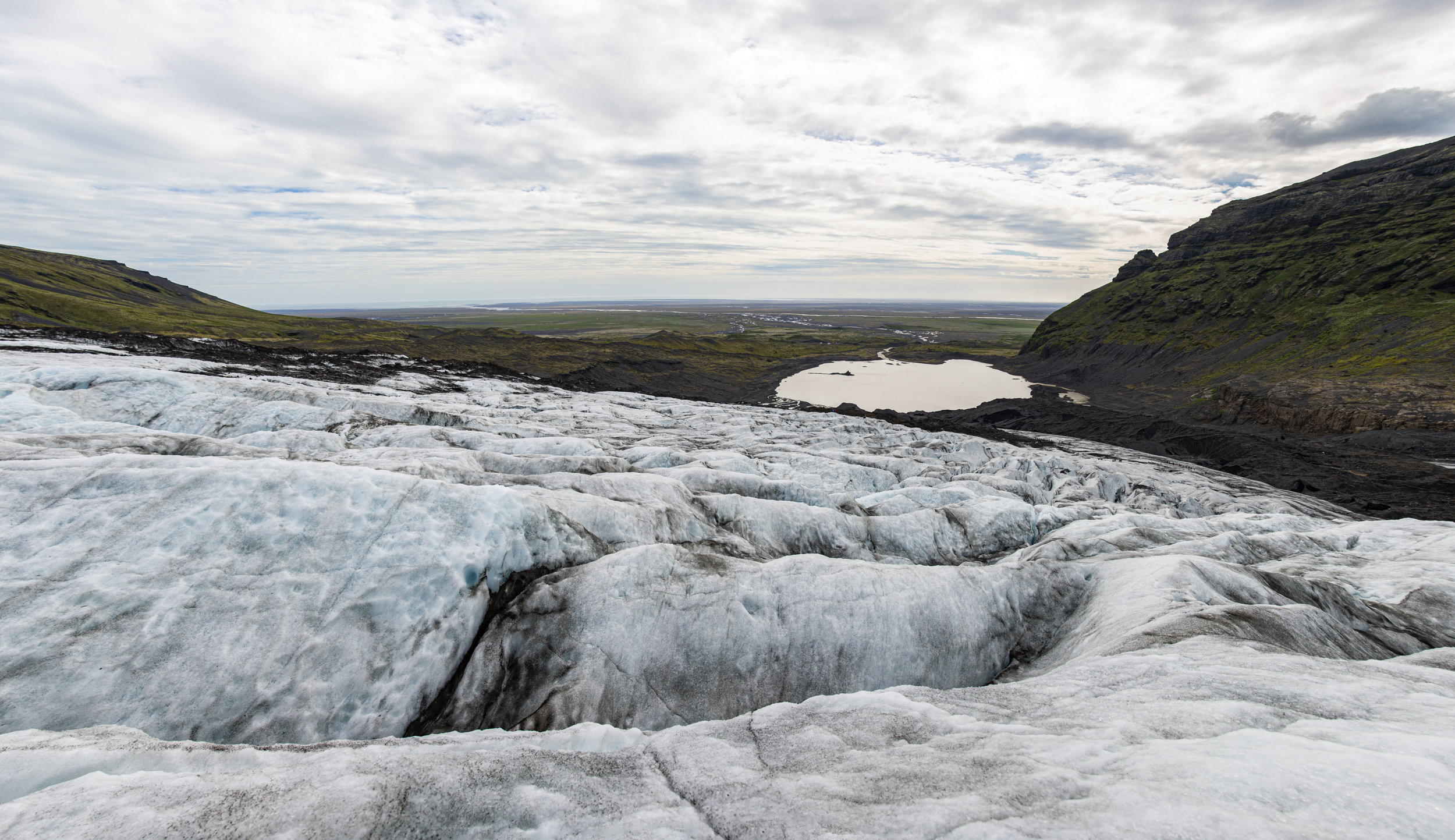
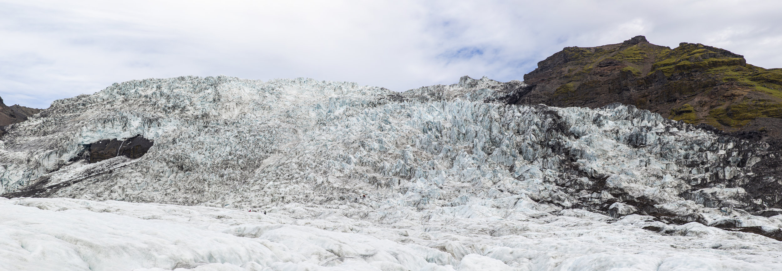
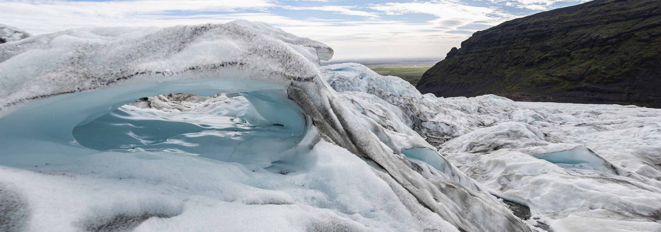
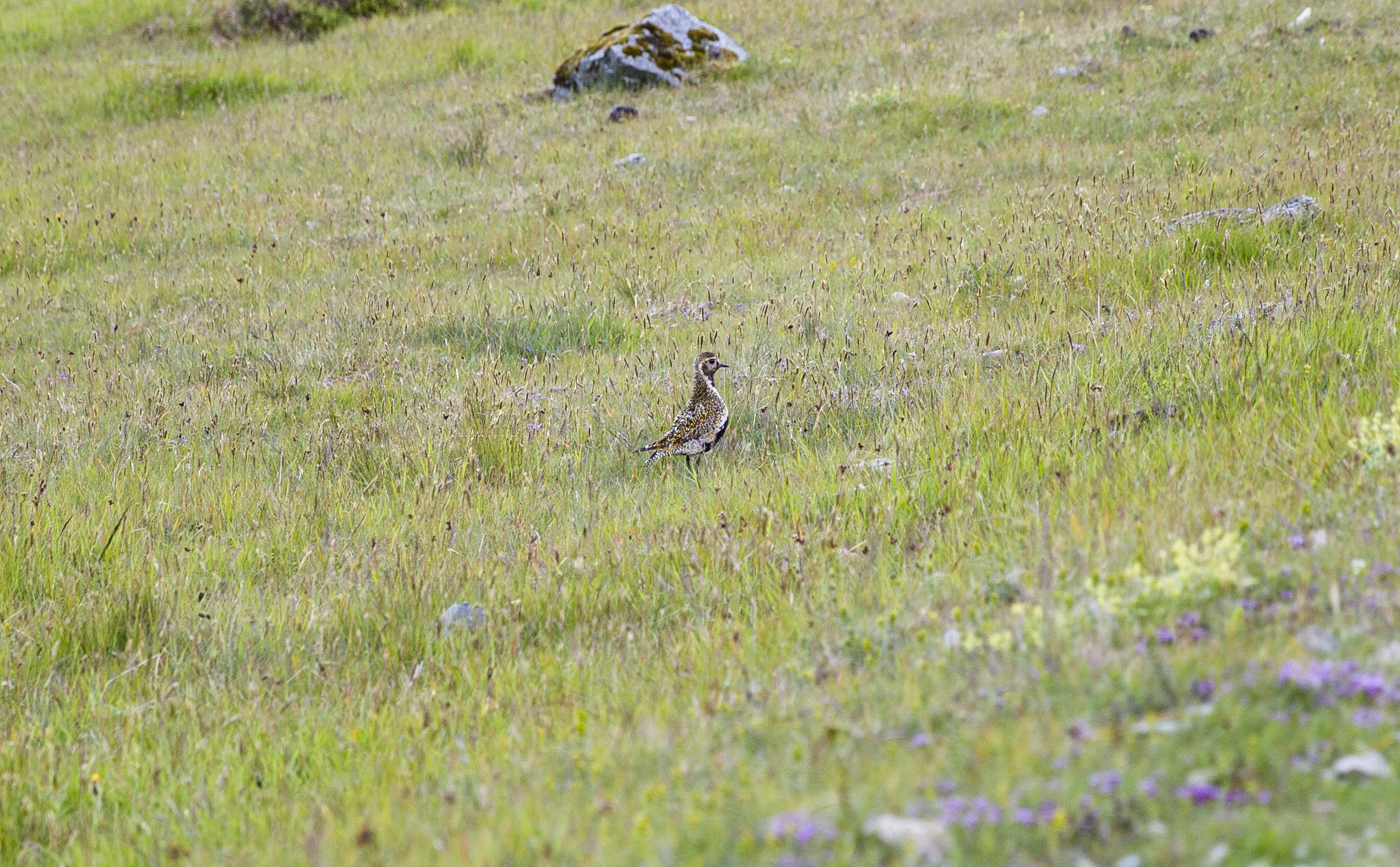
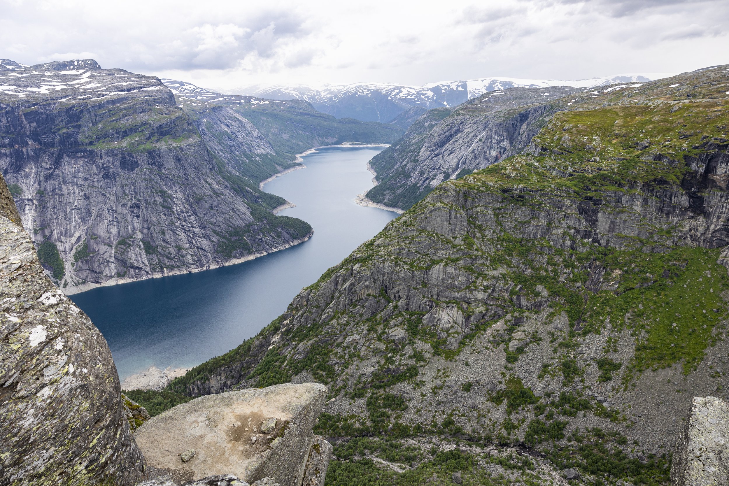
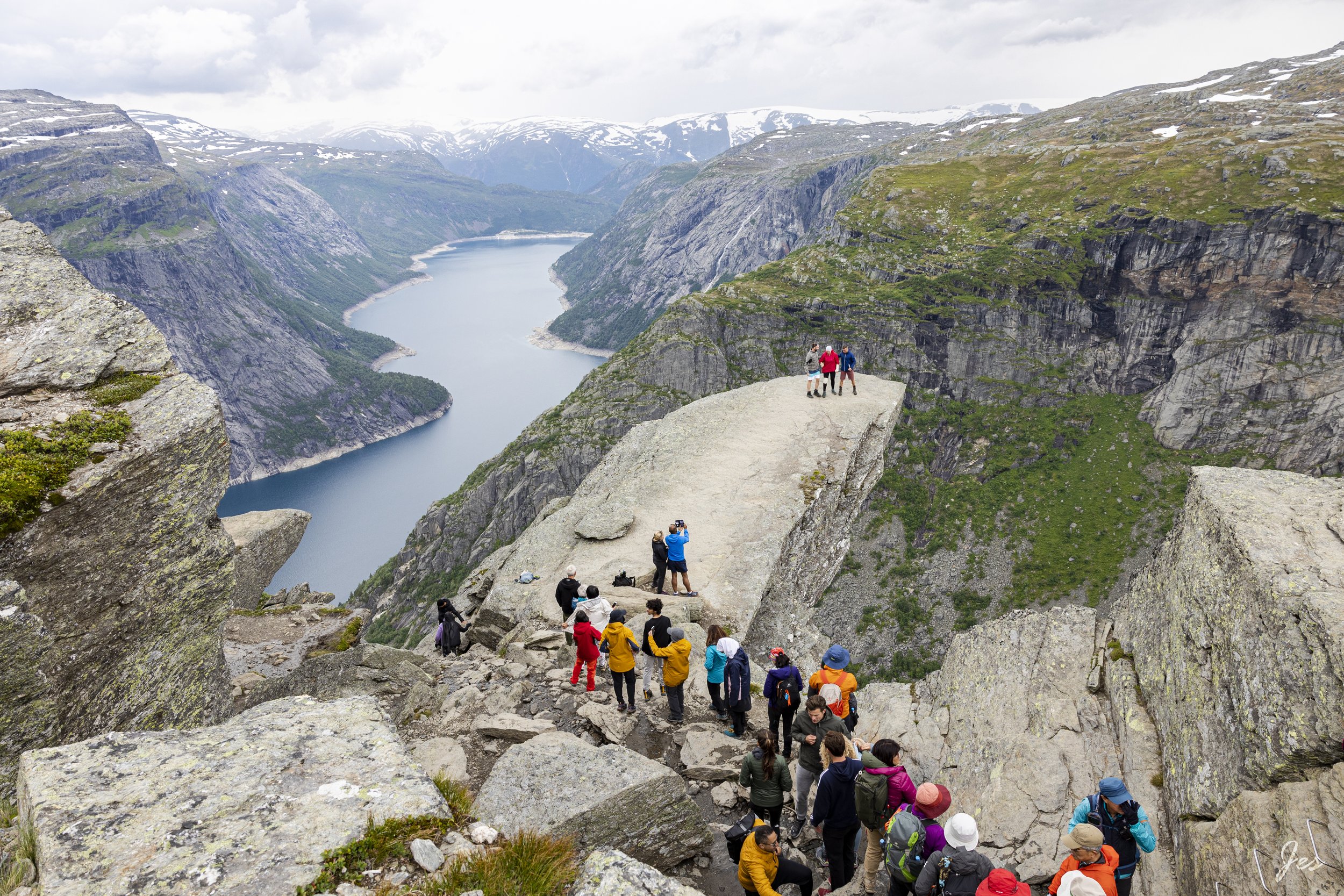
To be honest, most of the hike was not particularly scenic, except you do feel like you are surrounded by nature! As you get closer to the end, you can catch glimpses of the fjord. And when you get to the spot, you will have to climb down and line up for the picture we all are coming here for!

Don’t forget to actually look at the scenery when you are there (not just to take the picture)!!

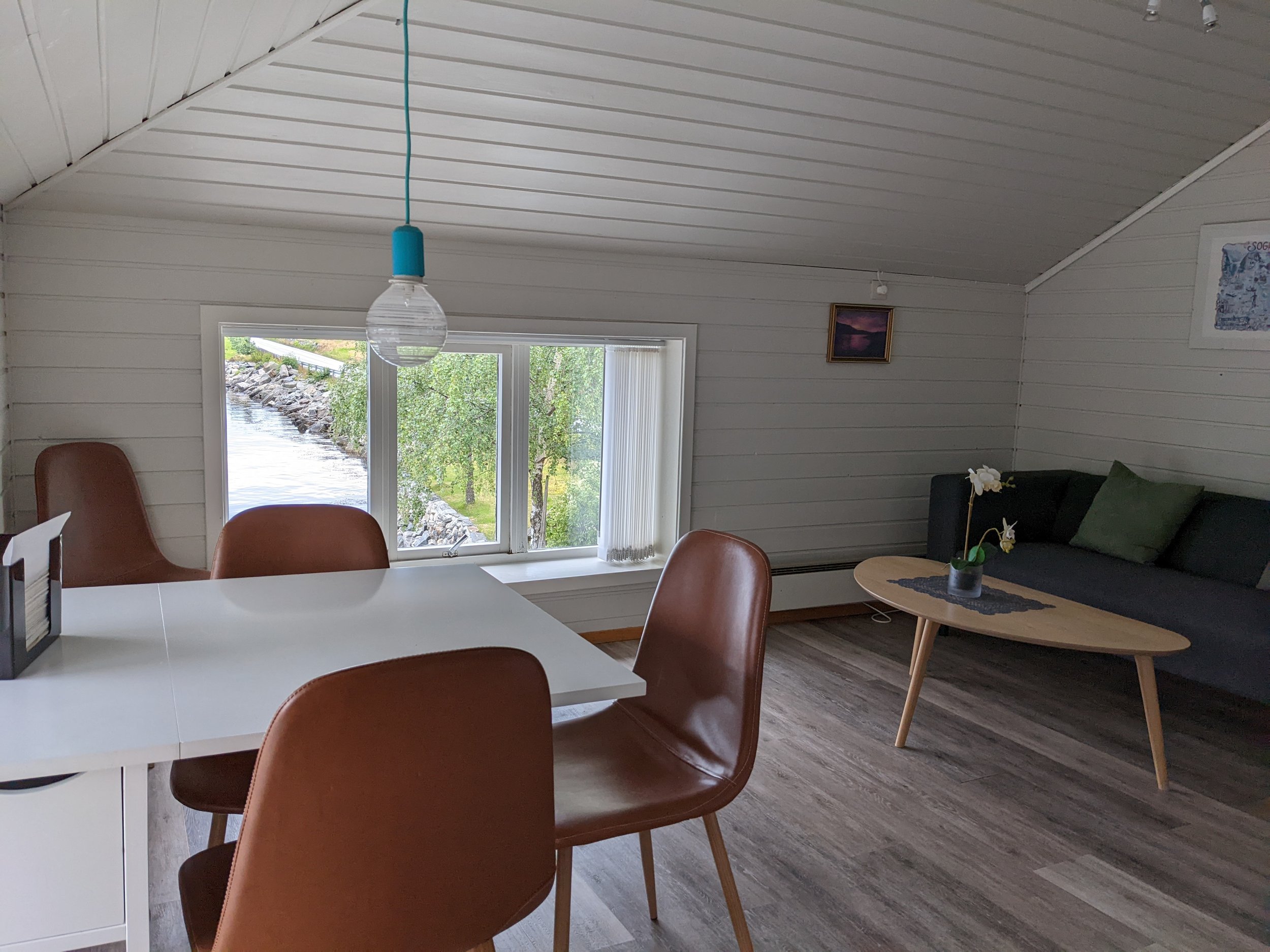
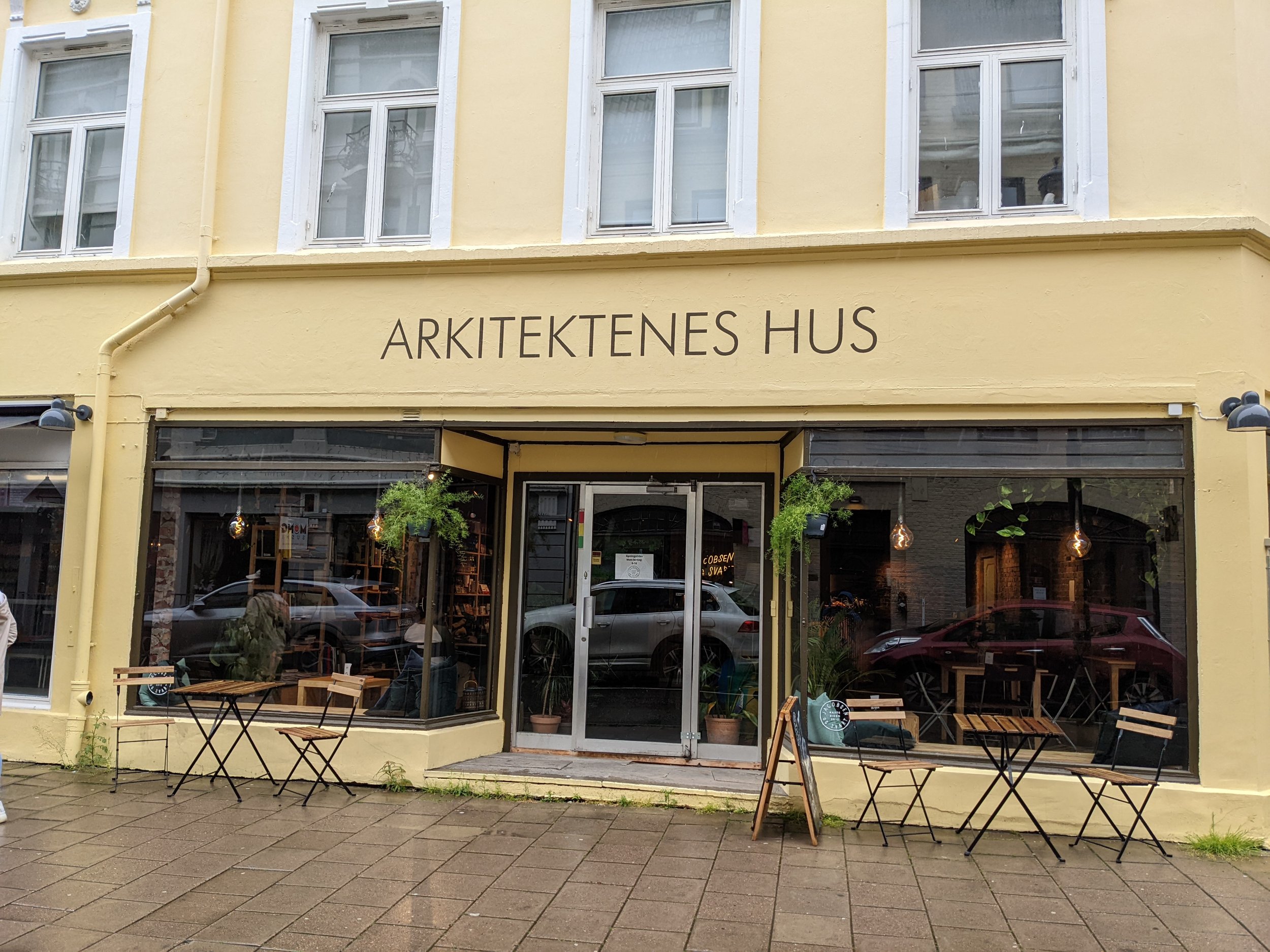
The hike down was a bit faster, so we were able to get to Bergen before dark. Tomorrow, we will take a break from hiking and explore the city of Bergen!

Comment

Comment

My Second Nordic Adventure (Day 10) - Borgund Stave Church, Viking village Njardarheimr, Flåm

Today is our '“rest day”, meaning no hikes for us! That being said, there are still so much we would like to do today, so not really resting.

We wanted to go to the Urnes stave church AND the Borgund stave church, but as it turned out, it takes quite a bit of time to drive to both if we also want to go to the viking village and make it on time to our boat tour in the evening. So, we had to pick one. It was a VERY tough choice - Urnes is Norway’s oldest and most decorated church (dated back to 1130), and it is included on the UNESCO’s world heritage list, while Borgund is the more “famous” or iconic church, with a very unique exterior.

Anyways, we ended up picking the Borgund stave church, and one of the reasons is that this church has a mix of Christian and Norse decor, which made it really interesting as it captured the reminiscent of the old Viking gods. We have always wondered how does a wooden church survive this long, and the secret is its black exterior! That is actually something called “tar”, which is a mixture of tree sap and ashes (from burning pine woods), and that protects the wood from rotting. We were told the original way of making tar has been lost, and the way that they are doing it now requires more frequent re-application in order to preserve the church.

Next, we headed to the Viking Valley Nærøydalen, where there are people who actually live there wi a Viking lifestyle. You do have to pay an entrance fee, so it could feel a little like a themed park, especially they have some activities made for visitors, like archery, axe-throwing, Viking boat experience, etc. However, I still find it very interesting to walk around and imagine the Viking life. On top of that, the village is situated next to a beautiful fjord and surrounded by mountains, so definitely worth a short visit!

Only about 20 mins away from the Viking village is the town called Flåm. For those who have time, I would recommend taking the Flåmbana to Bergen as it is often described as one of the most beautiful train ride with stunning views along the way. Unfortunately, we did not have time to do the train ride, but we did book a boat tour to see the Nærøyfjord! We usually didn’t like boat tour because it can be boring, but this one was surprisingly great, so would highly recommend that!

A few interesting things along the way (on top of seeing the beautiful fjords):
1. There are sheep grazing along these fjords, and their milk is used for cheese and other dairy products (yum!) - when the boat got closer, they thought we were going to pick them up, so they all came running! Tour guide said if we get any closer, they might actually jump into the water lol

2. This is a house on the top of the cliff, and it is now a hotel (it is booked out 3 years if I remember correctly). There are ziplines for transporting luggage up and down, but you will have to hike up there yourself. I can imagine that being a very interesting experience staying up there for a couple of days (heard they have great food as well)! Fun fact - this house used to be a farmhouse, and the owner was able to avoid taxes for hundreds of years because it is physically difficult for the tax collector to collect tax from them!

3. Undredal - This is a small cheese town, and this tour we are on included a cheese tasting at this cute little town. Cheese tasting included brown cheese as well, which is a sweet cheese that is unique to Norway. It was made from the residual liquid from making normal cheese trying not to waste anything!), and the sweetness comes from the natural sweetness of the milk itself. Another fun fact - the movie Frozen was inspired by this beautiful Norwegian town!

After the boat tour, we drove 3 hours to our Airbnb for the night around Sekse. We wanted to stay as close as we could to Trolltunga, which is a hike we are doing tomorrow (a long one)! Most people, at some point, have probably seen a picture of trolltunga, such iconic spot of Norway, and that is definitely not to be missed!

Comment

Comment

My Second Nordic Adventure (Norway Day 9) - Åndalsnes Romsdalseggen

Today, we are doing one of the most beautiful hikes in Norway - the Romsdalseggen ridge hike. This is a one way hike, so we parked in Åndalsnes, and then took a bus from there to the trail head. This is the website you can book the bus ticket online, but for some reason, it did not let me do it when I was there, so we just went to the bus stop and hope that we could get on, and we did! Do remember to bring cash with you for the bus if you decided to not pre-book your ticket, because they only take cash on the bus! Also, remember to check the schedule, the day we went was a Sunday, and there was only one scheduled time for the bus on that day.

This hike is about 11km (7 miles) long, with 970 meters elevation gain. It was pretty cold when we first started, but it got warmer as we climbed up the mountain. After we passed by some waterfalls, some muddy roads, and climbed over the boulders, we finally reached the top of the ridge. It was super foggy at the time, so we cannot see much unfortunately, but that probably made it less scary! As you can see from the photos below, there are parts with chains, so it could be quite treacherous.

We couldn’t see much at the first viewpoint (the highest point of the hike), and we waited for a good 30 mins to see if the fog would clear up. Then we gave up and kept walking, we passed by another viewpoint, and again couldn’t see much, BUT by the time we were at the 3rd one, the sky was much clearer, and the view of the valley was absolutely breathtaking (pictures below)! We were so happy that this hike did not turn out to be a total waste of time.

As you keep walking, you will reach the Eggen restaurant and the gondola down to Åndalsnes if you want the easy way down. But if you choose to walk, you will pass by another viewpoint called Rampestreken, which is a steel ramp that overlook the city (picture below). The last stretch of the hike down was quite steep and unpleasant because the roots of the trees on the ground made it so uneven and hard to walk. We were kinda regretting not taking the gondola LOL

Our Airbnb for the night was around Nærøyfjord, which is quite a bit south of Åndalsnes (5-6 hours). It sounds like a long drive, but as usual, the sceneries on the way (also the ferries) made it go so much faster!

As you drive south, you will pass by the Trollstigen. As you can see from the pictures below, it was quite an experience to drive up that road with all those hairpin bends! What’s crazier is that you can see a huge waterfall literally on the side of the road as you drive up (video on the left), which is very cool! Besides the stunning sceneries, this area is called Trollstigen because it was believed that trolls actually live here! Trolls are mythical creatures that are often portrayed as being short with wild hair or larger creatures that dwell in mountains, forests and caves. In Norse mythology, they were seen as evil giants associated with magic. and are portrayed as mischievous creatures who like to cause trouble to humans. You can find a lot of troll sculptures around this area, and there are many viewing and stopping points along the way for people to stop and take pictures!

After Trollstigen, we just kept driving to our destination, but for those who have more time or even an extra day, you should definitely spend some time around the Geirangerfjord area. We were told by the locals (and the pictures online) that it is a gorgeous area to visit!

When we arrived at our Airbnb, we were so taken away by the view (pictures below)! We were on a budget, so when we looked for Airbnb, we were not particularly looking for Airbnb with a view, but so far, ALL the Airbnb we stayed at have a gorgeous view! That really just tells us how beautiful this country is <3

Comment

Comment

My Second Nordic Adventure (Norway Day 8) - Trondheim to Åndalsnes

As I mentioned, our plane got delayed, so we arrived at Trondheim late last night. Originally, we planned to have dinner at this amazing place I found called Credo, but obviously did not make it and had to cancel our reservation. But for the foodies out there, there seems to be many good restaurants in Trondheim, so do your research and find one to try!

One thing you might noticed is that we “skipped” day 7, and that’s because we pretty much arrived at Bodø in the morning, so we slept in quite a bit before our evening flight to Trondheim. Nothing much to share!

Okay now, we are in the southern/western part of Norway. (See the map on the left) Starting from Trondheim, we are going on a road trip (again), passing by some of the most amazing fjords in Norway, and arguably in the world, and then to Bergen and Stavanger. The plan is to fly out of Stavanger back to the States.

As usual, this itinerary is a little crazy for most people because we are doing this in 7 days! For those who have more time, I would definitely suggest taking more time to appreciate the fjords along the way!

Before we start heading down to the gorgeous fjords, we spent a little time walking around the city. It was a little rainy (shocking, right?), but not too bad, so we were still able to explore a bit. We walked around the town square, saw the Bakke bru (bridge) and the Nidaros cathedral.

There are so many good coffee shops in the city, so we grabbed some coffee and cinnamon buns (they are just soooo good here in Norway, losing count on how many we have had) for the road before our 6 hours drive down!

The drive down was absolutely breathtaking. We passed by a beautiful bridge, a valley with a million waterfalls, and countless picturesque spots. Although there was a lot of driving, today is our “rest day” because… guess what?! We are doing another awesome hike tomorrow!

Comment

Comment

My Second Nordic Adventure (Norway Day 6) - Å, Reinebringen

Today is the last day in the Lofoten islands before we head to Bodø for the flight to Trondheim. The weather was not great today, drizzling a bit and a little foggy, but we were still able to do everything we intended to do!

We continue to drive down the main road E10 to visit a few fishing villages that we wanted to see, including Hamnøy and Å, and especially Å (pronunciation: “aw”). Å is one of the best preserved fishing villages in Lofoten, and was one of the largest fishing villages back in the day. It is located at the southernmost tip of the Lofoten islands, and has the perfect drying conditions for stockfish, and as many as 700 000 codfish were hung up on the fish flakes each season!

Side note: there is this one bakery in Å that has delicious cinnamon rolls - must try!

Another very interesting spot in this town is the old shop/ gammelbutikken, we did not go inside to the store because we were so distracted by all the nests on the building! You can see from the photos that the building was basically covered by nests, wherever possible!

The day in Lofoten obviously cannot end without a proper hike So next, we are going on another hike and this would be our last hike in this part of Norway - the Reinebringen! It is only 1km to the top, but it is 1km of steps, with NO FLATS at all! But once you get up there, you can see the iconic view of the Lofoten (the picture y’all have seen on social media) - the tiny islands of Reine, Hamnøy and Sakrisøy, and theoretically with tall rocky mountains in the background, which we weren’t able to see very well due to the weather :( This might not be the most interesting hike (it’s just stairs), the view is absolutely worth it though!

One other thing to check out before you leave here is the cafe Bringen Kaffebar, great coffee and cakes with amazing view to stare at (last 2 pictures below). After this, we headed to Moskenes to take the ferry to Bodø. Believe it or not, the line was so long that we couldn’t get on the first two ferries, and when we finally got onto the third ferry, it was almost midnight! It was a 3 hour ferry ride, and we have waited almost 6 hours for the ferry, so we were so tired when finally got to Trondheim. So, for those who plan to take this ferry, make sure you get there early! Fortunately (?), our flight got delayed and turned into an evening flight, so we were able to sleep in, and this concluded our time in northern Norway. Can’t wait to tell you all about the second part of our trip in southern or western part of Norway!

Comment

Comment

My Second Nordic Adventure (Norway Day 5) - Nusfjord, Ryten

Another day in the Lofoten islands - Lofoten is an archipelago, with mountainous islands, beautiful beaches and cute fishing villages. I know we have been hiking a lot, but for non-hikers, it is equally beautiful to enjoy the sceneries at the sea level and going to all these beautiful beaches!

Our first stop today is Glasshytta på Vikten - this glassblowing hut was established back in the 70s by Åsvar Tangrand and he was the first glassblower in Northern Norway. This place is now run by his son. The items created are rustic and unique, reflective of the rugged nature of Vikten. The glass hut is located a few kilometers out of the main road, facing the big sea, definitely a cool and scenic detour!

Next stop is Nusfjord, one of the oldest and best-preserved fishing villages in Norway and is a UNESCO World Heritage Site. In older days, Nusfjord was home to around 1500 fishers and some of them lived in rorbuer (the red houses, I think tourists now can book those as accommodations).

See the pictures on the left for the cute little bakery in this town, this bakery used to supply all the bread for the people who lived in this town (not current owner)! How cool is that?! And they have very delicious cinnamon buns!

A day in lofoten would not be completed without a hike, so our last stop is the Ryten. It is a 5.4 mile hike, with 2240 feet elevation gain, so it is not as steep as other hikes we have been on. First, you walked through a gorgeous flower field (see pictures above), and then the trails gradually takes you higher and higher up, and you will see some nice views along the way up. At the end, you will reach the viewpoint of the Kvalvika beach, and look at that beautiful turquoise water!

We debated whether we should another hike called the Mannen, and decided we should take it easy as we have been hiking every day, but based on the photos I saw online, I would recommend this hike for those who have time to do another hike!

On the way to the Airbnb, we saw rainbows!! During this trip, we have seen rain EVERY DAY! It could be a shower, could be a drizzle or could be pouring rain, but not one day passed by without rain! That being said, we have been lucky enough that there was always a time window that allowed us to do the hike we wanted to do every day, and because of the constant shift between rain and sun, we saw this beautiful rainbow!

Comment

Comment

My Second Nordic Adventure (Norway Day 4) - Lofotr Viking Museum, Fløya and Djevelporten

Look at those cute little houses that are clearly made for tourists (lol)!! Anyways, day 4 in Norway! Today’s itinerary is a bit strange, primarily due to poor planning on my part, but we made it work. We were going to be staying in Svolvær, but we drove further than Svolvær and hit the Lofotr Viking Museum first, then on the way back, we stopped by Henningsvær and the hike of the day (which would be an evening hike) is the Fløya and Djevelporten.

First stop was the Lofotr Viking Museum, it opens at 10am, so we planned to be there when it opens. First picture you saw above is the Viking longhouse (reconstructed next to the original site), and it is the largest Viking longhouse ever found and excavated. In the museum, they recreated some of the Viking experience for visitors, like the open fire in the feast hall, where they cooked the lamb soup in a large cauldron, or the craftsmen showing you how they work with different textiles to make clothing. The admission also included a Viking sailing experience. It is a 1km walk from the longhouse to the harbor, and the sailing trip was about 20 - 30 minutes. On the way there, you will pass by some outdoor activities, like axe-throwing and bow-and-arrow shooting, which was very fun! I have never sailed before, so this is a very cool experience for me to be on a real sail boat without a motor engine! What was surprising is that the sail boat could actually go pretty fast, and now I can imagine how the Vikings were able to sail all the way to UK or France for the raids!

Next, we stopped by a cute fishing village called Henningsvær. We walked around the village and found an interesting exhibition of Ai WeiWei’s artwork at the KaviarFactory - We have never seen his work in-person, so we decided to spend some time at this exhibition! Really impressed with his creativity on the art medium, like the use of lego bricks to create the Chinese zodiac, and the videos he took on the boat on immigration.

After walking around, we went to a local restaurant called Fiskekrogen - unfortunately, we arrived at the “soup hour” (4 - 5pm), meaning they were in between lunch and dinner, so they were only serving bread and soup. So, with no other choice, we ordered some bread and fish soup, and it was AMAZING! For the bread, it came with this amazing butter with whale flakes, and it was absolutely delicious, so delicious that we got another basket of bread for the butter! As for the soup, as you can imagine, seafood is fresh in this area, so it was also very delicious, and so delicious that we ordered another bowl of soup, which we regretted because we got sooooo full!!

After the delicious meal, we went to the Airbnb to take a small break before heading to an evening hike. And again, we had no intention of choosing a luxurious Airbnb or an Airbnb with a view, but look at this (right)! The Airbnb is super nice, with an amazing deck and view. Wish we had more time to just chill on the deck!

The hike we did was the Fløya and Djevelporten, it is about 3 miles, with close to 2000 feet elevation gain. It is a perfect hike to walk the bread and soup off! It started off with lots of stairs (built by Nepalese sherpas), and we saw some mountain sheep on the way. We saw one baby sheep (should have taken a video!) walking down the hill in the clumsiest way possible, and it was super adorable! As you climb up, you will be able to get a view of the town Svolvær. Once you reach the top, after seeing the incredible view, you can follow along the ridge to reach Djevelporten (Devil’s Gate), so it is like a mini Kjeragbolten, which has a rock stuck between two cliffs. We found it and climbed on top of it and it was pretty cool - it is really hard to describe that feeling, but it felt sooooo free when you were on the rock and looking out at the view. We got a little bit turned around when we were coming down (we accidentally went on a different trail, which is not what we wanted to do at 10pm lol), but we eventually found the right path and made it down!

For those who rock climb, it would be interesting to check out the Svolvaergeita, you can see it in the second picture below. It is the very tip of that mountain, and it looks super cool!

Comment

Comment

My Second Nordic Adventure (Norway Day 3) - Måtind

There are a lot of scenic bridges in northern Norway, connecting the Lofoten islands, and it is truly amazing to see them in person. I caught one in the picture above, beautiful, isn’t it? Perfect combination of the nature and human architecture.

Today, we needed to take the ferry we missed yesterday, from Gryllefjord to Andenes, and the first ferry is at 11am (we joked about how nice it must be to work in Norway, I have yet to see things open before 9am!). We were warned by our Airbnb host that we should probably be there at 9am if we want to get on the first ferry (next one is at 3pm!). So, we got there at around 9, and holy moly, the line was already soooooooooooo long. We were so worried about not able to get on the ferry, but luckily we made it! I was so grateful for the Airbnb host for telling us to come early, otherwise we definitely would not think to go 2 hours early. During those 2 hours when we were waiting for the ferry, we walked around the surrounding area a bit (see pictures above). From an Asian perspective, this is the perfect opportunity for stores to open up early to get business from people who are waiting for the ferry, but nothing was open when we arrived and one cafe opened up at 10am.

Today’s main activity is yet another hike - to the Måtind! It is located on the Vesteralen island, close to a 5-mile round trip, with 520m elevation gain (1700 feet). Compared to the hike we did yesterday (Segla), this is a much easier hike, with more gradual climb and some plateau towards the end of the hike, but the view is AMAZING!! On the left, you can see the beautiful Høyvika beach, and on the right, you can see the rocky peninsula and the Bleikøya island. I was told by the internet that in summer months, there might be sights of puffins and whales!

It took us about 4 hours total (we did spend quite a bit of time at the trail end to enjoy the sceneries), so when we were done, we drove to our next Airbnb at Stokmarknes. It might not seem like we are doing a lot in a day, but the drive itself is a big part of our daily activities! The sceneries were surreal and breathtaking everywhere (see pictures above as e'xamples), and whenever we feel like it, we will find a spot to stop, take in the sceneries and some pictures!

Comment

Comment

My Second Nordic Adventure (Norway Day 2) - Segla

Day 2 - The main activity today is to hike the Segla trail, which is a 2 hour drive and involved a ferry ride! The tricky part of these car ferries is that a lot of them only run a few times a day, and it can fill up pretty quickly, so if you want to make sure you make it to the ferry you plan for, you should arrive at least 30-45 mins before the departure time (in some cases, up to 2 hours!!).

The ferry we needed to take is from Brensholmen to Botnhamn. The ferry ride lasted about 45 mins, and we were able to get on the first ferry at 8:45am (next one is at 10:45), but there was already a short line when we got there at 8am!! Make sure to get there early if you must get on a ferry at a specific time! I thought it looked kinda funny (picture above) as you drove into the ferry, looks like a shark eating the cars (lol)! After getting off the ferry, we drove directly to the trail head and ate at the parking lot before the hike. Food is expensive here, and we do not always pass by food places on the way, so, similar to what we have done when we went to Iceland, we brought a bunch of dry food (and snacks) and a really good thermo. We filled the thermo with hot water every morning before leaving the Airbnb and use that to make food to save time and money. This way, we make sure we have enough energy for the hikes or whatever activities we plan for the day! When we can, we also get groceries to make dinners (price for grocery is pretty reasonable).

Side note: yummy Norwegian waffle and beautiful scenery on the ferry (see photo on the left)

We reached the trailhead before noon, it was a little overcast and foggy, but I have checked the weather forecast and it should clear up around 2pm, which we will likely be at the top by then. So, we were hopeful! This hike is about 5km round trip, so it was pretty short, but the elevation gain is 639m (>2000 feet). Given the short distance and high elevation gain, you can imagine how steep the trail was! So, do not underestimate this. It is not the hardest hike I have done, but certainly the hardest 3-mile hike I have done!

When we first got up to the top, we could barely see anything because it is super foggy (see picture on the right). So, we waited (we did miss the ferry to our Airbnb… but it’s worth it!) till it cleared up. We were not going to leaving without seeing the view! After an hour, we were about to give up, but literally in less than a minute, things started to clear up and Voila! The view we have been waiting for was right in front of our eyes, and it was absolutely worth the wait (pictures below)!

As I mentioned, we missed the ferry to our Airbnb, so we found something close to Gryllefjord (where the ferry was supposed to depart) in Finnsæter. The building itself is a matstudio (food studio), overlooking the fjord (of course!). The room is super tiny, with a bed and bathroom, which served the purpose of the night, so we were happy. After having some dinner, we took a little stroll around the area, saw a cotton field, a cute beach-side house, and a small stall with chairs for people to sit and enjoy the view. OH! And there was this cuckoo bird right outside of the room, we couldn’t see it, but could certainly hear the “cuck-oo, cuck-oo” sound! <3

Comment

Comment

My Second Nordic Adventure (Norway Day 1) - Tromsø, Ørnfløya

Look at these cute little houses next to the fjords! Can you imagine living in one of these and wake up every morning to the beautiful fjords? Although I can’t have that every day of my life, I am grateful that I can enjoy this scenery for 2 weeks!

On day 1, we arrived at the Tromsø airport (after 3 flights!!!) in the evening, picked up our rental car at the airport and headed to our first Airbnb, which is about 35 mins away from the airport. When we landed, it was about 30C, which is not at all what we expected. Tromsø is IN the arctic circle, and not supposed to be this warm! I was worried about having packed the wrong clothing for this trip, but luckily the weather cools down eventually! #globalwarming

As we drove to the Airbnb, first of all, the drive there already had AMAZING sceneries (see the big panoramic picture at the top), so I would say we pretty much fell in love with Norway within 5 mins of being here! When I picked out the Airbnb, because we are budget conscious, having a view was not a criteria for Airbnb selection, however, look at our Airbnb (see red house above)! Such a cute little house, with a spectacular view, right next to the beach! What more can we ask for?

After settling in, we decided to go on a short hike “Ørnfløya”, which overlooks Sommarøy, a small and old fishing village. The trail head is an hour drive from where we were, and the hike itself is about 1.5 miles, with 155m (or 510 feet) elevation gain. It is a relatively short and easy hike, perfect as a warm-up for the upcoming hikes we have planned! It took us ~45 mins to reach the top, and it was around 10pm, so you can see the beautiful “sunset” at the top. I use the word “sunset” loosely here as the sun doesn’t really set here this time of the year! If this is the view of a short and sweet hike, what will the other views look like??!!

Comment

Comment

My Second Nordic Adventure - Norway

Hi everyone, I HAVE RETURNED! I know I have been abandoning this blog for quite a WHILE now, but I am determined to pick it back up (have faith in me please?). Although my blog-writing has stopped, my travel has not. (well, except 2020 because of covid….). Anyways, guess where we went this time? Well, I know it is in the title, but if you only look at the picture above, you probably would have guessed that we went somewhere with a tropical beach, but no! This is the northern part of Norway, where there are spectacular arctic beaches! While it might not be warm enough to swim all year around, or even most of the summer months(lol), being surrounded by dramatic mountains and small fishing villages, these beaches are absolutely breathtaking here! (P.S. the picture was taken around 10pm, gotta love that midnight sun in the arctic!)

We spent about 2 weeks in Norway, while we can’t say that we have seen all of Norway, we have certainly seen a lot of it and have done a lot in this short amount of time, because as usual, our trip is sooooooo packed and crazy! I will be telling you more about each of the day we spent in Norway in subsequent posts, but to give you a general idea, see below for our itinerary:

Northern Norway

Day 1 - Arrived in Tromsø
Day 2 - Senja
Day 3 - Andøya
Day 4-6 - Lofoten islands
Day 7 - Fly from Bodø to Trondheim

Western Norway
Day 8 - Trondheim
Day 9 - Åndalsnes
Day 10 - Nærøyfjord
Day 11 - Trolltunga
Day 12 - Bergen
Day 13-14 - Stavanger
Day 15 - Oslo

I cannot wait to share our journey and pictures with you all in the coming weeks! Stay tuned :)

Embed Block
Add an embed URL or code. Learn more

Comment

Comment

My Nordic Adventure Part 2 - Faroe Islands - Day 5

Going to Mykines - or what I called the “puffin island” - was a dream come true! I have always seen pictures of these little cuties and there are only a few places on earth where they can be seen, and the highest concentration is probably here in Mykines!

There are boats daily from Sørvágur to Mykines, and it takes about 45 mins. The boat ride itself was also quite nice as it passed by the iconic nature sights of Drangarnir and Tindhólmur, which are pretty much as close as you can get to them!

One thing you need to know is that you will need to purchase a hiking permit, which you can do online, for hiking around the island. The lighthouse trail is the most popular one, and that’s the one we did as well. As you walk up the hill, you can get a view of the town. It is a very small town of about 10 - 20 people, which is beyond anything I have seen coming from a big city.

It is just really unbelievable how many puffins are there! They are literally everywhere around you, on the ground and flying around, and trust me when I say it is not hard at all to see them or get a picture of them (see below).

This is the one and only café on the island and this is where everyone hangs when they are waiting for the return boat ride.

Before we called it a day, we decided we wanted to explore another island called Viðoy, which is the northernmost island in the Faroe islands. We found a great hiking trail up the Villingardalsfjall, which offers an amazing view of the Malínsfjall and the fjords. This trail is quite steep, and you just keep going up and up but the view just keeps me going and going. The path on the ground might not be obvious, but you just need to follow the blue poles and you will be fine. Unfortunately, we did not make it to the top due to the fogs (we figured even if we hiked all the way, we couldn’t see the view anyways). I think we were probably half way there, and the view was already amazing! This is definitely a hike that I would return to if I am ever in the Faroe islands again.

Comment

Comment

My Nordic Adventure Part 2 - Faroe Island - Day 2

KallurLighthouse_Panorama5.jpg

Although there are a lot of tunnels to connect the many islands in Faroe Islands, there are a few that need ferry rides, including Kalsoy., which is where w are going today!

There are very limited ferries every day to and from Kalsoy. There are 3 in the morning to Kalsoy and 3 in the afternoon from Kalsoy back to the main islands. You could choose to go onto the ferry on foot or by car, but the ferry does not have a lot of space for many cars (see the picture below), meaning if you are not the first 10 cars, they might not have space for you. Gotta get there early! There is no public transportation on Kalsoy, so it would be super inconvenient or almost impossible to get around the island on foot. To be safe, we decided to take the first ferry of the day. The ferry to Kalsoy is in Klaksvik on the Borðoy island, which is about an hour from Torshavn and the ferry will bring us to Syðradalur on Kalsoy.

T67A8302.JPG

As you can imagine, most people do not get on the first ferry of the day, so we pretty much have the whole place to ourselves. The are 4 villages on Kalsoy, Syðradalur (where the port is for the ferry), Húsar, Mikladalur and Trøllanes. We decided to go to the opposite end of the island first and worked our way back to where the ferry is. The furthest village is Trøllanes, which is where the Kallur lighthouse is located as well. The Kallur lighthouse is the highlight of the island as well as the main reason that we came here.

The trail head starts with the red gate, and there are so many sheep on the way to keep you company! One thing I noticed is that the sheep in Faroe Islands are cuter and have more variety than Iceland.

It took us ~ 1.5 hour to get to the lighthouse. The first ferry back is not till 3pm, so we were really taking our time to enjoy the tranquility and the scenery. The end of the trail could be a little treacherous as the trail is quite narrow, so be careful!

On the way back, we stopped by the two villages in the middle. There are not many “attractions” but it was nice walking around different part of the island, especially when beauty is just anywhere and everywhere! In Mikladalur , there is an statue of a “seal woman” and an interesting story behind it. It is called the “Legend of Kópakonan”, which is one of the best-known folktales in the Faroe Islands.

Short version of the story:
Seals were believed to be former humans and once a year, they were allowed to come on land, take off their “skins” and be human for one night. A young farmer from the village wanted to see if this story is true, and therefore went to the beach on that day. He saw the seals arriving and transforming into humans. He laid eyes on the seal woman, and stole her “skin” to keep her from going back to the ocean. He locked the “skin” up and she was then forced to stay with him until one day, he forgot his key in the house and when he returned, she’s gone. She went back to the ocean and reunited with her husband and children. One day, she sent this young farmer a message that he should not hunt the seals in a particular cave as they are her husband and children, but he did not listen and killed them. She later came back as a troll and told them she will be seeking revenge on the men in this village. Even today, it happens from time to time that men from this village drown at sea or fall from the tops of cliffs.

We were literally done exploring by 1pm and there are absolutely no cafés or anything that we could hang out in, so we went to the port early to make sure we can get onto the first ferry back, especially when we have another ferry to catch this evening!

Comment

Comment

My Nordic Adventure Part 2 - Faroe Islands - Day 1

T67A8212.JPG

Faroe Islands is a North Atlantic archipelago, located north of Scotland and halfway between Iceland and Norway. We got greedy when we were planning our Iceland trip because Faroe Islands are so close, so we thought it would be a good idea to stop by Faroe Islands as well and it was the best decision made. According to the local, the temperature does not change much all-year round, so it is kinda like the North Atlantic Hawaii.

Given the remote location, I thought things would be very minimalistic there, but to my surprise, it is a well developed country (the roads are better than Iceland!) and everything is easily accessible. Needless to say, the scenery is absolutely breathtaking and this is my favorite part of the trip.

On our way

We arrived in the middle of the day, and there are a few spots that are super close to the airport that we could visit right away on the island of Vágar. As we drove around, we immediately fell in love with the island. It is SOOOOOOO pretty.

Gásadalur Village

It is also called the hidden village. It is a very tiny village that is right next to a tall cliff and it is “hidden” because there are a ring of mountains surrounding it. Before the tunnel was built, the only way to get there would be to hike through the mountain terrain, but now you can just drive to the village and enjoy a short walk around the village and waterfall.

In the village, we went into a small local store called Uanni. The shop is owned by a local couple and they made their own sheepskin and hand-knitted products. The owner is very welcoming and started chatting with us about the Faroe Islands and the village. He was telling us that there are about twenty something people in this village, and they all know each other. When I asked them what do they do for a living, he told me that they just trade for things they need (fish with eggs for example) and help each other out when needed. Living in cities all my life, I just cannot imagine living in this way, such strong sense of community and everything is just so simple.

Múlafossur Waterfall

A beautiful waterfall where the hidden village sits.

Lake Sørvágsvatn and Bøsdalafossur

Sørvágsvatn is the largest lake in the Faroe Islands. The hike is 3km one way and relatively easy. The steep cliff in front creates an optical illusion that the lake is a lot higher than the ocean. But in reality, it’s only 90 feet above the ocean. Bøsdalafossur is where the lake meets the ocean, and there is just no words to describe this view.

Tórshavn on the Streymoy Island is the largest city and the capital of Faroe Islands, which is where we stayed most of the time (except for when we went to Suðuroy). We ended the day a little earlier than we normally would because we have an early boat ride to catch tomorrow to Kalsoy!

Comment

Comment

My Nordic Adventure Part 1 - Iceland - Day 8

T67A7954.JPG

Today, we are heading back to Reykjavík from Snæfellsnes, which is about 2 hours drive (180km/110miles). We got started early so that we can have a full day exploring the city.

Gerðuberg Cliff

Before leaving, we decided to stop by the basalt column in Snæfellsnes, the Gerðuberg Cliff. These are some of the most impressive basalt columns in Iceland, and it is always amazing to think that these perfectly hexagonal pillars are merely the creation of mother nature.

Árbæjarsafn

This is slightly outside of the city, and that is primarily the reason we stopped by here first. Árbær is a historical open-air museum that is supposed to show the living conditions, work and recreational activities in earlier times. Unfortunately, we arrived too early and the museum is not open till 1pm. However, the door was open, so we let ourselves in and walked around a little bit.

Hallgrímskirkja

This is an iconic church in Iceland, and its design was inspired by the basalt columns found in nature (which we saw earlier!) As with most churches in Europe, you can go up to the top and get a nice view of the city.

We happened to see an organist practicing. Always love the sound of the organ <3

Reykjavík Roasters

In search of a decent cup of coffee after many days of gas station coffees, we found a cute coffee shop with amazing coffee!

Wandering Around Part 1

We were walking around the city a little bit. There are obviously a lot of souvenir stores for tourists, but besides that, we found the rest of the city very colorful, with lots of graffiti and/or murals on the buildings. I have always imagined Reykjavík to be a hip city, and it is exactly that.

ROK

We went to a pretend turf house for lunch. This place is 5 mins away from the Hallgrímskirkja, so it is a perfect spot for lunch after visiting the church and walking around the neighborhood a bit. Not to mention their food is amazing! The menu is tapas style and is therefore meant for sharing and the size of each dish is quite small. One must try the Icelandic fish pie, it is super tasty and unique as we have never had anything similar before.

We picked 5 dishes from the menu, but there were so many more we wanted to try:
“Thai” shrimps with corn, chili, coriander and lime juice
Garlic roasted baby potatoes with crispy chorizo and parmegiano cheese
Wild mushroom risotto with fresh parmegiano and red wine sauce
ROK “Plokkfishkur” Traditional Icelandic fish pie with cheese, hollandaise and rye bread
Icelandic char served with almond potatoes and baked garlic

Sólfarið /Sun Voyager

When I saw the sculpture, I thought it was a representation of a Viking ship, but after googling it, I realized that it was a common misunderstanding that many tourists have, including me. It is apparently a dream boat and an ode to the sun. The artist says that the sculpture represents, "the promise of undiscovered territory, a dream of hope, progress and freedom.”

Harpa Reykjavik Concert Hall and Conference Centre

This is another building in which its design is also inspired by the basalt columns! I really love the hexagon-shaped glass exterior , makes it very interesting and unique.

Landakotskirkja / Kristssókn

The church was built in the late 1920s. It is not the most famous church in Iceland, but it is a beautifully built neogothic church that I think it’s worth a visit.

Wandering Around Part 2

We continued to wander around the city. We went to the Alþingishúsið (the Parliament house), the settlement museum, statue of Ingólfr Arnarson,

Saga Museum

This is a great place to learn about the history of Iceland. At the end, there are different Viking customs, and you can play dress up and take pictures!

T67A8113.JPG

Whales of Iceland

Whales of Iceland is the biggest whale exhibition in the world, with life-sized models. Really cool!

Forréttabarinn

Dinner time! This is definitely one of the best restaurants we had in Iceland, and I highly recommend it! We each picked a 4-course set menu. There are 4 options: Green mile, fly fish, smokey bay and seahorse. You can probably tell by the name of them that each menu has a theme. We chose to try the fly fish and the smokey bay.
I might have mentioned this before in my previous posts, but Iceland really surprised me with their food. They are not exactly a country that are known for their cuisine, but the food has been quite exceptional (in both taste and price). Would love to try more restaurants when we come back next time!

The original plan was to end our Iceland trip with a fabulous dinner, but we made a last minute decision to go on a whale watching tour. As you can probably tell from the lack of whale pictures, the tour did not go well. We did not see any whales :( but we completely understand that there is always a risk that we might see anything on these wild nature tours. What was worse is that the boat ride out to the ocean was really rough. I mean really rough, so rough that you could barely stay standing in one place even when you were holding on to the railings. So, especially after a full meal, we got super seasick that we probably threw up the whole meal (I guess I did not have to worry about getting fat from that meal). Tips from us: do not go on a whale watching tour with a full (or empty probably) stomach, super bad idea! Although the way we ended our Iceland trip wasn’t perfect, this trip was amazing and we would never forget the amazing sceneries!

Comment

Comment

My Nordic Adventure Part 1 - Iceland - Day 7

ontheway_Panorama2.jpg

Today is the last day before we head back to Reykjavík. Last part to explore is the Snæfellsnes peninsula, which is located in western Iceland, about 2 hours away from Reykjavík. We drove about 250km / 150miles today and we are so close to completing the whole circle!

Rauðisandur Beach

There is one more spot we wanted to hit before heading down. If you have enough time, this is something you could do on the way to the bird cliff Látrabjarg (~ 10km), but we ran out of time yesterday because we ended up spending a long time at the bird cliff, aka puffin hunting (just to be clear, not actually hunting puffins, but spotting them for pictures!).
Unlike most beaches in Iceland (mostly black), Rauðisandur beach is a beautiful red sand beach and it is located in a relatively remote area that it is unlikely to see any tourists around.

RauoisandurBeach_Panorama1.jpg

Stykkishólmur

This is a cute little town on the north of the Snæfellsnes peninsula. To be honest, there isn’t a whole lot to see in the town, but it is worth stopping by as it is on the way to the more exciting part of Snæfellsnes anyways. Right outside of the town, there is this “sacred hill” called the Helgafell. If you hike to the top (it is a small hill, so it only took ~ 15mins) without looking back and talking, it is believed that you will get 3 wishes fulfilled. I tried to do that but I failed :(

Kirkjufell - Waterfall

Kirkjufell literally translates to “church mountain”, which has a very distinct shape and therefore is a very popular mountain for photographers. It is apparently called “the most photographed mountain in Iceland”. Right next to it sits a gorgeous waterfall, highly recommended!

Kirkjufell - Mountain

There are two trails, where one wraps around the mountain and the other one goes to the top of the mountain. We decided to take a walk around the mountain, and it took a lot longer than I thought it would (I was deceived by the look of the mountain, I mean… it really did not look that big lol). It took us ~ 2.5 hours, but it has some really nice views and it was a really nice walk as well. Love it!
We did not know at the time that it is possible to climb up the mountain, but based on what I read online, it is a very treacherous hike, and takes about 1.5 hour one way. For those of you who are more adventurous, the view looks amazing!

Svöðufoss

Surprise! Another beautiful waterfall! This is really close to the Snæfellsnes National Park and would be a perfect detour on the way to the national park.

svodufoss_Panorama1.jpg

Svörtuloft Lighthouse

Svörtuloft lighthouse is located on the cliff at the tip of the Snæfellsnes Peninsula. The formation of the cliff is quite interesting, especially the beautiful natural arch by the lighthouse. I personally did not find a lot things to see in the Snæfellsnes National Park, and it could very well be that I didn’t do enough research, but this is one of the highlights!

Búðakirkja

How often do you see a church painted pure black? There is a very interesting one in Iceland!

T67A7767.JPG

This really concludes the nature part of our Iceland trip. A lot of people complained about how touristy Iceland has become, although it is true, the natural beauty is indisputable. And one tip I have is the further you are from Reykjavik, the less touristy it gets, and also the more remote attractions you go to, the less touristy it gets. So if you really hate being around a bunch of tourists, plan accordingly, there are plenty of quiet spots with stunning scenery!

Comment

Comment

My Nordic Adventure Part 1 - Iceland - Day 6

ontheroad_Panorama11.jpg

This is definitely one of our favorite days, driving around the Westfjords region. We got lucky that, after 2 days of rain and overcast weather, today is clear and we can see the beautiful fjords. We wanted to take the scenic route around, so we drove 670 km / 420 miles today, but as usual, worth every minute of it!

Drangajökull

This is the northernmost glacier. It was quite a rough drive on gravel roads and you can’t really get very close. Not a lot of tourist because this is kind of out of the way, but it was a nice drive with great scenery. We were hoping to catch a glimpse of the Hornstrandir, but the angle really wasn’t right and there’s no way we could see it from here.

Speaking of the Hornstradir, that is definitely our biggest regret of the trip. I heard that hike itself is not hard, however, there is no easy way to get there. You would need to pre-arrange a tour, there would be a boat-ride involved and an overnight stay (probably camping?). Unfortunately, we did not have enough time to do this, so this would definitely be on the top of my list next time we visit Iceland!

On the road - Litlibær Café

As we are driving around the fjords, we were hoping to see a convenient store or something so that we can get a coffee (since we did get up super early for the long drive today) and we found something so much better - a cute café with a spectacular view that offers coffee and waffles!

Ísafjörður & Bolafjall

Ísafjörður is the largest town in the Westfjords region, with a spectacular view. Can you imagine living here and waking up to this view every day? So we planned to drive up the Bolafjall to see the spectacular view of the fjord, but it was so foggy that you literally cannot see anything. We drove up there anyways (although we can barely see beyond 50m) and were hoping for a great view, but nothing. :(

Dynjandi

Our next long drive led us to this amazing waterfall Dynjandi! It is a huge waterfall, and you can actually see it from afar as you drive closer to it. It is uniquely situated between the fjords, offered an amazing view of the fjords as well as the waterfall itself.

Látrabjarg

Our last stop of the day - Látrabjarg, one of the biggest bird cliffs in Iceland and in Europe. Guess what I wanted to see the most? That’s right - the puffins!!! As you walk closer to the cliff, it is actually incredibly noisy with all the birds there. This is definitely the most birds I have ever seen in my life. There are many species of birds, including razorbill, gannets, kittiwakes, arctic terns, etc. on top of puffins. A true bird paradise!

Iceland is a beautiful country, but if I have to choose one region to visit (now that I have been to most of them), it would be the Westfjords region. It took us a long time to drive around the fjords but we have enjoyed every minute of it because of the breathtaking views. There are also fewer tourist around here, which makes it super nice because I don’t like to share.

Comment

Comment

My Nordic Adventure Part 1 - Iceland - Day 5

OnTheRoad_Panorama1.jpg

Iceland is so picturesque that you can literally find a “picture” anywhere. I originally thought that being in a car driving for hours every day would be a waste of time, but it turned out to be a great part of the trip and an amazing way to see the country! We would constantly stop on the road because we see a nice view, and we had to stop ourselves from doing that too frequently (but it’s so hard!). Today, we will be driving through the northern Iceland and explore a few attractions (focusing on turf houses!). We took the scenic route, meaning driving around the fjords, not cutting through it to make sure we see the best views.

Laufás

Laufás is very close to Akureyri. This is considered a rich farm and one of the larger turf houses you will see around Iceland. It dated back as early as the 800s and it was rebuilt in the 1800s. Super cool to visit!

Grafarkirkja

This is one of the 5 church turf houses standing in Iceland and this is believed to be the oldest one. You can see it from the main road when we were driving, but it took us a while to find the right turn to drive into the parking lot. As you can see from the picture, this is not the most popular tourist spot (there is nobody else but us!), but we appreciate the fact that we can have the place all to ourselves. From the parking lot, you just follow the narrow path between the grass and flowers to the church. It is such a beautiful place surrounded by mountains and greeneries. Unfortunately, you cannot go inside, but we walked around it and it is super cool to see these type of architecture, especially in the middle of nowhere.

Glaumbær

This is another cute historic turf houses worth visiting in Skagafjörður. There is a beautiful church with a small cemetery right next to the turf house. Since this is on a small hill, it also offers you a nice view.

Reykjafoss

This is our last stop of the day before heading to our Airbnb. It was super hard to find (we almost gave up, and glad we didn’t). We saw a couple people who were parked at the bottom of the hill trying to look for it as well. It turns out that you will need to drive up the hill a little to see the gate. What’s crazier is that from the parking lot to the waterfall, there are 4 more gates you need to pass through on the trail and I was wondering why is there a need for all these gates! Anyways, one thing we didn’t know is that there is a small natural hot spring next to the waterfall (we didn’t take picture because there are people in it), we would have brought our swimsuit with us if we knew! Anyways, the waterfall is also very nice and again, this is one of the attractions with very few tourists around and we loved it!

After 325 km / 200 miles, we finally reached our Airbnb for the night, which is a dairy farm I think. We didn’t want to walk around too much because it was already quite late (although it looks bright in the picture, it’s almost 10pm) and also it was private property, so we didn’t want to be lurking around. But we definitely saw a lot of sheep hanging around the place!

airbnb_Panorama1.jpg

Comment

Comment

My Nordic Adventure Part 1 - Iceland - Day 4

Akureyri_Panorama1.jpg

On day 4, the end destination of the day was Akureyri, which is the second largest city in Iceland. You can see from the picture above that it was situated in the Eyjafjörður Fjord. It must be so magical to live in a city like this! This day, we drove about 525km / 325 miles, through the beautiful east fjords to the northern part of Iceland. The weather was a little cloudy but that gave us another feel of the fjords.

This is the longest distance we travelled in a single day, therefore we had to adjust our originally very aggressive plan to skip the Hengifoss and the Ásbyrgi Canyon to make it to Akureyri by the end of the day. There are just too many things to see!!!

Dettifoss & Selfoss

This is definitely not easy to get to. I was so happy that we insisted getting a 4 wheel drive for the trip, even without the snow! We drove 28km of dirt road off the ring road and even with a relatively high clearance AWD, I was still quite worried along the way that we won’t make it, but we DID! Absolutely worth the drive, both waterfalls were breathtaking. Dettifoss is very powerful, but if you walk a little further, you will reach the Selfoss, which I think it is quite unique, one of the widest waterfalls I have seen in Iceland. It’s almost like the land cracked open and let the water flow through.

Mývatn - Krafla

This is basically a geothermal region in Iceland. On the way there, you can see steam coming out left and right, it Is pretty cool. Icelanders also take advantage of the natural geothermal energy to generate power as you can see some power stations there. We did not have too much time to explore the area, so we just walked around the Víti Maar (means “crater of hell” in Icelandic), a volcanic crater. Really liking the contrast of ice and fire in Iceland.

Mývatn - Grjótagjá Cave

This is a small lava cave with a thermal spring inside. This cave was used for bathing back in the 18th century. There are still lot of places that is worth visiting in the diamond circle in the Northern Iceland, like Ásbyrgi canyon, lake Mývatn, etc., but due to limited time, we couldn’t do everything! :(

Grjotagjacave_Panorama1.jpg

Goðafoss

This is one of the most beautiful waterfalls! The name “waterfalls of the God” came from a story about a member of the Icelandic parliament (Alþingi) in ~1000 AD. He threw away his Pegan statues into the waterfall as part of his conversion to Christianity.

Akureyri

Our last stop of the day is the second largest city in Iceland, Akureyri! We finally had a proper meal after days of cup noodles and campers’ meals. We walked around the city a little bit and saw some interesting architecture. Our journey continued after a good night’s rest here :)

Comment

Comment

My Nordic Adventure Part 1 - Iceland - Day 3

T67A5432.JPG

On day 3, we drove about 380km / 235 miles from the southern part of the island to the east, hitting some spectacular scenery along the way.

Fjaðrárgljúfur Canyon

This impressive canyon was created by progressive erosion from the flowing water through the rocks over a very long period of time (obviously). There is a Chinese saying “drops of water can drill through rocks”. This is a motivating saying that if you keep at it long enough, you will succeed and this is certainly true in the natural world.

We found out that if you keep driving for another 48km on this very rocky road, you can reach the Laki craters, which is created by an eruption in the 18th century. It looks quite interesting and impressive based on google images, but unfortunately, we did not have the time to go it.

On the way to the Vatnajökull national park, we passed by stunning views of the glaciers.

ontheroad_Panorama2.jpg

Skaftafell - Vatnajökull

We signed up for a glacier hike. The tour lasted a few hours and provided us with all the necessary gear (e.g., helmets, axe, boots and crampons) for an amazing walk on (part of) the largest glacier in Iceland. It was truly an amazing experience to be surrounded by the glacier. We walked through crevasses, saw melting streams of blue water and the “icefall” (instead of waterfall). It was an awesome experience. For more adventurous people, they also offer ice climbing tours as well, which looks super fun!

There is one other attraction that we skipped called the Svartifoss, which is right next to the glacier. It is a waterfall with the hexagonal columns in the background, which makes it pretty unique. It is a 1-mlie hike one way to reach the waterfall, however, we chose to spend quite a bit of time to see the glacier and therefore didn’t have time to go.

Jökulsárlón

This is a famous glacier lagoon, where you can see icebergs floating on the Atlantic Ocean. The icebergs are basically products of the melting glacier, and the lagoon is getting larger and larger every year while the glacier is shrinking due to global warming.

Diamond Beach

From the Jökulsárlón, you can walk down to the shore to a black sand beach, where the icebergs get washed up to the shore, creating an interesting contrast on the black sand beach. There are also tons of birds flying around and seals sunbathing / swimming in the ocean.

Höfn - Vestrahorn and the viking village

Vestrahorn is 10 mins away from Höfn, and the area was one of the first settlements in Iceland by people from Norway. From the pictures below, you can see the breathtaking view of the mountains. There is a small entrance fee that you will have to pay to go in, but it is totally worth it for this view. We also took a walk down to the Viking village to see the turf houses, which were also very cool.

On the way back from the village to the parking lot, we came across this bird (see pictures below) that kept chirping at us and following us, as if it wanted to kick us out of its territory. Super cute! We have only been in this country for 3 days at this point, and we have already seen so much and have definitely fallen in love with it.

T67A6052.JPG

Comment